🥾 Trail guide · Vágar – Miðvágur
Trælanípan Hike: How to Walk to the Lake Above the Ocean on Vágar

- Distance
- 7 km
- Ascent
- 150 m
- Time
- 2.5–3 hours
- Difficulty
- Easy
- Route
- Out and back
- Best season
- May–September (the gate is open all year)
👶 With kids: A gentle, mostly grassy path that suits kids who can walk 7 km, and children up to 15 hike for free. The cliff edges are sheer, so keep little ones close. Not suitable for pushchairs.
✅ Updated and fact-checked on 5 November 2026. Prices, timetables and rules can change, so check the official sources before you go.
This post contains affiliate links. If you book or buy through them, I may earn a small commission at no extra cost to you. More about this
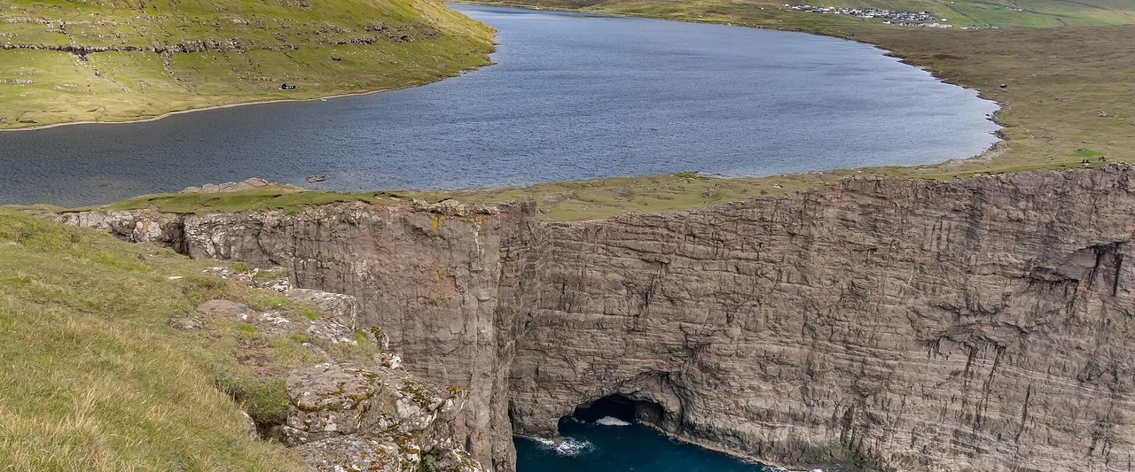
Have you seen the photo of a lake that seems to float high above the ocean? It is one of the most famous views in the Faroe Islands. The lake is Sørvágsvatn, also called Leitisvatn, and the best place to see it is from the top of Trælanípan, a sheer cliff on the island of Vágar. In reality the lake is only about 32 m above the sea. But from the right angle, the cliffs make it look like it is hanging hundreds of metres above the waves. It is a really clever optical illusion!
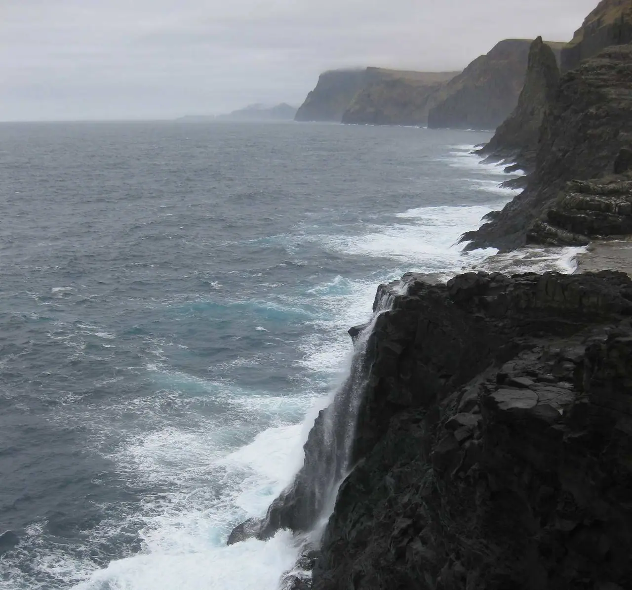
We haven't hiked this one yet, but it is high on our bucket list, so I've researched every detail for you. The good news is that this is one of the easiest hikes in the Faroes. It is about 3.5 km each way on a mostly gentle path, and the trailhead is only a 5-minute drive from the airport. You can even do it on the day you land. At the end of the walk, the lake pours into the Atlantic over the Bøsdalafossur waterfall.
However, you have to pay a hiking fee to the landowners, and the cliff edges are seriously high. The weather can also change in minutes. So here is everything you need to know about the fee, the route and staying safe.
At a glance
- Distance: about 7 km return (3.5 km each way)
- Elevation gain: around 150 m, mostly in the short climb to the top of Trælanípan
- Allow 2.5–3 hours including photo stops. It is about 45 minutes' walk each way
- Difficulty: Easy. The landowners describe it as relatively easy and suitable for most fitness levels
- Route type: Out and back
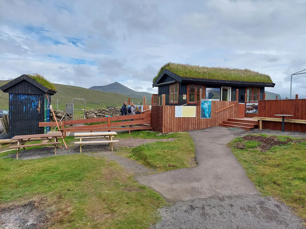
- Start/finish: the landowners' gate and coffee shop on the edge of Miðvágur, Vágar
- Best season: May–September for longer days and milder weather
- Prices: 200 DKK per adult to hike on your own, and children aged 0–15 go free (2026)
- Toilets: free toilets at the trailhead. There are none on the trail
- Parking: free at the trailhead
- Dogs: sheep graze on Vágar, so keep dogs on a lead and check with the landowners before you go
Route description
Miðvágur to the lake
The trail starts on the outskirts of Miðvágur, and the way to the trailhead is signposted from the village. All visitors have to go through the main gate and check in at the landowners' reception. Here you pay the fee in the coffee shop. There is a map and an information board at the start, plus a QR code with a short video about the hike.
From the gate, the path follows the lake towards the sea over open, grassy ground. This is the largest lake in the Faroe Islands, at 3.4 km². The path is mostly firm and gentle, with a few rocky patches. After rain, short stretches can be muddy.
Important: in 2026, the path along the shore of the lake is closed to protect nesting birds. Please stick to the designated route.
The climb to Trælanípan
Near the end of the lake, close to the sea, a short climb takes you up onto Trælanípan. This rock wall rises 142 m straight out of the sea. Its name means "Slave Cliff". According to the legend, in Viking times old and sick slaves were pushed off the top. Nobody knows if the story is true, but it definitely adds some drama to the view!
From the top you get the famous view. The lake stretches behind you, and the cliffs drop straight into the ocean below. Walk a little way along the edge to find the best angle for the illusion. Please be really careful here. The drop is vertical and the wind can be very strong. Stay well back from the edge, especially with kids.
Bøsdalafossur waterfall
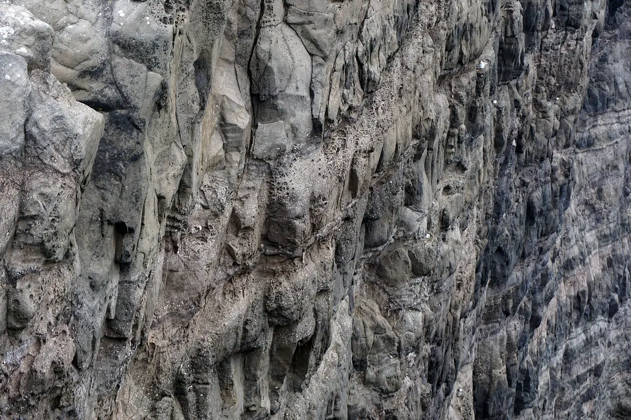
From Trælanípan, follow the path down to Bøsdalafossur. This is where the lake empties straight into the Atlantic over a 30 m waterfall. The ground near the waterfall is more uneven, with basalt rock edges. Watch your footing on wet rock. On a clear day you can also see the lonely sea stack of Geituskorardrangur out to sea.
Back to Miðvágur
Return the same way to the gate in Miðvágur. If you started early for sunrise, this is when you pay at the coffee shop.
How to get there
By car
The trailhead is just outside Miðvágur on Vágar, about a 5-minute drive from Vágar Airport. From Tórshavn you drive west to Vágar through the sub-sea tunnel, Vágatunnilin. Follow the signs for Trælanípa and Bøsdalafossur.
Prices: the tunnel toll for a car was DKK 50 in 2026. It covers the return trip and is charged when you drive back from Vágar. There are no barriers, as cameras register your number plate, so pay online within 6 days. With a Faroese rental car, the rental company charges you instead.
Parking: free parking at the trailhead, next to the coffee shop. The car park can get muddy after heavy rain.
By bus
Bus 300 (Tórshavn – Airport – Sørvágur), run by Strandfaraskip Landsins (SSL), stops in Miðvágur. In 2026 there were about 10 departures from Tórshavn on weekdays and 5 on Saturdays and Sundays. The journey from Tórshavn to Miðvágur takes about 45 minutes. From the bus stop, walk through the village to the trailhead. Check the current timetable on ssl.fo before you go, especially at weekends.
Permits, fees & opening times
- Hiking fee (2026): 200 DKK per person if you hike on your own. Children aged 0–15 are free. You don't need to book. Pay at the coffee shop by card or cash.
- Guided hike: 600 DKK per person, with a minimum of 5 people (smaller groups pay for 5). Book at least 2 days in advance on tralanipan.fo.
- Coffee shop: open 07:00–22:00.
- Gate: open 24/7, so you can hike at sunrise or stay for sunset. Early sunrise hikers can pay when they come back.
Visit Faroe Islands also warns that new sustainable tourism laws may change hiking fees in the future. So check tralanipan.fo before your trip.
When to go
You can do this hike all year, as the gate is always open. However, I suggest May to September, when the days are long and the weather is a bit milder. Summer evenings are lovely here, and the sunset light on the cliffs must be beautiful.
The Faroese weather changes really fast. Fog can roll in and hide the view completely, and the wind on the cliff can be very strong. So keep an eye on the forecast and be flexible. If it is foggy in the morning, try again later in the day. Since it is so close to the airport, it is a great hike for your first or last day on the islands.
Hiking with kids
Suitable for children: yes, for kids who are happy to walk 7 km. The path is mostly gentle and there is not much climbing. The best part? Children up to 15 hike for free.
- Cliff edges: the drops at Trælanípan and around Bøsdalafossur are sheer. Hold small hands, keep children well back and don't let them run ahead.
- Carriers: a back carrier is the easiest way to bring toddlers. Be careful in strong wind.
- Pushchairs: I wouldn't bring one. The path is grassy, rocky in places and muddy after rain.
- Keep them engaged: tell them the legend of Slave Cliff, look out for seabirds and count the sheep. A hot chocolate at the coffee shop makes a great reward.
What to pack
- Sturdy hiking boots, as the path can be wet and muddy
- A proper waterproof jacket and trousers
- A warm layer, a hat and gloves, even in summer
- Water and snacks
- Card or cash (DKK) for the hiking fee
- A fully charged phone for photos and emergencies
There is nowhere to refill your bottle on the trail. If you like to travel light, a small filter lets you top up from a stream. The Sawyer Mini is the one I recommend in my wild camping kit list. It is tiny and you can drink straight through it.
Safety tips
- Stay well back from the cliff edges. Trælanípan is 142 m high and the edge is vertical.
- Don't go near the edge in strong wind. Gusts on exposed cliffs can knock you off balance.
- Turn back in thick fog. You won't see the view anyway, and it is hard to judge where the edge is.
- Watch your footing on wet basalt near the waterfall.
- Tell someone your plans if you go at sunrise or late in the evening, when there are few people around.
- In an emergency, call 112.
Leave no trace & sustainable tips
- Pay the fee. The land is privately owned, and the fee helps the landowners keep the trail open, with free parking and toilets.
- Stick to the designated route. Paths are closed when birds are nesting, so please respect the signs.
- Don't disturb the sheep and keep dogs on a lead.
- Take your rubbish home, including food scraps.
- Come by bus if you are staying in Tórshavn. Bus 300 stops in Miðvágur.
Where to stay & eat nearby
- Miðvágur and Sørvágur on Vágar are handy bases, close to the airport and the trailhead. I suggest looking for a guesthouse or holiday home on the island, especially if you fly in late.
- Tórshavn, the capital, has the widest choice of hotels and restaurants. It is about 45 minutes by bus or car.
- The coffee shop at the trailhead is open 07:00–22:00 and is the obvious stop for a warm drink after the walk.
More to explore nearby
- Gásadalur: a tiny village on the west of Vágar with the famous Múlafossur waterfall. Bus 350 runs there from Tórshavn via the airport.
- Mykines: the puffin island. From 1 May to 31 August a guide is mandatory and the fee was 500 DKK (400 DKK if you book online in advance), plus the ferry. The path to the lighthouse is closed after a landslide.
- Drangarnir sea stacks: guided tours only, 600 DKK per person, on Wednesdays, Saturdays and Sundays from 1 April to 1 October.
- Kallur Lighthouse on Kalsoy: another famous cliff walk. The fee was 200 DKK for adults, 100 DKK for ages 13–17 and free under 13.
FAQ
How much does it cost to hike to Trælanípan?
In 2026 the fee is 200 DKK per person if you hike on your own, and children aged 0–15 go free. A guided hike costs 600 DKK per person, with a minimum of 5 people.
How long is the Trælanípan hike?
It is about 3.5 km each way, so 7 km return. Most people take 2.5–3 hours, including photo stops.
Do I need to book the Trælanípan hike?
No, not if you hike on your own. Just pay at the coffee shop at the trailhead. Guided hikes must be booked at least 2 days in advance.
Can I hike at sunrise or sunset?
Yes. The gate is open 24/7. If you start before the coffee shop opens at 07:00, you can pay when you get back.
Can I get to Trælanípan by bus?
Yes. Bus 300 from Tórshavn stops in Miðvágur in about 45 minutes, and the trailhead is on the edge of the village.
Did you find this useful? Save it for later or share it with a friend who'd love this walk. And if you have been, let me know in the comments!
Photo credits (4)
All photos on this page are by other photographers and are used under free licences. Thank you for sharing them.
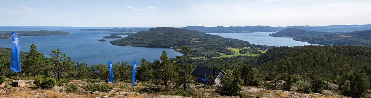
- Cover photo: Sørvágsvatn from Trælanípa.jpg by Ekrem Canli, CC BY-SA 4.0, via Wikimedia Commons. Resized and cropped for this page.
- Photo 2: Sørvágsvatn and Trælanípa trailhead.jpg by Ekrem Canli, CC BY-SA 4.0, via Wikimedia Commons. Resized for this page.
- Photo 3: Sørvágsvatn 5.jpg by kallerna, CC BY-SA 4.0, via Wikimedia Commons. Resized for this page.
- Photo 4: Bøsdalafossur Wasserfall auf Vágar.jpg by Kusafiri, CC BY-SA 3.0, via Wikimedia Commons. Resized for this page.


join the conversation
Comments
No comments yet. Be the first to share your thoughts!