🥾 Trail guide · Northern Norway – Lofoten (Moskenesøya)
Reinebringen Hike: A Guide to Lofoten's Stone Staircase and the View Over Reine

- Distance
- 5.8 km
- Ascent
- 480 m
- Time
- 2.5–3.5 hours from Reine (1–2 hours on the stairs)
- Difficulty
- Challenging
- Route
- Out-and-back
- Best season
- June–early September (official season May–September; not recommended in winter)
👶 With kids: Not recommended for children by the local operators: very steep, crowded steps where carriers and child harnesses are discouraged. Not suitable for pushchairs or dogs.
✅ Updated and fact-checked on 2 November 2026. Prices, timetables and rules can change, so check the official sources before you go.
This post contains affiliate links. If you book or buy through them, I may earn a small commission at no extra cost to you. More about this
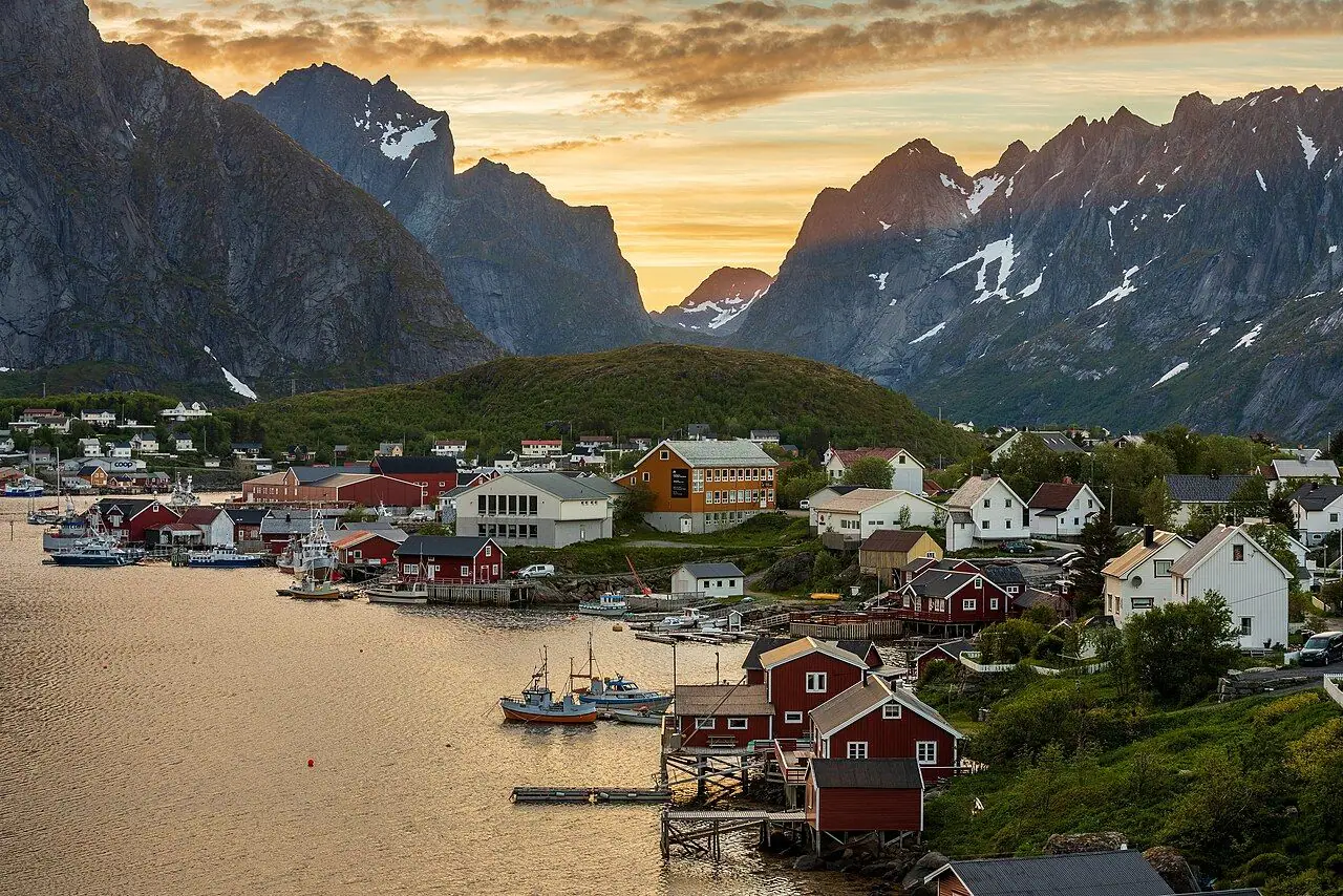
Have you seen a photo of Lofoten? Then you have probably seen the view from Reinebringen. Red and white fishermen's cabins sit on little islands linked by bridges, with the blue Reinefjord and a wall of jagged peaks behind. The photo is taken from the top of this mountain, around 450–480 m directly above the village of Reine. It is on the covers of countless brochures and books.
I've hiked Kjerag and Preikestolen on my Norway road trip, but I haven't made it up to Lofoten yet. Reinebringen is high on our bucket list, so I've researched every detail for you.
For years the climb was a really steep, muddy and slippery scramble. Then between 2016 and 2019 a stone staircase was built almost all the way to the top. It is known as the Sherpa steps, and now thousands of people climb it each summer. However, don't let the word "stairs" fool you! The steps are high and uneven and go almost straight up the mountainside, so it is really hard work. At the top, the wind can be ferocious.
The view is definitely worth it, and the hike is short enough to fit into an evening. Under the midnight sun of a Lofoten summer, that is often the best time to go. In this guide I cover the stone staircase, parking in Reine, closures, transport and safety at the top.
At a glance
- Distance: about 5.8 km return from the official parking at Reine Ytre Havn. That is around 1.9 km each way to the trailhead, plus roughly 2 km return on the mountain.
- Elevation gain: around 450–480 m (the summit is given as 448 m or 484 m, depending on the source).
- Steps: more than 1,500 according to the official site. Visit Lofoten counted 1,974 in January 2024, as the total has grown while work continued.
- Allow 1–2 hours up and down on the mountain itself, or 2.5–3.5 hours from Reine.
- Difficulty: Challenging. It is short but extremely steep, with high steps and an exposed top.
- Route type: Out-and-back.
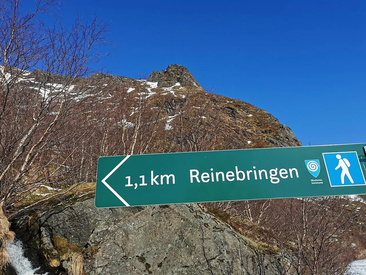
- Start point: by the Ramsvik tunnel (Ramsviktunnelen) on the E10, just outside Reine.
- Best season: June to early September (the official season is May–September).
- Prices: free to hike. Parking at Reine Ytre Havn is charged.
- Toilets: public toilets in Reine. There are none on the trail, and no bins or water either.
- Pushchairs: no.
- Dogs: officially discouraged, so leave them at home.
Route description
Reine to the trailhead
Start from the parking area at Reine Ytre Havn (turn right at the Circle K petrol station as you enter Reine). Walk through the village to Reinehalsen, then follow the E10 towards Å. Before the Ramsvik tunnel, take the old road that runs outside the tunnel, on the left beyond the road fence. Don't walk through the tunnel! This part takes about 30 minutes (1.9 km). It is a lovely warm-up along the water's edge.
The Sherpa steps
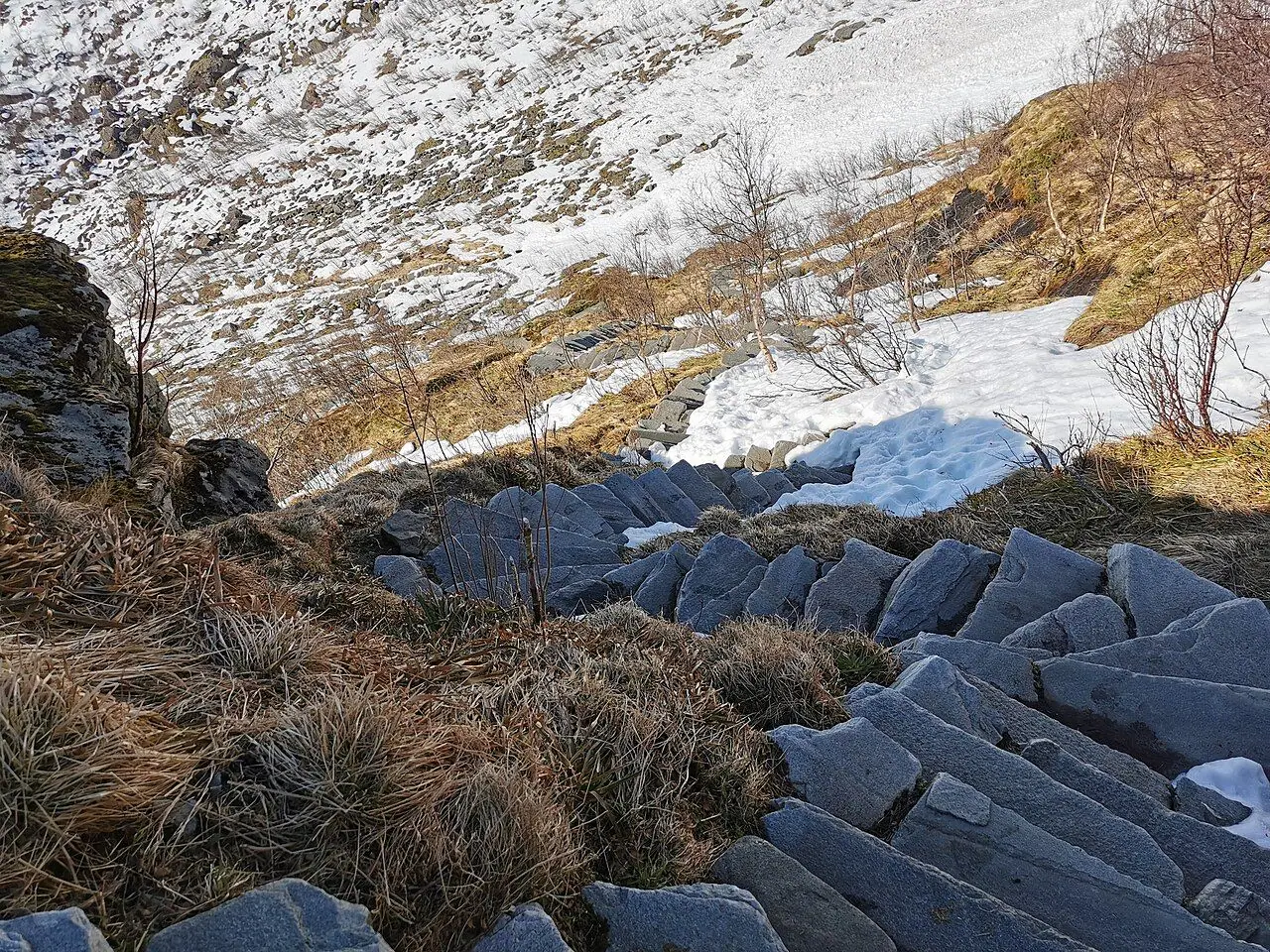
The stone staircase begins almost straight away and hardly lets up. It zigzags up a steep gully on the side of the mountain. The steps are large, flat stones set into the hillside. Many of them are really high, more like a giant's staircase, and your thighs will feel every one. There are benches and flatter spots along the way, where you can catch your breath and turn around. The view over Reine and the fjord gets better and better as you climb.
On busy summer days the steps can get crowded. Be patient and let faster walkers pass where it is safe. Also, step aside on the wider sections rather than stopping in the middle.
The final section and the summit ridge
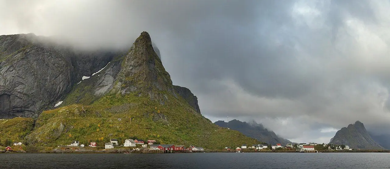
The stairs end just short of the top. The last hundred metres or so are on a path without steps, so take extra care here. You come out on a grassy ridge with sheer drops on the Reine side. The panorama is stunning. Below you are Reine and the islands of Hamnøy and Sakrisøy, with the long Reinefjord running inland and the jagged peaks of Moskenesøya all around. Here is a fun fact: the ridge leading down towards Reine is a moraine. It is gravel and soil left behind by Ice Age glaciers, and it reaches out into the sea like a natural causeway.
Descent
Return the same way. Going down is often harder than going up, with tired legs, high steps and maybe wet stone. Go slowly and use your hands on the rocks if you need to. Walking poles really help your knees.
How to get there
By public transport
- Ferry from Bodø: the car ferry from Bodø to Moskenes crosses the Vestfjord to the southern tip of Lofoten. Some sailings call at the outer islands of Værøy and Røst. It takes several hours. Check the current timetable, fares and any vehicle booking requirements with Reis Nordland (reisnordland.no), which runs public transport and ferries in Nordland. You can reach Bodø by train from Trondheim (Nordland Line) or by plane.
- Moskenes to Reine: the ferry terminal at Moskenes is a short way down the E10 from Reine. Local buses run along the E10. The nearest bus stop for Reinebringen is Reine kryss, or you can take a bus into Reine itself. Buy bus tickets in the Reis app and check times in the Reis Nordland journey planner.
- Other routes into Lofoten: an express passenger boat connects Bodø with Svolvær, and there are airports at Leknes and Svolvær. From there, buses run along the E10 through the islands towards Reine. Allow plenty of time, as buses are less frequent than in the UK.
By car and parking
Parking: use the official Reine Ytre Havn car park in Reine. The operators say it has plenty of space. Parking on the E10, in passing places, in nature or on private driveways is prohibited or strongly discouraged. The roadside near the tunnel is dangerous, and local residents are understandably fed up with blocked driveways. So please be considerate when you park!
Good to know
- Stair work and closures: work on the steps has continued after the main staircase was finished. Visit Lofoten notes that the mountain can be closed during parts of the summer for this work. Before you go, check the Reinebringen Facebook page, the official site (reinebringen.no) or the tourist information office in Reine for the current status. Always obey any closure signs.
- Free to hike: there is no entry fee, but parking is paid. The local company Reinebringen AS works on visitor management and safety on Moskenesøya. It is a small community of around 1,000 residents, and it gets about a million visitors a year!
- Own risk: you hike at your own risk. The operators ask people with heart or knee problems or low fitness to think carefully before setting out.
When to go
The best months are June to early September. From late May to mid-July, the midnight sun means you can hike at any hour. Early morning and late evening are the quietest times, and the soft low light over the fjord is magical. July is the busiest month.
Winter hiking is strongly discouraged. Avalanches, snow and ice on the steps make the route dangerous, and there have been accidents in winter. Ice can also form on the steps in early autumn. On any day, check the forecast for wind and rain, not just the sun icon. Wind above about 10 m/s makes the top really dangerous, and fog hides the view and adds risk.
Hiking with kids
Let's be honest: the local operators do not recommend Reinebringen for children. The steps are extremely hard for small legs. Child carriers and harnesses are discouraged too, because of the crowds and the risk of falling on the steep descent. Pushchairs are impossible.
With young children, I suggest enjoying the view from below instead. Walk the bridges between Reine, Sakrisøy and Hamnøy, or try one of Lofoten's gentler beach walks (see below). Fit, experienced teenagers who are used to steep mountain paths may manage it on a calm, dry day. Ideally go early in the morning when it is quieter, and keep them close at the summit.
What to pack
- Hiking boots with good grip, as running shoes are a common cause of slips
- Plenty of water (there is nowhere to refill) and snacks
- Windproof and waterproof jacket, plus a warm layer for the summit
- Walking poles for the descent
- Sunglasses and sun cream for long summer days
- A bag for all your rubbish (including snus and cigarette ends)
Safety tips
- Check the weather and avoid strong wind, fog and rain. Conditions at the top can be much worse than in Reine.
- Stay on the stairs and the marked path. The ground beside them is fragile and very slippery.
- Keep well back from the edge at the summit! The drop on the Reine side is sheer, and there are no railings. No photo is worth getting close to the edge, especially in gusty wind.
- Don't hike in winter or when there is ice on the steps.
- Save enough time and energy for the descent, as this is where many slips happen.
- Drones aren't banned, but they are strongly discouraged in crowded areas.
- In an emergency in Norway, call 112.
Leave no trace & sustainable tips
- Arrive by ferry and bus where you can. If you drive, only park at Reine Ytre Havn.
- Use the toilets in Reine before you set off. There are none on the mountain, and unfortunately the hillside has suffered from human waste.
- Carry out all your rubbish, as there are no bins on the trail.
- Don't step on plants, break branches or move rocks.
- Go early or late to spread the crowds, and be patient and polite on the steps.
- Spend your money locally. Buy supplies in Reine, eat at local cafés and stay in local rorbuer (traditional fishermen's cabins).
Where to stay & eat nearby
Reine and the neighbouring islands of Hamnøy and Sakrisøy are famous for their rorbuer. These are traditional red fishermen's cabins turned into holiday accommodation, often right on the water. There are also guesthouses and campsites around Moskenesøya. Reine has a supermarket, a petrol station and a few cafés and restaurants. Local specialities include stockfish (dried cod) and fresh fish cakes. Book your accommodation well ahead for summer.
More to explore nearby
- Hamnøy and Sakrisøy: picture-perfect fishing villages, linked to Reine by bridges along the E10.
- Å: the village at the very end of the E10, with a stockfish museum and historic fishing buildings.
- Kvalvika Beach: a wild white-sand beach, reached by a moderate walk, further north on Moskenesøya.
- Bunes Beach: take the small passenger ferry across the Reinefjord from Reine, then an easy walk. Great for families.
- Værøy and Røst: remote outer islands with huge seabird colonies, served by the Bodø ferry.
FAQ
How long does the Reinebringen hike take? Around 1–2 hours up and down on the mountain itself. Or allow 2.5–3.5 hours return from the parking in Reine, including the walk to the trailhead.
How many steps are there on Reinebringen? The official site says more than 1,500, while Visit Lofoten counted 1,974 in January 2024. Work has continued on the route since the main staircase was finished.
Is Reinebringen open? It is normally open in summer, but it can close during parts of the season for step work. It is not recommended in winter. Check the Reinebringen Facebook page, reinebringen.no or the local tourist office before you go.
Is Reinebringen dangerous? It is very steep, and the summit has sheer drops with no railings. In good weather, with proper boots and care, fit hikers can manage it. But in wind, rain, fog, ice or snow it becomes dangerous.
Can you get to Reinebringen without a car? Yes. Take the ferry from Bodø to Moskenes, then a local bus along the E10 to Reine kryss or Reine. Buy tickets in the Reis app and check timetables on reisnordland.no.
Have you climbed the Reinebringen steps? How did your legs feel the next day? Let me know in the comments!
Photo credits (4)
All photos on this page are by other photographers and are used under free licences. Thank you for sharing them.
- Cover photo: Houses of Reine by Gravdalsbukta, Moskenes, Nordland, Norway, 2022 June.jpg by Ximonic (Simo Räsänen), CC BY-SA 4.0, via Wikimedia Commons. Resized and cropped for this page.
- Photo 2: Hammarskaftet at Reine, Lofoten, Norway, 2015 September.jpg by Ximonic (Simo Räsänen), CC BY-SA 3.0, via Wikimedia Commons. Resized for this page.
- Photo 3: Reinebringen stairs.jpg by Wolfgang Hägele, CC BY-SA 4.0, via Wikimedia Commons. Resized for this page.
- Photo 4: Reinebringen sign.jpg by Wolfgang Hägele, CC BY-SA 4.0, via Wikimedia Commons. Resized for this page.


join the conversation
Comments
No comments yet. Be the first to share your thoughts!