🥾 Trail guide · Vestland – Hardanger (Odda)
Trolltunga Hike: A Complete Guide to the Troll's Tongue from Skjeggedal (P2) and Mågelitopp (P3)

- Distance
- 27 km
- Ascent
- 1200 m
- Time
- 8–12 hours from P2 (7–10 hours from P3)
- Difficulty
- Strenuous
- Route
- Out and back
- Best season
- July–mid-September (official summer season 1 June–30 September)
👶 With kids: Only for fit, experienced older children and teenagers. Even from P3 it is a 20 km day on rough ground, and there are no railings at the rock. Not for pushchairs or carriers.
✅ Updated and fact-checked on 5 November 2026. Prices, timetables and rules can change, so check the official sources before you go.
This post contains affiliate links. If you book or buy through them, I may earn a small commission at no extra cost to you. More about this
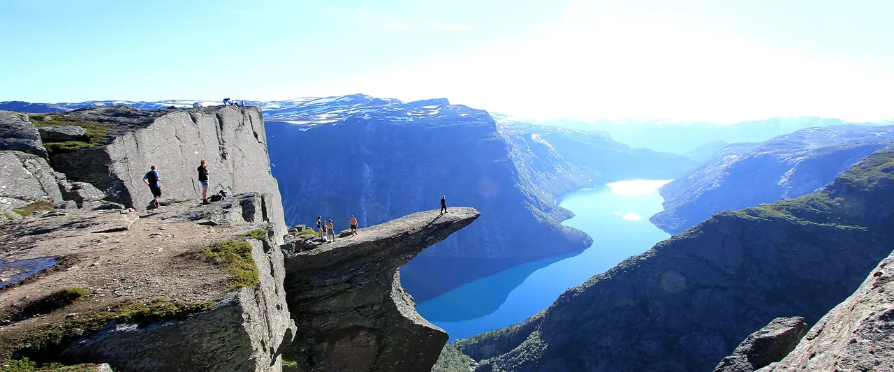
Is there a more famous rock in Norway than Trolltunga? The "Troll's Tongue" is a thin slab of rock that sticks straight out of the mountain, about 700 m above the lake Ringedalsvatnet. You have probably seen the photos of people standing on the tip. However, the photos don't show the long walk you need to get there. It is one of the toughest popular day hikes in Norway.
We hiked Trolltunga back in 2015, on our Norway road trip, the same trip when I climbed Preikestolen and stood on Kjeragbolten. You can see it in my Norway road trip video. A lot has changed since then, with new parking rules, shuttle buses and a booking system for the upper car park. So I've researched every detail again for 2026.
In this guide I explain the three starting points (P1, P2 and P3), the route, the shuttle buses, when to go and how to stay safe. Will you do it in one long day or camp on the mountain?
At a glance
- Distance: 27 km return from P2 Skjeggedal, or 20 km return from P3 Mågelitopp. It is 38 km return from P1 Tyssedal
- Elevation gain: about 1,200 m in total from P2, or about 800 m in total from P3, with lots of ups and downs
- Allow 8–12 hours from P2, or 7–10 hours from P3, plus time in the photo queue
- Difficulty: Strenuous. The official grade is "extra demanding", mostly because of the length. You need good fitness and mountain experience
- Route type: Out and back on the same trail
- Start/finish: P2 Skjeggedal (415 m) or P3 Mågelitopp (860 m), near Tyssedal and Odda
- Best season: July to mid-September. The official summer season is 1 June to 30 September
- Prices: the hike is free, but parking is expensive. P2 costs NOK 550 per day (2026)
- Toilets: only at the car parks. There are no toilets on the mountain
- Dogs: allowed, but they must be on a lead from 1 April to 31 October
Route description
P2 Skjeggedal to P3 Mågelitopp
From P2 Skjeggedal, the first 4.3 km follow a narrow tarmac road that climbs 400 m to P3 Mågelitopp. It takes a little over an hour on foot and is pretty boring, to be honest. That is why I recommend taking the shuttle bus up to P3 (from early June to late September). It saves time and energy for the beautiful part of the walk. Next to P2 you will also see the tracks of the old Mågelibanen funicular, which is no longer in use.
Mågelitopp to Store Floren
From P3 it is about 10 km to Trolltunga on a marked trail. After about 45 minutes, the path climbs steeply up to Gryteskar. This is the hardest climb of the day, so take it slowly. Then another steep section takes you up to Trombeskar. The trail passes a small lake and drops down to Store Floren, where you get your first view down to Ringedalsvatnet. This is also a good place to refill your water bottle. The first emergency hut is just before Store Floren, roughly halfway.
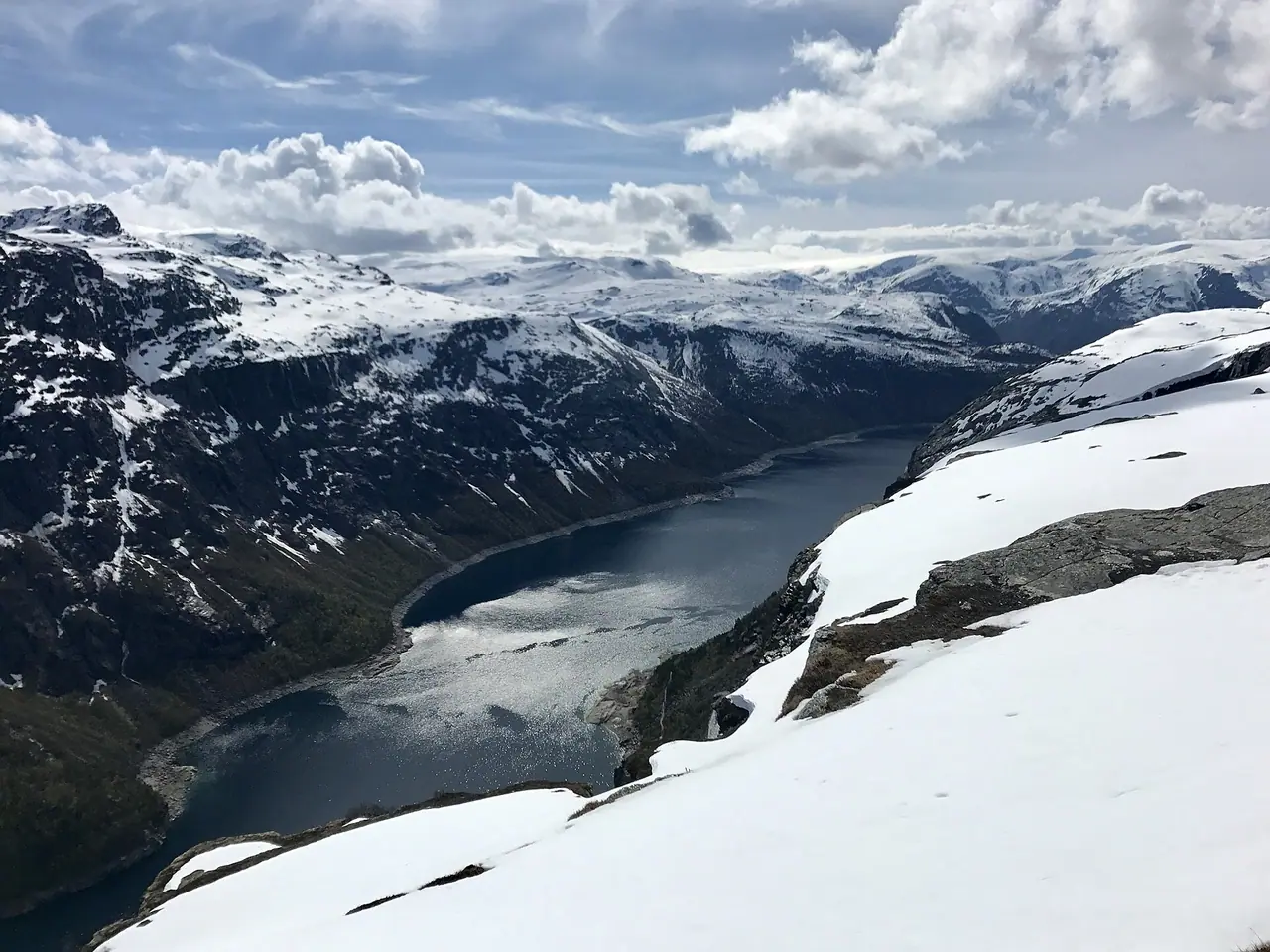
Across the plateau
Once you are up on the plateau at around 900 m, the walk gets flatter. But don't expect an easy stroll! The ground is rocky and uneven, with lots of small climbs and descents. You cross rivers on bridges, including at Endåen, and pass a waterfall. There is one more steep climb up to Endanuten. Near Tyssehøl you pass a dam and the remains of the old Tyssestrengene waterfall.
Trolltunga
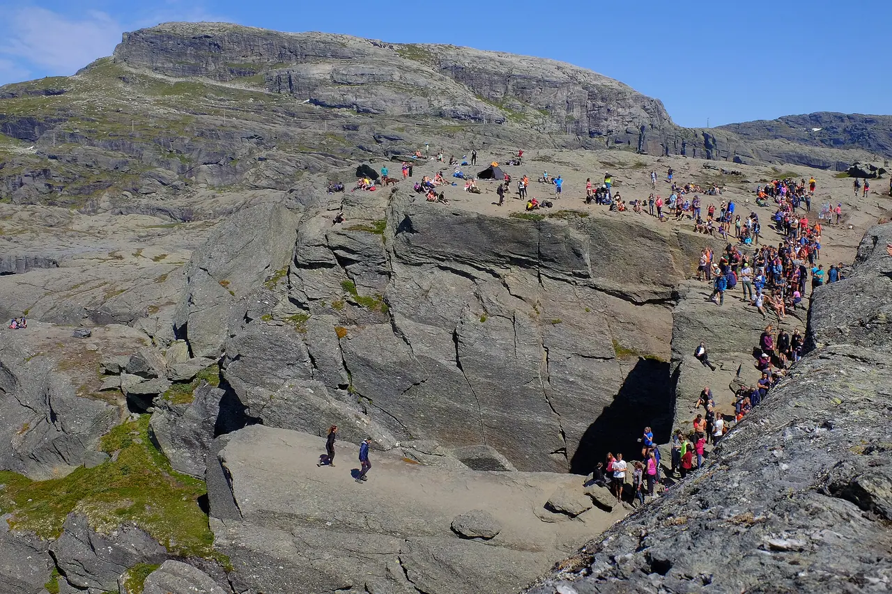
And then you are there! Four solid iron steps lead down to the rock. If you want the famous photo, you will need to queue. In midsummer the wait is usually 30–45 minutes on weekdays and 60–90 minutes on Saturdays, especially between 12 noon and 3 pm. Use the time to have your lunch. Please stay at least a couple of metres from the edge. A fall here would be fatal.
The walk back
You return the same way. Remember, the hike back is the hardest part for most people. Your legs will be tired, and the steep descent from Gryteskar to P3 is hard on the knees. Most rescues on Trolltunga happen on the way back, not on the rock itself. So save some energy, and take the shuttle bus down from P3 if you can.
How to get there
Getting to Odda
The trailhead is near Tyssedal, about 30 minutes by bus from Odda. Odda sits at the end of the Sørfjorden, a branch of the Hardangerfjord. By car it is about 3 hours from Bergen, 2.5 hours from Haugesund, 4 hours from Stavanger and 6 hours from Oslo.
By public transport, Skyss buses run to Odda from Bergen and Voss, where you can connect with trains on the Bergen Line. NOR-WAY express buses link Odda with Oslo, Stavanger and Haugesund. There is also the Hardangerfjord Express boat from Bergen to Rosendal, then bus 760 to Odda. Plan your trip on Entur or Skyss.
Shuttle buses
- Odda – P1 Tyssedal – P2 Skjeggedal: Odda Buss and Odda Taxi run shuttles from mid-May to late September (15 May to 27 September in 2026). The first bus leaves Trolltunga Camping in Odda at 5:45 am. A return ticket with Odda Buss costs about NOK 400, and a single is about NOK 200. I definitely recommend booking online, as seats are limited.
- P2 Skjeggedal – P3 Mågelitopp: the Trolltunga-Road Bus runs from 8 June to 27 September (2026). Buses go up from 6:30 am until 11 am, then again in the afternoon. In 2026 the fare was NOK 150 up and NOK 100 down for adults, and NOK 50 each way for children aged 4–12. There is a midday break, so check the times for your way down.
By car and parking
Parking: there are three car parks, and prices are high (2026):
- P1 Tyssedal (227 spaces): NOK 330 per day. No camping or overnight sleeping allowed.
- P2 Skjeggedal (229 spaces): NOK 550 per day, NOK 770 for two days and NOK 990 for three. The road toll is included. Just dropping someone off costs NOK 220. The road from P1 to P2 is narrow, so buses, campervans, minivans and vehicles over 5.2 m long must park at P1.
- P3 Mågelitopp (30 spaces): NOK 600 per day, plus a NOK 220 road toll that you pay at the machine at P2. You must pre-book until 31 August. Cars can only drive up in the morning, the height limit is 2 m and motorcycles are not allowed.
Important: in November 2026, the official website said the road from P1 to P2 (Skjeggedalsvegen) was open from 6 am to 9 pm, with traffic control. It was fully closed overnight while rockslide protection work continued. So check the latest road status on trolltunga.com before you go, and don't plan to drive down late at night.
Permits, fees & opening times
- You don't need a permit or a ticket to hike Trolltunga. You only pay for parking and buses.
- From 1 June to 30 September, experienced hikers can go on their own. From October to May, the trail is often covered in snow, and a guided hike is recommended.
- Mountain guards (fjellvakt) patrol the trail in the main season.
- Open fires are banned from 15 April to 15 September.
- If you fly a drone, follow the rules and never fly when people are standing on Trolltunga.
When to go
The best time is July to mid-September. Snow often stays on the trail until June, and from October the days get short and the weather turns wintry. July and August are the busiest months, so expect long queues at the rock.
To beat the crowds, start really early. The first shuttle buses leave in the early morning, and the quietest times at the rock are early morning and late afternoon. The first sunny day after a rainy spell is always busy. In my opinion, a weekday in early September would be perfect: fewer people, cooler air and the first autumn colours on the plateau.
The weather on the mountain is often much colder and windier than down by the fjord, and it can change fast. Always check the forecast on yr.no the night before.
Hiking with kids
Suitable for children: only for fit, experienced older children and teenagers. Even from P3, it is a 20 km day with steep climbs, rough ground and a lot of time on your feet. I think most families with young children would enjoy a shorter hike much more.
- Pushchairs and carriers: not suitable. The trail is too long and rocky.
- Start from P3: with older kids, always take the shuttle bus to P3, so you skip the road section in both directions.
- Camp overnight: splitting the hike over two days makes it more manageable and a real adventure.
- Keep them close at Trolltunga. There are no railings and the drop is huge.
- Alternative: try a shorter Norwegian classic, like Preikestolen, which is about 8 km return.
What to pack
- Good hiking boots with ankle support
- Windproof and waterproof jacket and trousers
- Warm layers, a hat and gloves, even in summer
- A head torch, in case you are still walking when it gets dark
- Lots of food and snacks for a long day
- At least 2 litres of water, plus a way to treat water from streams
- Walking poles for the steep descent
- Cash or card for the buses and parking
The official advice is not to drink water near the huts or near Trolltunga, and that boiling makes stream water safe. A small filter is a much lighter option. The Sawyer Mini is the one I recommend in my wild camping kit list.
If you want to camp on the mountain, you will need a bigger backpack for your tent and sleeping bag. Tom and I are long-time fans of Osprey backpacks, and we use them on our own wild camping trips.
Phone signal can be patchy in the mountains. Before our wild camping trip to Suilven, we bought a satellite communicator for peace of mind. It lets you send messages and call for help with no phone signal, and I have it on my wild camping kit list too.
Safety tips
- Start early, and make sure you can finish in daylight and before the last bus.
- Set a turnaround time. If you are slower than planned, turn back. The rock will still be there next year.
- Stay away from the edge. In 2015 a young hiker died after falling from Trolltunga.
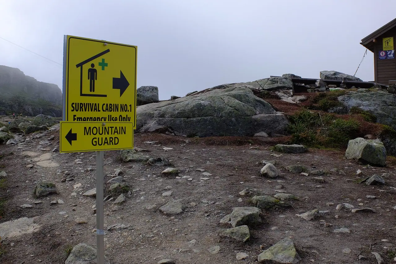
- Use the emergency huts at Floren, Endåen and Tyssehøl if the weather suddenly turns bad. They have sleeping bags, blankets and food, but they are for emergencies only.
- Follow the Norwegian mountain code (fjellvettreglene): plan your trip, check the weather and know when to turn back.
- In an emergency, call 112 (police and rescue) or 113 (medical).
Leave no trace & sustainable tips
- Use the shuttle buses. Parking is limited, and the narrow roads get very busy.
- Take all your rubbish home, including used toilet paper. There are bins at P2.
- Go to the toilet at P1 or P2 before you start. On the trail, go well below the path and far from streams and lakes.
- Camp only at the recommended spots marked on the official map. Pitch below the trail, away from water, and never near the emergency huts or helicopter landing sites. Bare rock is best for the fragile plants.
- Keep dogs on a lead. It is the rule in Ullensvang from 1 April to 31 October.
Where to stay & eat nearby
- Odda is the main base, with hotels, guesthouses, supermarkets and restaurants. Trolltunga Camping in Odda is also the first stop for the early shuttle bus.
- Tyssedal, next to P1, is a small village closer to the trailhead.
- Camping on the mountain: many hikers split the trip over two days and camp on the plateau. You can also book guided overnight trips in a tent or dome with local guide companies.
- Food: there is nowhere to buy food on the trail, so stock up at the supermarkets in Odda the day before.
More to explore nearby
- Låtefossen: a powerful twin waterfall south of Odda, right next to road 13, with an old stone bridge built in the 1860s.
- Buarbreen and Folgefonna: two glaciers just west of Odda and two of the main sights in the area.
- Tyssedal: Odda grew up around its smelters, which were powered by the hydropower plant in Tyssedal.
- Via ferrata: for something different, local guides run a via ferrata route up to Trolltunga.
FAQ
How long is the Trolltunga hike?
It is 27 km return from P2 Skjeggedal (8–12 hours) or 20 km return from P3 Mågelitopp (7–10 hours). From P1 Tyssedal it is 38 km return.
Do I need to book anything for Trolltunga?
You don't need a permit. However, you must pre-book parking at P3 until 31 August, and I strongly recommend booking the shuttle buses from Odda in advance.
How much does it cost to park at Trolltunga?
In 2026, parking at P2 cost NOK 550 per day, P1 cost NOK 330, and P3 cost NOK 600 plus a NOK 220 road toll.
Can beginners hike Trolltunga?
Only if they are fit and well prepared. It is graded extra demanding because of its length. Start early, wear proper boots and be ready to turn back.
Can I camp near Trolltunga?
Yes, at the recommended spots shown on the official map. Camp below the trail, away from water and the emergency huts, and take all your rubbish home.
Have you hiked Trolltunga? Did you start from P2 or P3? Let me know in the comments!
Photo credits (4)
All photos on this page are by other photographers and are used under free licences. Thank you for sharing them.
- Cover photo: Trolltunga 2.jpg by Steinar Talmoen, CC BY-SA 3.0, via Wikimedia Commons. Resized and cropped for this page.
- Photo 2: Trolltunga trail.jpg by kallerna, CC BY-SA 3.0, via Wikimedia Commons. Resized for this page.
- Photo 3: Tourists in line to stand on Trolltunga.jpg by Frankemann, CC BY-SA 4.0, via Wikimedia Commons. Resized for this page.
- Photo 4: Signs of survival cabin in connection with the trail to Trolltunga.jpg by Frankemann, CC BY-SA 4.0, via Wikimedia Commons. Resized for this page.


join the conversation
Comments
No comments yet. Be the first to share your thoughts!