🥾 Trail guide · England – Lake District
Helvellyn via Striding Edge: A Complete Guide to the Classic Scramble from Glenridding

- Distance
- 13 km
- Ascent
- 900 m
- Time
- 5–7 hours
- Difficulty
- Challenging
- Route
- Circular
- Best season
- May–September, in dry and calm weather (winter needs an ice axe, crampons and winter skills)
👶 With kids: Only for older, confident kids with scrambling experience and a head for heights. Not for pushchairs or carriers. Younger families can walk up to Red Tarn instead.
✅ Updated and fact-checked on 5 November 2026. Prices, timetables and rules can change, so check the official sources before you go.
This post contains affiliate links. If you book or buy through them, I may earn a small commission at no extra cost to you. More about this
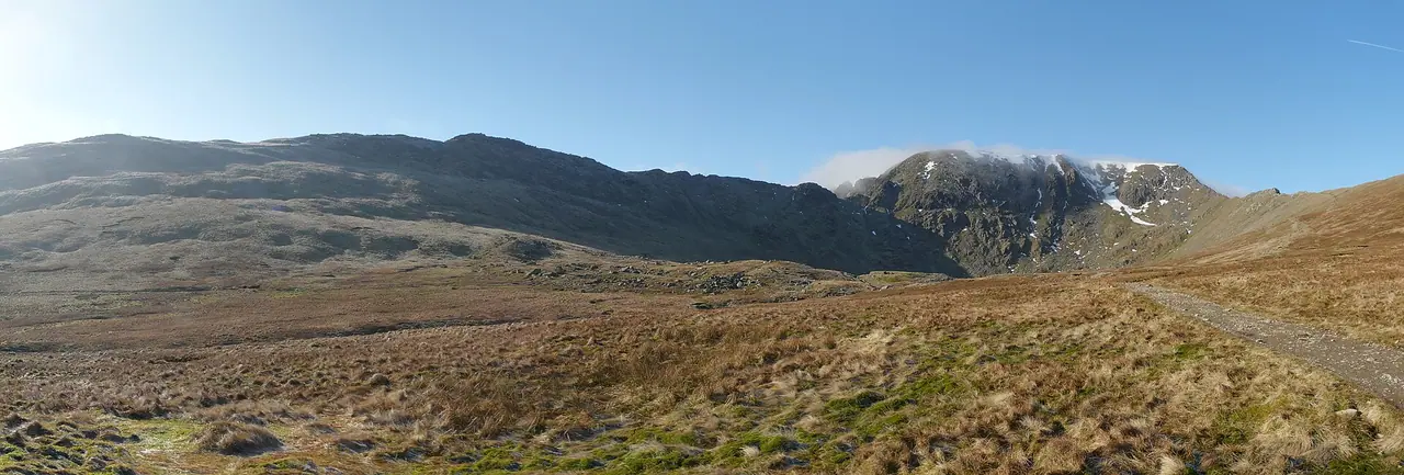
Are you brave enough for Striding Edge? This narrow, rocky ridge leads straight to the summit of Helvellyn, 950 m above sea level. Below it, the deep blue Red Tarn sits in a rocky hollow, and Ullswater shines in the distance. It is probably the most famous ridge walk in England, and every keen hiker seems to have it on their list.
We have walked up from Patterdale to wild camp at Angle Tarn, just across the valley, but we haven't done Striding Edge yet. It's high on our bucket list, so I've researched every detail for you. The classic loop starts in the lakeside village of Glenridding. You climb up to Hole-in-the-Wall, cross Striding Edge to the summit, then come down the shorter Swirral Edge and past Red Tarn.
However, I want to be honest. This is a real scramble with big drops on both sides, and people have died here. In good weather and with a head for heights, it is an amazing day out. In wind, rain, ice or cloud, it is a different story. Below I describe the full route, how to get to Glenridding and how to decide if the conditions are right.
At a glance
- Distance: about 12–13 km for the loop from Glenridding
- Elevation gain: around 900 m
- Allow 5–7 hours, plus stops. Most people need about 3 hours to reach the summit
- Difficulty: Challenging. A Grade 1 scramble on an exposed ridge, with a short down-climb known as the Chimney
- Route type: Circular (Glenridding → Hole-in-the-Wall → Striding Edge → Helvellyn → Swirral Edge → Red Tarn → Glenridding)
- Start/finish: the main car park in Glenridding, next to the Ullswater Information Centre
- Best season: late spring to early autumn, in dry, calm weather
- Prices: free to walk. You pay to park in Glenridding
- Toilets: public toilets next to the main car park in Glenridding. Nothing on the mountain
- Suitable for children: only for older, confident kids with scrambling experience and a head for heights
- Dogs: allowed, but only for dogs that are happy with heights and rock. Keep them on a lead near sheep
Route description
Glenridding to Birkhouse Moor
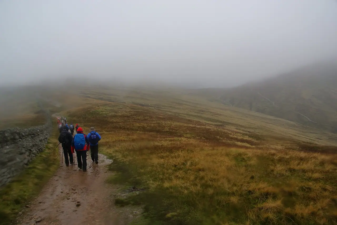
From Glenridding, follow the minor road on the south side of Glenridding Beck. Keep right where the paths split, cross a bridge and follow a gravel track. Go through a metal gate and climb to a wooden gate. After the gate, cross Mires Beck and climb the grassy shoulder beside the stream.
It is a steady pull, but the views back over Ullswater are lovely. When you reach the ridge near Birkhouse Moor, you have already done about two-thirds of the height. So take a breather here!
Hole-in-the-Wall
Follow the wide path along the wall to Hole-in-the-Wall. Its name comes from an old gap in the stone wall. Today there is a ladder stile instead. This is the start of Striding Edge, and the best place to stop and check the weather one more time. If the ridge is in cloud or the wind is strong, I suggest turning back or walking up to Red Tarn instead.
Striding Edge
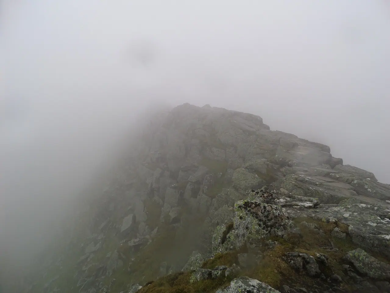
From Hole-in-the-Wall, Striding Edge runs for over 1.5 km to the summit plateau. The trickiest part is around 300–400 m long. In places the crest is only 2–3 m wide, with steep drops on both sides. You will need to use your hands, so keep your rucksack small and your poles packed away. The highest point of the ridge is High Spying How, at 863 m.
There is a narrower path a little below the crest that avoids some of the rocky bits. However, it is narrow with a steep drop too, so it is not really easier. Along the way, look out for the Dixon memorial. It remembers Robert Dixon of Patterdale, who was killed here in 1858 while following foxhounds.
Near the end of the edge comes the Chimney. This is a short rock step of about 5–6 m that you climb down. Most of your weight goes on your arms, so take it slowly and face the rock if that feels safer. After this, a steep, rocky climb takes you up onto the summit plateau.
The summit
The top of Helvellyn is a wide, flat plateau. The highest point is a small rocky knoll with a cairn. There is also a stone shelter and a trig point. Here are two fun stories. A memorial stone remembers Charles Gough, who fell from Striding Edge in 1805. His dog Foxie was found still beside him three months later. In December 1926 a pilot called Bert Hinkler even landed a small aeroplane on the summit. A stone tablet near the shelter marks the spot.
Down Swirral Edge to Red Tarn
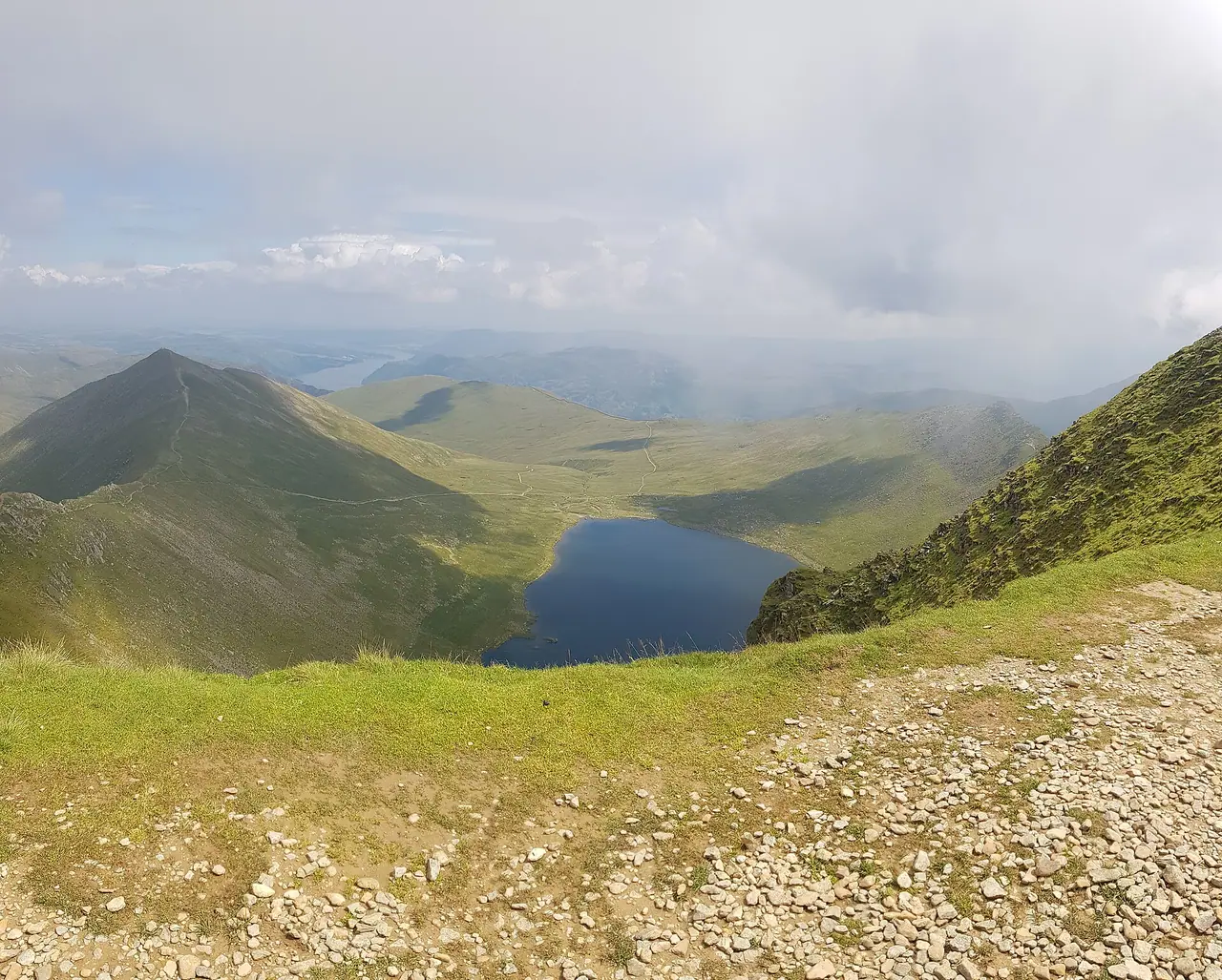
From the summit, head north-west to the rocky path down to Swirral Edge. It is steep and scrambly, but less narrow than Striding Edge. At the low point of the ridge, take the right fork towards Red Tarn. Ignore the left fork, which goes up Catstye Cam.
Red Tarn sits in the hollow between the two edges. It is about 25 m deep and one of the few homes of the schelly, a rare fish. So please don't wash anything in it.
Red Tarn back to Glenridding
Follow the path down the grassy valley beside Red Tarn Beck and cross a wooden bridge. Carry on past the bridge over Glenridding Beck and walk between the ferns. Both forks of the path lead back to the wooden gate you passed in the morning. Then retrace your steps to Glenridding. I think you will have earned a big slice of cake!
How to get there
By car and parking
Glenridding is at the southern end of Ullswater on the A592, between Penrith and the Kirkstone Pass.
Parking: the main pay and display car park is in the centre of Glenridding, next to the Ullswater Information Centre. It fills by mid-morning on sunny weekends and holidays, so arrive early to avoid disappointment. There is also a pay and display car park by the Ullswater 'Steamers' pier, which takes cash or contactless.
By public transport
- Train: the nearest station is Penrith, on the West Coast Main Line.
- Bus: Stagecoach's 508 runs from Penrith to Glenridding and Patterdale all year. In 2026 the section over the Kirkstone Pass to Windermere ran daily from 23 March to 1 November. In winter there are fewer buses, so check the timetable.
- Bus and boat: combined tickets let you take the 508 to Glenridding and use the Ullswater 'Steamers' on the lake. It is a lovely way to finish a day.
Permits, fees & opening times
- You don't need a permit or ticket to climb Helvellyn.
- Parking: pay and display in Glenridding. Check the machine for current prices.
- 508 bus: runs all year between Penrith and Patterdale. In late 2025 single fares were capped at £3 under the national fare cap.
- Winter conditions: the National Park's Fell Top Assessors climb Helvellyn every day in winter. They post a conditions report on the Weatherline website. They will be back from December 2026 until spring 2027.
When to go
In my opinion, the best time is a dry, calm day between late spring and early autumn. Weekdays are much quieter than weekends, and an early start helps you avoid queues on the Chimney.
Always check the Met Office mountain forecast or MWIS for the Lake District. The wind on the edge can be much stronger than in Glenridding. Avoid the ridge on wet, windy or icy days. In winter, ice and snow cornices on the final climb are especially dangerous. Only go then with an ice axe, crampons and the skills to use them. Check the Fell Top Assessors' report on the morning of your walk.
Hiking with kids
Suitable for children: Striding Edge is not a family walk for little ones. The drops are big and there is no margin for a slip. Older kids and teenagers who already enjoy scrambling, follow instructions well and have a head for heights may love it. Stay right next to them on the crest and on the Chimney.
- Pushchairs: not suitable at all.
- Carriers: please don't take a child in a carrier on Striding Edge. A carrier changes your balance, and you need your hands free.
- A gentler option: walk up to Red Tarn and back, and look up at both edges from below. Or enjoy a boat trip on Ullswater and a paddle at the shore.
What to pack
- Walking boots with good grip, as the rock can be polished and slippery
- A small rucksack. A big pack can unbalance you on the ridge
- A waterproof jacket and trousers, a warm layer, a hat and gloves
- OS Explorer OL5 (The English Lakes – North-eastern area), a compass and the skills to use them
- Water and food, as there is nothing on the route
- A head torch, a whistle and a charged phone
- Walking poles for the descent, packed away on the scramble
For a serious scramble like this, I suggest carrying a personal locator beacon. The OceanSignal rescueME PLB1 is the smallest and lightest one in my guide to emergency GPS devices. You can activate it with one hand, and it doesn't need a subscription.
Safety tips
- Only go in good weather. Striding Edge is a notorious accident spot, and there have been several fatal falls.
- Turn back at Hole-in-the-Wall if the ridge is in cloud, wet or windy. There is no shame in it!
- Take the Chimney slowly and face the rock if you feel unsure.
- Don't descend Striding Edge if you are new to scrambling. It is much harder going down.
- Know your way off the summit. In mist the plateau is confusing, so carry a map and compass.
- In an emergency, call 999 and ask for Police, then Mountain Rescue. Patterdale Mountain Rescue Team covers this area.
Leave no trace & sustainable tips
- Come by bus. The 508 runs all year from Penrith, and the Glenridding car park fills early.
- Stay on the main paths to stop erosion, especially on the grassy slopes around Mires Beck.
- Protect Red Tarn. It is home to the rare schelly fish, so don't wash dishes or yourself in it.
- Keep dogs on leads around sheep.
- Take all litter home, including food scraps.
- Support local: eat and shop in Glenridding and Patterdale.
Where to stay & eat nearby
- Glenridding is the perfect base. It has hotels, B&Bs, cafés, pubs and a shop, all close to the start of the walk.
- Patterdale, just down the road, is quieter and also on the 508 bus route.
- Pooley Bridge, at the northern end of Ullswater, has more places to stay and eat. You can reach it by boat from Glenridding.
- Penrith is the nearest town, with supermarkets and the railway station.
More to explore nearby
- Ullswater 'Steamers': take a cruise on the lake from Glenridding pier.
- Aira Force: a pretty waterfall walk run by the National Trust, also on the 508 bus route.
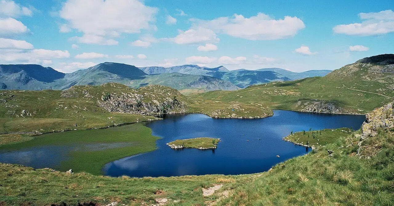
- Angle Tarn: a beautiful tarn above Patterdale, where we wild camped on a rainy night in May.
- Brothers Water: an easy lakeside walk south of Patterdale.
- Catbells: a much gentler ridge walk near Keswick if you want an easier day.
FAQ
How long does the Helvellyn Striding Edge walk take?
The full loop from Glenridding takes most people 5–7 hours. It takes about 3 hours to reach the summit via Striding Edge.
Is Striding Edge dangerous?
It can be. The ridge is narrow and exposed, with big drops on both sides, and there have been fatal falls. In dry, calm weather it is a manageable Grade 1 scramble for confident walkers with a head for heights.
Can you avoid the scramble on Striding Edge?
There is a lower path beside the crest, but it is narrow with a steep drop too. If you want to avoid scrambling, choose a different route up Helvellyn or walk to Red Tarn instead.
Is there parking in Glenridding?
Yes, there is a large pay and display car park in the village centre. It fills by mid-morning on sunny weekends, so arrive early or take the 508 bus from Penrith.
Can I climb Helvellyn in winter?
Only with winter skills, an ice axe and crampons. Ice and snow cornices make the final climb very dangerous. Check the daily Fell Top Assessors' report on Weatherline first.
Have you crossed Striding Edge? How did you find the Chimney? Let me know in the comments!
Photo credits (4)
All photos on this page are by other photographers and are used under free licences. Thank you for sharing them.
- Cover photo: Striding Edge and Helvellyn - geograph.org.uk - 2322543.jpg by Gareth Jones, CC BY-SA 2.0, via Wikimedia Commons. Resized and cropped for this page.
- Photo 2: Path from Birkhouse Moor to Hole-in-the-Wall - geograph.org.uk - 2621291.jpg by Bill Boaden, CC BY-SA 2.0, via Wikimedia Commons. Resized for this page.
- Photo 3: Striding Edge, Helvellyn, Lake District (14193959955).jpg by Andrew Bone from Weymouth, England, CC BY 2.0, via Wikimedia Commons. Resized for this page.
- Photo 4: Helvellyn July 2022 5.jpg by Amakuru, CC BY-SA 4.0, via Wikimedia Commons. Resized for this page.


join the conversation
Comments
No comments yet. Be the first to share your thoughts!