🥾 Trail guide · England – Lake District
Catbells Walk: A Complete Guide to the Catbells & Derwentwater Circular

- Distance
- 6 km
- Ascent
- 390 m
- Time
- 2.5–3.5 hours
- Difficulty
- Moderate
- Route
- Circular
- Best season
- April–October
👶 With kids: A classic first fell for kids around 5+ who are used to walking; a back carrier works for little ones, but the ridge isn't pushchair-friendly. The lakeshore path through Brandelhow is gentler but still has roots, rocks and steps.
✅ Updated and fact-checked on 2 November 2026. Prices, timetables and rules can change, so check the official sources before you go.
This post contains affiliate links. If you book or buy through them, I may earn a small commission at no extra cost to you. More about this
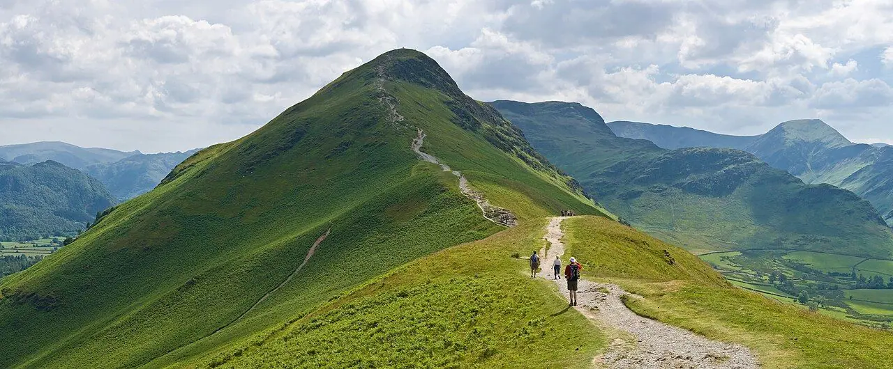
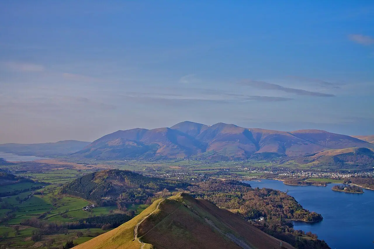
Catbells is only 451 m high. But the views from the top are amazing for such a short climb. The knobbly ridge rises straight from the western shore of Derwentwater. From the top you can see the islands of the lake, the rooftops of Keswick, Skiddaw and Blencathra to the north, the green Newlands Valley to the west and Borrowdale to the south. No wonder Alfred Wainwright thought it was the perfect fell for the whole family, from grandparents to young children.
We have explored other corners of the Lake District, but we haven't climbed Catbells yet. It's high on our bucket list, so I've researched every detail for you. What I love about this circuit is how you get there and back. Instead of fighting for a roadside parking space, you can take the Keswick Launch across Derwentwater to the little jetty at Hawes End. Then you climb the ridge, drop down to the lakeshore and wander back through Brandelhow Park. This was the very first land the National Trust bought in the Lake District, in the early 1900s, to save it from housing development. Here is a fun fact for Beatrix Potter fans: she placed Mrs Tiggy-Winkle's home on the slopes of Catbells. Also, the gardens at nearby Lingholm are said to be the inspiration for Mr McGregor's garden.
However, don't let the small height fool you. The climb is steep in places, there are two short rocky sections where you will need to use your hands, and the ridge is fully exposed to wind and rain. With good timing and sensible shoes, it is definitely one of the best half-day walks in England. Below I describe the full circuit from Hawes End, plus every way to get there by boat, bus or car.
At a glance
- Distance: about 5.5–6 km for the loop from Hawes End. Add about 4 km each way if you walk from Keswick instead of taking the boat
- Elevation gain: around 380–400 m
- Allow 2.5–3.5 hours, plus stops
- Difficulty: Moderate. A steep, stone-pitched climb with two short, easy scrambles, then a rocky descent to Hause Gate
- Route type: Circular (Hawes End → ridge → Hause Gate → lakeshore → Hawes End)
- Start/finish: Hawes End jetty on Derwentwater's western shore (or the Hawes End cattle grid bus stop)
- Best season: April–October, when the boat and the Honister Rambler bus both run fully
- Prices: free to walk, but you pay for the Keswick Launch or the bus
- Toilets: none on the route itself, and no cafés either. There are toilets and cafés in Keswick. The Lingholm Kitchen is about 15 minutes' walk north of Hawes End
- Suitable for children: yes, great for kids on foot or in a carrier. Not pushchair-friendly
- Dogs: welcome, and they travel free on the Keswick Launch. Keep them on a lead near sheep and on the scrambly sections
Route description
Hawes End to Skelgill Bank
From the Hawes End jetty, follow the path up through the trees away from the lake to the road. Turn left and walk uphill a short way past the cattle grid. At the first bend, a signposted path leaves the road for Catbells. If you come by bus, the stop at the Hawes End cattle grid drops you right here.
The path climbs steeply straight away. It zig-zags up the end of the ridge on stone pitching, which was rebuilt to stop erosion. The views open up fast: Derwentwater and its wooded islands below, Keswick beyond and Skiddaw rising behind. Low down on the ridge you pass a memorial stone to Thomas Arthur Leonard, a pioneer of outdoor holidays for working people.
The first scramble and the ridge
Not far above the memorial there is a short rocky step where you will need to use your hands for a few moves. Thousands of boots have polished it, so it is slippery when wet. Take it slowly with kids! After this the path levels out over Skelgill Bank, the lower of Catbells' two tops. From here you get your first good look along the ridge to the summit.
This middle section looks like so much fun. It is a gentle, grassy walk along the crest, with the Newlands Valley on your right and Derwentwater on your left.
Summit
The final climb to the top is steeper and rockier, with a second short scramble. If you would rather avoid the hands-on bit, there is usually an easier line slightly to the right. The summit is a small rocky knoll with 360-degree views. On a clear day it is one of the best views in the Lakes for so little effort. On sunny weekends, expect to share it with lots of other people.
Down to Hause Gate
Continue south over the summit on a rocky, uneven path down to Hause Gate. This is the grassy saddle between Catbells and the higher Maiden Moor. Ignore the path that carries straight on up towards Maiden Moor.
Descent to the lakeshore
At Hause Gate, turn left (east) onto the steep, stone-pitched path down towards Derwentwater. It is well made but steep, so take your time on wet days. Lower down, follow the path towards the road near the old mine workings and the woodland above Brandelhow Bay. Cross the road and take the path down to the lakeshore.
For a shorter, gentler option, you can take the Terrace path from the lower slopes. It runs north along the hillside above the lake back towards Hawes End.
Brandelhow lakeshore back to Hawes End
The walk back along the shore is a lovely way to cool down. The path winds through the oak and birch woods of Brandelhow Park. You pass little pebbly beaches, the High Brandelhow and Low Brandelhow jetties and views across the water to Keswick and Skiddaw. Look out for the Centenary Stones sculpture, which marks 100 years of the National Trust in the Lakes. Follow the shore path north back to Hawes End jetty. It is around 15 minutes' walk from Low Brandelhow.
Tip: if your legs are tired, you can catch the launch back to Keswick from High or Low Brandelhow instead of walking all the way to Hawes End.
How to get there
By boat: Keswick Launch
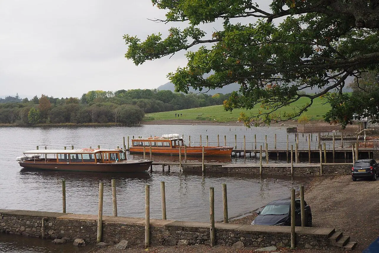
I think the most fun way to arrive is on the Keswick Launch from Keswick Boat Landings. It is a short walk from the town centre, past Theatre by the Lake. In the summer timetable (roughly late March to early November), launches leave Keswick hourly in each direction, with extra sailings in the school summer holidays. There is usually an early walkers' direct launch to Hawes End. In 2026 it was the 09:45 from Keswick, arriving 09:55. Anticlockwise sailings reach Hawes End in around 10 minutes. Clockwise ones take around 40 minutes, as they go round the lake first.
Prices: In 2026, a single from Keswick to Hawes End cost £6.95 for adults and £3.50 for children (5–15). Under-5s travel free. A hop-on, hop-off round-the-lake ticket was £16 for adults. Well-behaved dogs travel free. You board by steps with a handrail, so you will need to fold a pushchair. The winter service is very limited, with no sailings in December and January. Sailings can also be cancelled in bad weather, so check the current times, fares and daily service status on the Keswick Launch website.
By bus
The Honister Rambler 77/77A (Stagecoach) runs a circular route from Keswick bus station via Portinscale, Catbells, Grange, Honister and Buttermere. It runs daily in the main season (in 2026, from 23 March to 1 November), up to hourly. Get off at the Hawes End cattle grid stop. Unfortunately, it does not run in winter.
Getting to Keswick
There is no railway station in Keswick. The nearest stations are Penrith, on the West Coast Main Line, and Windermere. From Penrith, Stagecoach's X4/X5 buses run to Keswick. Windermere is linked to Keswick by the 555. Check Traveline for current timetables.
On foot from Keswick
You can walk from Keswick to the foot of Catbells in about 4 km via Portinscale, on footpaths through fields and woods (passing near Lingholm). I suggest walking one way and taking the boat the other.
By car and parking
Parking: Parking near Catbells is extremely limited. There is only a small amount of space near Hawes End, and it fills up very early in summer. Parking on double yellow lines is enforced, because it blocks emergency vehicles. Please don't do it! A good alternative is Park and Sail. Park at Keswick Rugby Club (around 200 spaces) and you get 15% off launch tickets. Check the details on the Visit Keswick website.
Permits, fees & opening times
- You don't need a permit or entry fee to walk Catbells.
- Keswick Launch: pay at the Keswick Boat Landings booking office or online. At other jetties, pay on board (card preferred). The summer timetable runs from late March to early November. Winter sailings are limited to selected dates. Check keswick-launch.co.uk.
- Honister Rambler 77/77A: spring to autumn only. Check Stagecoach or Traveline for current times. Lake District day tickets are available.
When to go
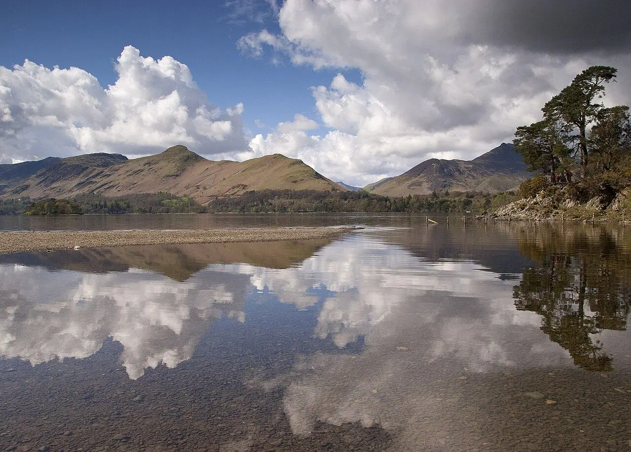
In my opinion, spring and autumn are the best times. There are fewer people, the light is lovely, and the bracken is either fresh green or burnt orange. Summer is beautiful but extremely busy, especially on sunny weekends and in school holidays. So aim for the early walkers' launch to beat the crowds. Midsummer evenings on the ridge can be magical, but check the last launch and bus times.
The ridge is exposed, and the wind on top can be much stronger than in Keswick. After heavy rain the rock steps are slippery, and in winter they can be icy or covered in snow. Always check the Met Office mountain forecast or MWIS for the Lake District before you set off.
Hiking with kids
Suitable for children: Catbells is famous as a family fell, and for good reason. The climb is short enough for most children from around 5 who are used to walking. The scrambles feel like a real adventure without being serious. And the boat trip at the start makes the day even more special.
- Pushchairs: not suitable on the ridge. The lakeshore path through Brandelhow is gentler, but it still has roots, rocks, steps and uneven ground. You also need to fold the pushchair on the launch.
- Carriers: a back carrier is the best way to bring toddlers. Take care on the scrambles and the steep descent from Hause Gate, and keep your balance in the wind.
- Walking kids: help them through the two rocky steps and keep a close eye on them on the steep descent.
- Keep them engaged: tell them the story of Mrs Tiggy-Winkle, who lived on Catbells. Count the islands on Derwentwater from the summit, skim stones on the beaches in Brandelhow, and visit the Lingholm walled garden, Beatrix Potter's inspiration for Mr McGregor's garden.
What to pack
- Walking boots or trail shoes with good grip, as the rock is polished
- A waterproof jacket and a warm layer, as it is often much windier on top
- Water and snacks, because there is nothing on the route
- OS Explorer OL4 (The English Lakes – North-western area) or a navigation app
- Cash or card for the launch and the bus
- Sun hat and sunscreen in summer, as there is no shade on the ridge
- A swimsuit for a paddle in the lake at Brandelhow in summer. Be careful, the water is cold and deep!
Safety tips
- Take the scrambles slowly, especially in the wet. Countless boots have polished the rock smooth.
- Stay on the main path. There are old mine workings on the sides of the fell, including the Yewthwaite mine on the western side.
- Don't continue to Maiden Moor unless you have planned a longer walk. The paths beyond Hause Gate lead onto higher, more remote ground.
- Check the last launch and bus times before you set off, so you don't get stranded.
- In an emergency, call 999 and ask for Police, then Mountain Rescue.
Leave no trace & sustainable tips
- Stick to the pitched path. Catbells gets so many visitors that the National Trust's Fix the Fells team and volunteers work all year to stop the main path widening and gullying. Walking on the edges or cutting corners undoes their work. You can donate to Fix the Fells to help.
- Come car-free. The launch and the Honister Rambler take pressure off the narrow lanes around Catbells, where illegal parking is a serious problem.
- Keep dogs on leads around sheep, and never let them chase wildlife.
- Take all litter home, including food scraps.
- Swim responsibly. Don't disturb wildlife, and never swim near the launch jetties.
- Support local: eat and shop in Keswick, Portinscale and Grange.
Where to stay & eat nearby
- Keswick is the obvious base. There are lots of hotels, B&Bs, self-catering places, hostels and campsites, plus plenty of cafés, pubs and outdoor shops.
- The Lingholm Kitchen & Walled Garden is about 15 minutes' walk north of Hawes End. It is a café overlooking a walled garden and sounds like a lovely post-walk stop (check opening times).
- Portinscale, a small village between Keswick and Catbells, has accommodation and places to eat.
- Grange-in-Borrowdale, south of Catbells and on the 77/77A bus route, has a café and accommodation.
- YHA Keswick and other hostels in the Keswick area are budget-friendly options for families.
More to explore nearby
- Derwentwater by launch: hop on and off at Lodore (for Lodore Falls) or Ashness Gate (for Ashness Bridge and Surprise View).
- Friar's Crag: a short, buggy-friendly walk from the Keswick Boat Landings to a famous viewpoint.
- Castlerigg Stone Circle: a Neolithic stone circle on the edge of Keswick.
- Maiden Moor and High Spy: extend your ridge walk south from Hause Gate if you are feeling energetic.
- Whinlatter Forest: trails, mountain biking and play areas, which you can reach on the 77/77A bus.
- Honister Slate Mine and Buttermere: another stop on the Honister Rambler.
FAQ
How long does it take to walk up Catbells? Most people reach the summit from Hawes End in about 1–1.5 hours. The full circular route, back along the lakeshore, takes 2.5–3.5 hours.
Is Catbells suitable for beginners and children? Yes, it is one of the best-known family fells in the Lake District. However, the path is steep in places and there are two short scrambles where you will use your hands. So you need good footwear and some care.
How do I get to Catbells without a car? Take the Keswick Launch from Keswick Boat Landings to Hawes End jetty. Or take the Honister Rambler 77/77A bus from Keswick to the Hawes End cattle grid stop (spring to autumn). You can also walk from Keswick in about an hour.
Is there parking at Catbells? Only a very small amount near Hawes End, and it fills early. Use Park and Sail at Keswick Rugby Club, the launch or the bus instead. Never park on double yellow lines.
Does the Keswick Launch run all year? No. It runs a full timetable from late March to early November and a limited service on selected days in November, February and March. There are no sailings in December and January.
Have you climbed Catbells? Let me know in the comments!
Photo credits (4)
All photos on this page are by other photographers and are used under free licences. Thank you for sharing them.
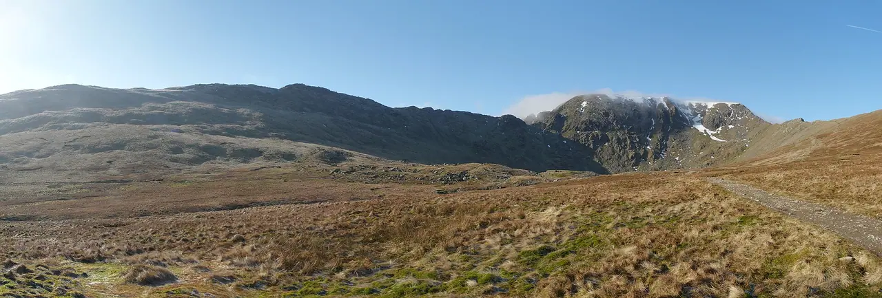
- Cover photo: Catbells Northern Ascent, Lake District - June 2009.jpg by Diliff, CC BY-SA 3.0, via Wikimedia Commons. Resized and cropped for this page.
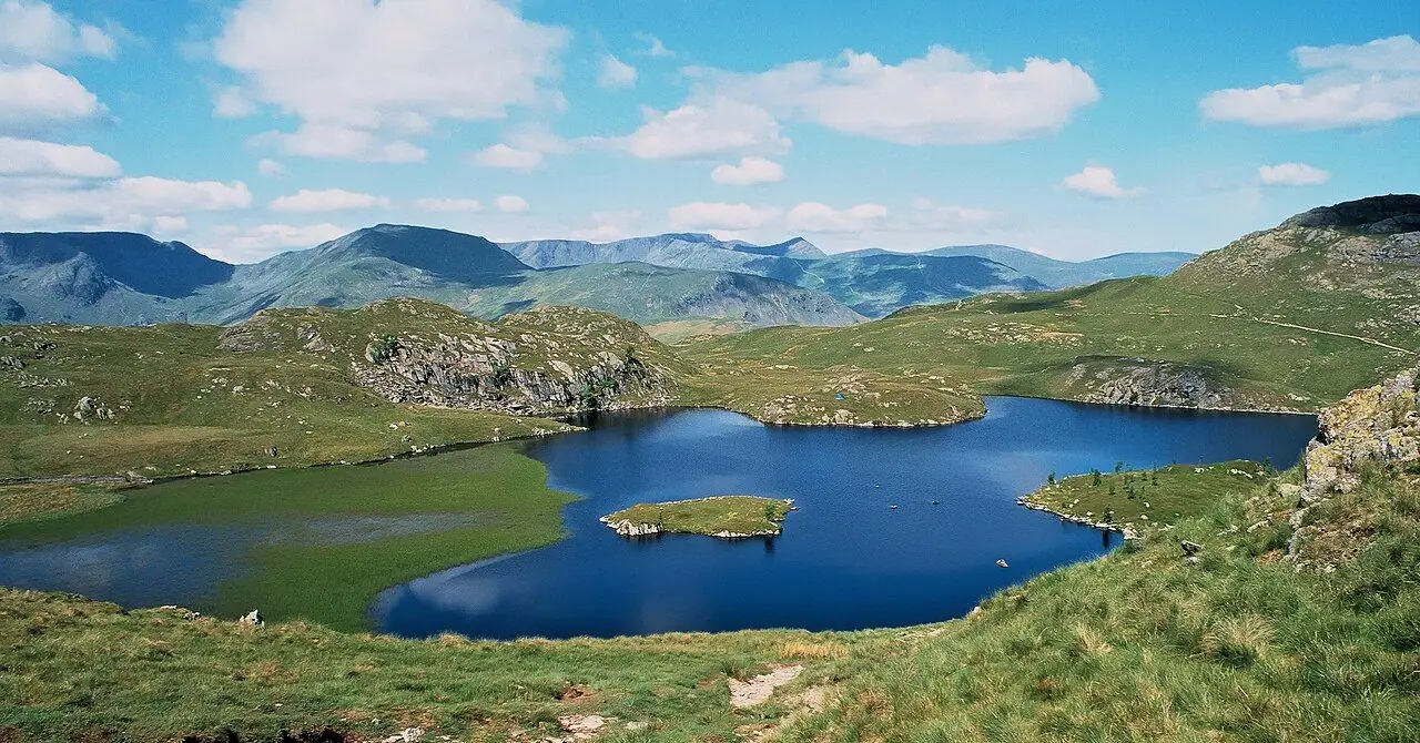
- Photo 2: Catbells View - geograph.org.uk - 3193666.jpg by Mike Harris, CC BY-SA 2.0, via Wikimedia Commons. Resized for this page.
- Photo 3: Catbells and Friars Crag - geograph.org.uk - 3634667.jpg by Chris Denny, CC BY-SA 2.0, via Wikimedia Commons. Resized for this page.
- Photo 4: Launches on Derwentwater in Keswick - geograph.org.uk - 6998787.jpg by Jennifer Petrie, CC BY-SA 2.0, via Wikimedia Commons. Resized for this page.


join the conversation
Comments
No comments yet. Be the first to share your thoughts!