🥾 Trail guide · Albanian Alps – Valbona and Theth
Valbona to Theth Hike: A Complete Guide to Crossing Albania's Accursed Mountains

- Distance
- 16 km
- Ascent
- 900 m
- Time
- 6–8 hours
- Difficulty
- Challenging
- Route
- Point to point
- Best season
- Mid-June–mid-September (snow can linger on the pass into June)
👶 With kids: Only for fit older kids and teenagers who are used to long mountain days. With younger children, walk part of the way up the valley from Valbona or Theth and turn back.
✅ Updated and fact-checked on 5 November 2026. Prices, timetables and rules can change, so check the official sources before you go.
This post contains affiliate links. If you book or buy through them, I may earn a small commission at no extra cost to you. More about this
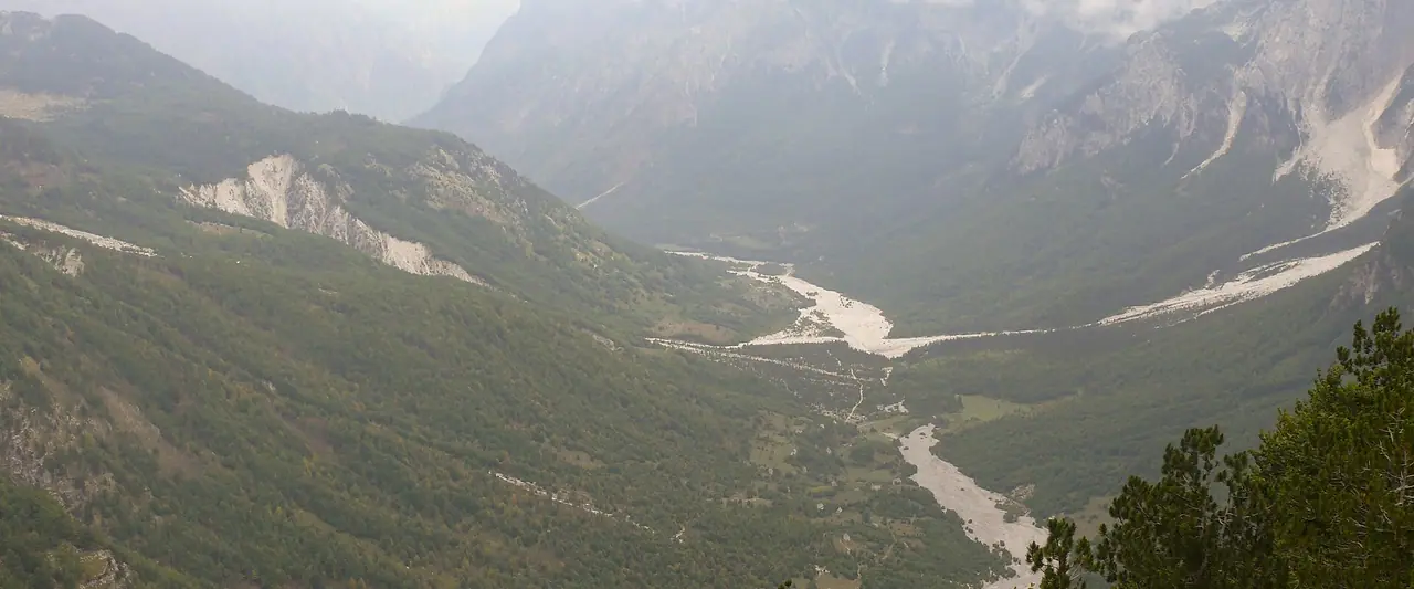
Jagged limestone peaks, green valleys, old stone guesthouses and a pass that links two of the most beautiful villages in the Balkans. The hike from Valbona to Theth crosses the Accursed Mountains, the Albanian Alps, in one long, unforgettable day. Add the ferry ride across Lake Komani at the start, and you have one of the best mini adventures in Europe.
We haven't hiked this one yet, but it's high on our bucket list, so I've researched every detail for you. What I love about it is that it is a real journey. You take a minibus, a boat and another minibus to reach Valbona. Then you walk over the Valbona Pass at about 1,795 m and drop down into Theth on the other side.
However, it is a long day in remote mountains, with a big climb and a long, rocky descent. Would you be ready for 7 or 8 hours on your feet? Below I explain the route step by step, the 2026 ferry and minibus times, what to pack and when to go.
At a glance
- Distance: about 14–17 km, depending on where you start in the Valbona valley.
- Elevation gain: around 800–1,000 m up from Valbona, then about 1,000 m down to Theth (around 750 m).
- Allow 6–8 hours. Many hikers take 6–9 hours with breaks.
- Difficulty: Challenging. It isn't technical, but it is long, steep in places and rocky on the descent.
- Route type: Point to point, from Valbona to Theth.
- Highest point: the Valbona Pass (Qafa e Valbonës), about 1,795 m.
- Trail marking: red and white paint on rocks and trees.
- Best season: mid-June to mid-September. Snow can stay on the pass in May and early June.
- Prices: I couldn't find any official permit or trail fee. Bring cash for the cafés along the way.
- Toilets: at Simoni Café, about 1–2 hours from the start.
- Suitable for children: only for fit older kids and teenagers who are used to long mountain days.
Route description
Valbona to Rragam and the dry riverbed
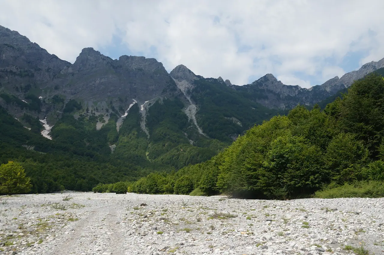
Guesthouses in Valbona are spread out along a long road, so where you start makes a big difference. From the village, it takes about 40 minutes to walk to the trailhead, and some guesthouses will drive you there. The trail starts near Rragam, at the top of the valley. The asphalt ends about 2 km from Valbona.
The first section crosses a wide, dry riverbed. It is flat and rocky, with very little shade. Hikers do sometimes lose the path here, so keep an eye out for the red and white markings.
The forest climb to Simoni Café
Next, the path climbs into the forest. After about 1–2 hours you reach Simoni Café. It has a toilet, fresh spring water and coffee, and it is the last café for a while. This is a good place for a break, because the steep climb through the forest above it is probably the hardest part of the way up.
Up to the Valbona Pass
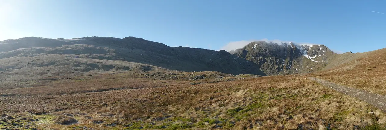
About 2.5 hours from the start, a big rock with a signpost marks a change in the terrain. There is a short scramble here, and then the path gets easier. Soon you reach the Valbona Pass, at about 1,795 m. From the top you can look back down the Valbona valley and ahead over Theth. I think this must be one of the most stunning views in Albania!
If you still have energy, there is an optional, steep scramble to a higher viewpoint near the pass. Aim to reach the pass by early afternoon, as storms can build up later in the day.
Down to Theth
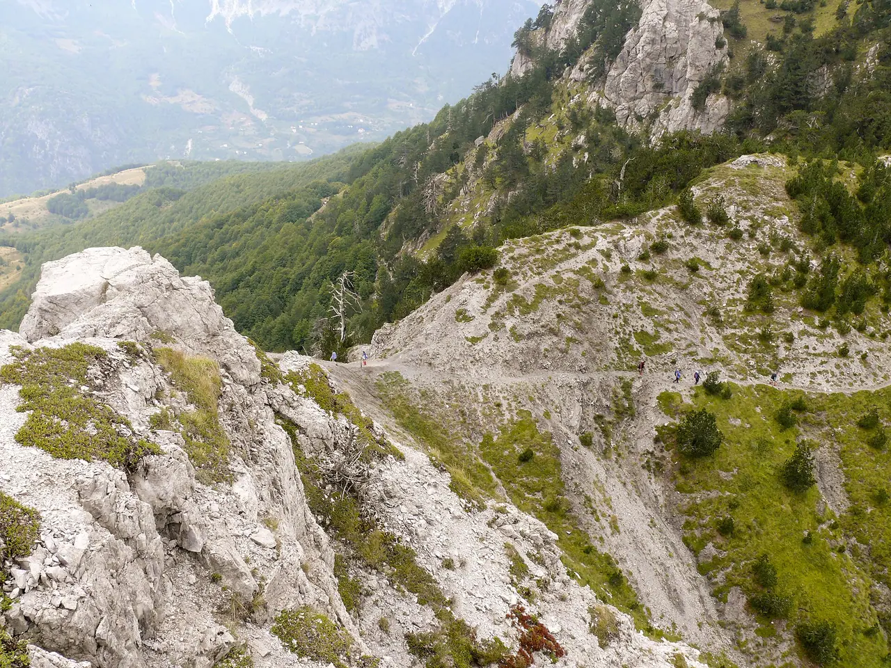
Just over the pass there is another seasonal café, where you can refill your water and have a mountain tea. Then the path drops through the forest, where tree roots make it easy to trip. The final descent is on loose, slippery gravel, and many hikers say it is the hardest part on the knees. Take your time and use walking poles if you have them.
Finally, you arrive in Theth, at about 750 m. The guesthouses here are also spread across the valley, so save the location of yours before you set off.
How to get there
Shkodër to Valbona by ferry
The classic way to reach Valbona is the stunning ferry across Lake Komani. Most people start in Shkodër. In 2026 the Berisha ferry company ran this timetable from 15 April to 5 November:
- Shkodër to Koman: minibus at about 7 am, €8. Taxis cost from €70.
- Koman to Fierza: ferry at 9 am, about 2.5–3 hours. €9 online or €10 in cash.
- Fierza to Valbona: minibus at 12 pm and 4 pm, €8, about 1 hour.
Spend the night in Valbona and hike the next day. Other ferry companies also run on the lake in summer, with their own timetables.
Theth back to Shkodër
From Theth, minibuses ran back to Shkodër at 11 am and 5 pm in 2026, for €12. The drive takes just under 2 hours on a winding mountain road. A taxi costs from €90. Times can change and may depend on passenger numbers, so I suggest booking your transfer through your guesthouse.
By car
A car isn't very practical for a point-to-point hike. You can take a car on the ferry (€7 per square metre online in 2026), but then you need to get back to it. Most people leave their car in Shkodër. The road to Theth has been paved and upgraded, but it is usually impassable in winter until April.
Luggage
Leave your big bags at your accommodation in Shkodër, as many places offer luggage storage. Then carry only a daypack for the two or three nights in the mountains. Horses sometimes carry luggage over the pass, but I recommend travelling light instead.
Permits, fees & opening times
- Permits: you don't need a permit to hike. Both valleys are part of the Alps of Albania National Park, created in 2022 from Theth National Park, Valbona Valley National Park and the Gashi Nature Reserve.
- Cash: the cafés don't take cards, and there are no ATMs in the villages. Take enough cash from Shkodër for your guesthouses, food and transport.
- Ferry season (2026): daily from 15 April to 5 November. Outside this period, you need to reach Valbona by road instead.
- Cafés: all the cafés on the trail are seasonal and may be closed outside summer.
When to go
The best time is from mid-June to mid-September. In May and early June there can still be snow on the pass. July and August are the hottest and busiest months, so book your guesthouses early. September is probably my favourite choice, with cooler days and fewer people.
From October to April, I don't recommend this hike unless you have winter gear and local information. Always check the forecast, start early and be over the pass before the afternoon storms.
Hiking with kids
Suitable for children: this is a hard day, so I would only bring fit older kids and teenagers who already enjoy long hikes.
- Little ones: instead of the full crossing, walk up the valley from Theth or Valbona for a few hours and turn back.
- Carriers: the descent is too long and slippery to carry a child safely all the way.
- Breaks: plan a long stop at Simoni Café and another at the café over the pass.
- Theth for families: a walk to the Grunas waterfall is an easier outing for younger kids.
What to pack
- Hiking boots with good grip and ankle support
- At least 2 litres of water per person
- Walking poles for the long descent
- A waterproof jacket and a warm layer for the pass
- Sun hat, sunglasses and sun cream
- Cash for the cafés and your guesthouse
- A downloaded offline map and a charged power bank
There are springs along the way, such as the one at Simoni Café. If you want to refill from streams too, a small filter is handy. The Sawyer Mini is one I recommend in my wild camping kit list. You can filter straight into your water bottle.
The mobile signal disappears on large parts of the pass. So if you hike a lot in remote places, a satellite messenger is worth thinking about. The Garmin inReach Mini is one I recommend in my guide to personal locator beacons and emergency GPS devices.
Shops in the villages are very limited, so buy your snacks in Shkodër. Nuts, energy bars and dried fruit are perfect for a long day like this, and I share more ideas in my post on the best food for expeditions.
Safety tips
- Start early. This gives you time for breaks and gets you over the pass before afternoon storms.
- Follow the red and white markings, especially in the dry riverbed. The distance signs aren't always accurate.
- Download an offline map before you leave, as there is no signal on much of the route.
- Tell your guesthouse your plan and save their phone number.
- Take care on the descent. Loose gravel and roots cause most slips.
- Remember it is wild country. Brown bears, wolves and lynx live in the Valbona valley, although you are unlikely to see them on this popular trail.
Leave no trace & sustainable tips
- Take all your rubbish with you, and leave nothing behind at the cafés or the pass.
- Stay on the marked path and don't cut the zigzags on the descent.
- Refill your bottle at the springs and cafés instead of buying plastic bottles.
- Support local families. Stay in guesthouses, eat their home-cooked dinners and buy a coffee at the cafés on the trail.
- Use the shared minibuses rather than private taxis where you can.
Where to stay & eat nearby
- Valbona: choose a guesthouse close to the trailhead, as the village is spread along a long road. Most guesthouses offer dinner and breakfast.
- Theth: I suggest staying at least one night after the hike, so you have time to explore. The guesthouses are spread across the valley.
- Shkodër: the best base before and after, with lots of hostels and hotels and plenty of places to store your luggage.
- Book ahead in July and August, when the guesthouses fill up.
More to explore nearby
- The Blue Eye of Theth: a beautiful blue natural pool in the mountains near the village.
- Grunas waterfall: reached from Theth over a bridge built by the Project Albanian Challenge.
- The Lock-in Tower: one of the very few remaining towers where families in a blood feud once hid.
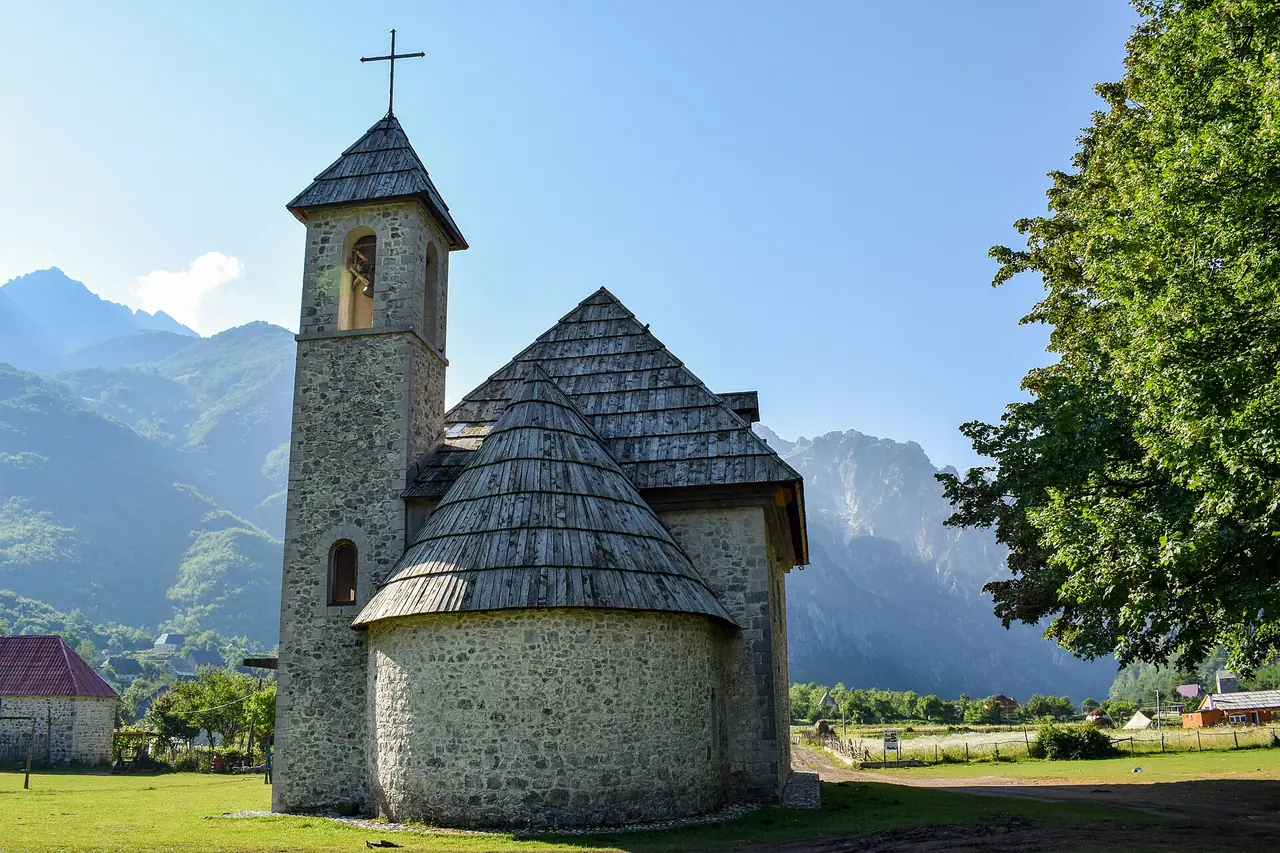
- Theth church: the little Catholic church in the valley is a lovely photo spot.
- Lake Komani: even if you don't hike, the ferry ride through the narrow, fjord-like lake is a highlight.
- Peaks of the Balkans: Valbona to Theth is one stage of this long-distance trail through Albania, Kosovo and Montenegro.
FAQ
How long is the Valbona to Theth hike?
It is about 14–17 km, depending on where you start in Valbona. Most hikers take 6–8 hours, or up to 9 with long breaks.
Is it better to hike from Valbona to Theth or Theth to Valbona?
Both work. Many hikers go from Valbona to Theth, because the climb on the Valbona side is more gradual and the transport connections with the Komani ferry work better.
Is the Valbona to Theth hike hard?
It is not technical, but it is a long day with around 1,000 m of climbing and a steep, rocky descent. You need to be fit and have good boots.
Do I need a guide for the Valbona Pass?
Not in summer, if you are an experienced hiker. The trail is well marked in red and white. However, download an offline map, as there is little signal on the pass.
How do I get back to Shkodër from Theth?
Minibuses ran from Theth to Shkodër at 11 am and 5 pm in 2026, for €12. Your guesthouse can help you book a seat.
Have you hiked from Valbona to Theth? Which direction did you choose? Let me know in the comments!
Photo credits (4)
All photos on this page are by other photographers and are used under free licences. Thank you for sharing them.
- Cover photo: Valbona Valley from Valbona Pass.jpg by Jirka Dl, CC BY-SA 3.0, via Wikimedia Commons. Resized and cropped for this page.
- Photo 2: Lugina i Valbonës në Rragam.jpg by Albinfo, CC0, via Wikimedia Commons. Resized for this page.
- Photo 3: Valbona Pass.jpg by Jirka Dl, CC BY-SA 3.0, via Wikimedia Commons. Resized for this page.
- Photo 4: Kisha e Thethit - 2018 (2).jpg by Liridon, CC BY-SA 4.0, via Wikimedia Commons. Resized for this page.


join the conversation
Comments
No comments yet. Be the first to share your thoughts!