🥾 Trail guide · West Iceland – Hvalfjörður
Glymur Waterfall Hike: How to Reach Iceland's Second-Tallest Waterfall in Hvalfjörður

- Distance
- 7 km
- Ascent
- 400 m
- Time
- 3–4 hours
- Difficulty
- Challenging
- Route
- Circular
- Best season
- June–September (when the log bridge is usually in place)
👶 With kids: Not suitable for small children, pushchairs or carriers because of the unfenced cliff edges, the log crossing and the river wade. Families can walk to the cave and the river and back instead.
✅ Updated and fact-checked on 5 November 2026. Prices, timetables and rules can change, so check the official sources before you go.
This post contains affiliate links. If you book or buy through them, I may earn a small commission at no extra cost to you. More about this
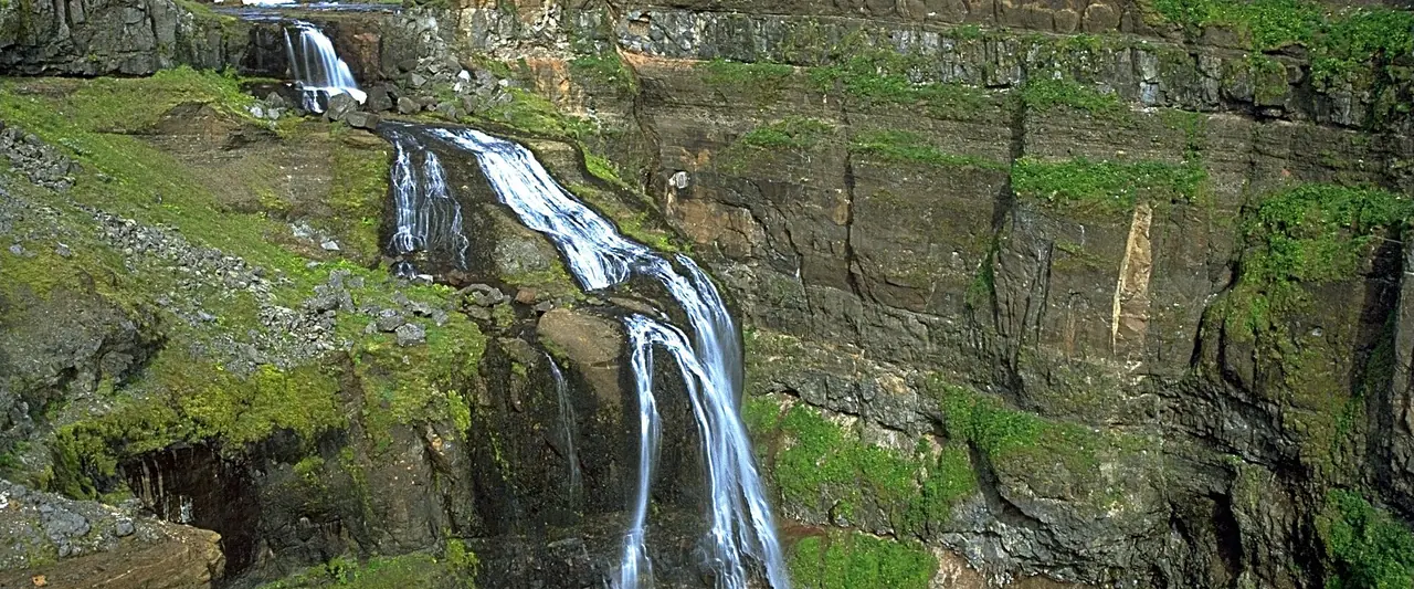
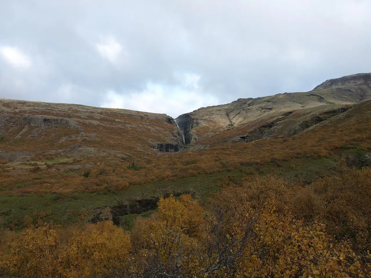
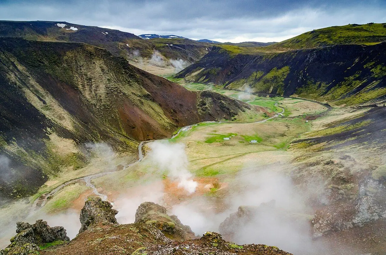
Glymur is 198 m tall, and you can't see it from the car park. You have to earn it. The hike takes you into the quiet Botnsdalur valley at the end of Hvalfjörður, through a little cave, across a river on a log and up along the edge of a deep, mossy canyon. Then, finally, Iceland's second-tallest waterfall appears, dropping into the gorge below you. For years it was thought to be the tallest in the country, until Morsárfoss was measured in 2011.
We road-tripped around Iceland in 2016, but we didn't make it to Glymur, so I've researched every detail for you. It is only about an hour's drive from Reykjavík, yet it feels much wilder than the busy Golden Circle stops. However, it is not a stroll. There are cliff edges with no railings, a log crossing and a cold river to wade at the top. Are you up for a proper adventure?
There is also a fun legend behind the name. According to the story, a man was turned into a whale called Rauðhöfði (Redhead) by an elf woman. A blind pastor lured him up the river, and the whale's thrashing in the canyon made a loud rumbling echo. That is what "Glymur" means. The whale is said to have died in Hvalvatn, the lake that feeds the river.
At a glance
- Distance: about 7 km for the loop (sources give 6.9–7.1 km)
- Elevation gain: around 300–425 m, depending on the source
- Allow 3–4 hours, plus time for photos
- Difficulty: Challenging for a short hike. It is not technical, but there are steep sections, cliff edges and two river crossings
- Route type: Circular, up one side of the canyon and down the other. You can also go up and back the same way
- Start/finish: the Botnsá / Glymur car park in Botnsdalur, off Route 47
- Best season: June–September, when the log bridge is usually in place
- Prices: free to hike, and parking was free in 2026
- Toilets: none at the car park or on the trail
- Suitable for children: not for small children or anyone nervous of heights
- Dogs: I wouldn't bring one, because of the log crossing and the unfenced edges
Route description
Car park to the river
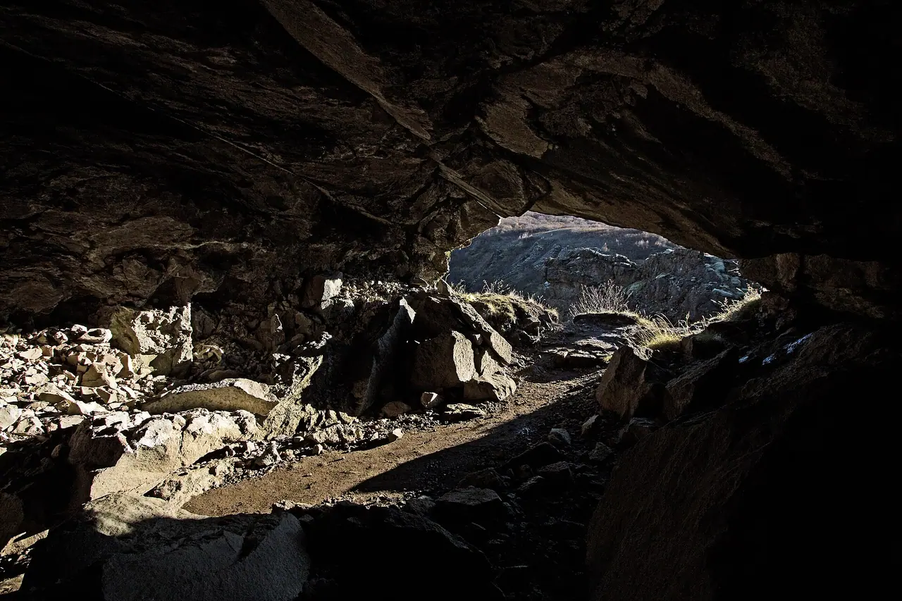
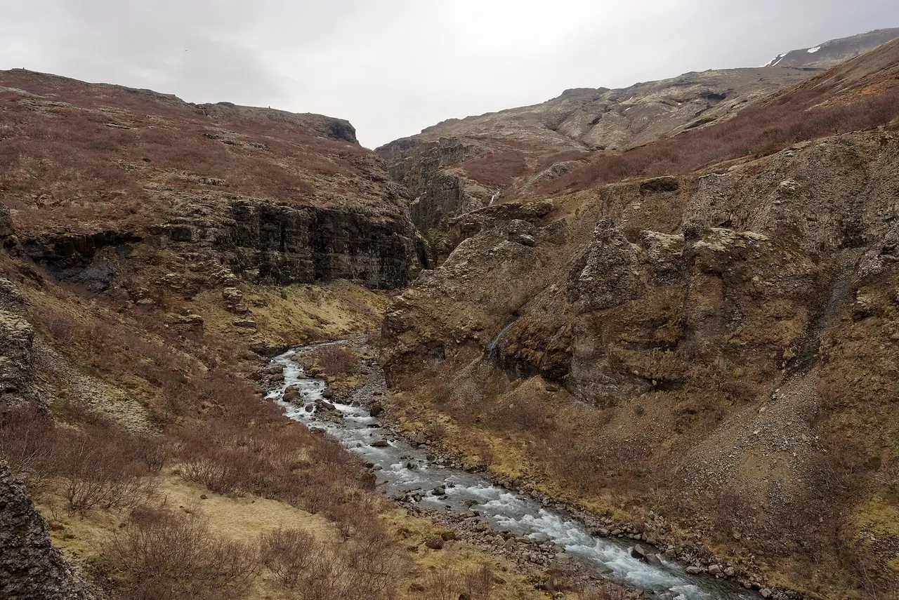
From the car park, a fairly flat path leads into Botnsdalur. It takes about 30 minutes to reach the Botnsá river. The trail is marked with yellow posts and cairns. Just before the river, the path goes through a small cave. It is a fun little surprise, especially with the green valley framed by the cave opening. After the cave, turn and follow the river upstream.
The log crossing
Next comes the famous part. You cross the Botnsá on a log, with a cable to hold on to for balance. The log is usually in place from about June to September. Outside these months it is removed, and the crossing gets much harder. If the log isn't there, I would not try to wade the river. Turn back and choose another walk.
Up along the canyon
Now the real climb begins. Allow 1–1.5 hours of steady uphill walking to the highest viewpoint. The path follows the edge of the canyon, and there are several viewpoints on the way with views of Glymur and smaller cascades. Some sections are steep and loose, and some run really close to the cliff edge. There are no railings, so take it slowly and keep children close!
The best views of the full drop come near the top, with the waterfall plunging into a canyon lined with green moss. I think this must be one of the most dramatic waterfall views in Iceland.
The upper crossing
Above the waterfall you have a choice. You can turn around and go back down the same way. Or you can cross the river and come down the other side to make a loop. Here the river is wide, shallow and slow, but there is no log, bridge or stepping stones. So expect wet feet. The water is very cold, even in July. You can take your boots off and wade barefoot or in water shoes. Never cross if the river looks fast or deep.
Down the other side
On the far side, an easier path takes you back down the valley to the car park. Some hikers follow a rougher route closer to the river, but it is poorly marked and easy to lose. I suggest sticking to the main path.
How to get there
By car
Glymur is about 70 km from Reykjavík, which is roughly a 60–70 minute drive. Head north on Route 1 towards Borgarnes. Just before the Hvalfjörður tunnel, turn right onto Route 47 and follow the road around the fjord. At the head of the fjord, look for the signs for Glymur. A gravel access road of about 3 km leads to the car park.
Parking: free, in a gravel car park labelled "Botnsa" on Google Maps. There are no facilities. It is not huge and can fill up on sunny summer days, so arrive early. Please don't park on the verges.
Public transport
Unfortunately, there is no public transport to the trailhead. You need your own car, or you can join a guided hike from Reykjavík.
Permits, fees & opening times
- No permit or entry fee is needed, and in 2026 parking was free.
- The trail has no opening hours, but the log bridge over the Botnsá is only in place in summer (roughly June to September).
- In winter the path can be dangerous. Visit West Iceland warn that you need proper equipment and hiking experience.
When to go
The best time is June to September. The log is usually in place, the snow has melted and the valley is green. Also, the long summer days mean you can start late and still finish in daylight. Weekdays and early mornings are quieter.
In spring and autumn the river can be higher, and snow or ice can cover the path. Outside summer, the crossing without the log can be impossible. In winter I wouldn't try it at all unless you are an experienced winter hiker with the right kit. The weather can change fast, so check the forecast on vedur.is and road conditions on road.is before you set off.
Hiking with kids
Suitable for children: honestly, I wouldn't bring small children. The trail has narrow paths right next to big drops, a log crossing and a cold river to wade. Confident, sure-footed older kids who listen well might enjoy it with an adult right next to them.
- Pushchairs: not suitable at all.
- Carriers: not a good idea, because of the log crossing and the steep, loose sections near the edge.
- Family alternative: walk to the cave and the river and back. It is a short, fairly flat walk and the cave is fun to explore.
- Better family hikes: Reykjadalur, near Hveragerði, has a warm river to bathe in and is a lot more forgiving.
What to pack
- Hiking boots with good grip
- Water shoes or sandals and a small towel for the upper river crossing
- A spare pair of socks
- A waterproof jacket and warm layers, as Icelandic weather changes fast
- Snacks and lunch, as there are no facilities
- Walking poles, which help on the steep descent and in the river
You can top up your bottle from the river, but I'd always filter it. The Sawyer Mini is the filter I recommend in my wild camping kit list. It is light and you can drink straight through it.
Safety tips
- Stay away from the cliff edges. There are no railings, and the ground near the edge can be loose.
- Use the cable on the log and cross one at a time.
- Don't wade the upper river if it looks fast or deep. Just turn back the way you came.
- Turn back in poor visibility or strong wind.
- Don't go in winter without proper equipment and winter hiking experience.
- In an emergency, call 112.
Leave no trace & sustainable tips
- Stay on the marked path. The moss in the canyon is really fragile.
- Take all your rubbish home. There are no bins at the car park.
- Plan a toilet stop before you leave, as there are no toilets at the trailhead.
- Park considerately and don't block the access road.
- Share a car or join a small group tour to keep traffic down in the valley.
Where to stay & eat nearby
- Reykjavík is the most practical base, with the widest choice of hotels, guesthouses and restaurants. Glymur makes an easy day trip from the city.
- Hvammsvík, about 20 minutes away on the fjord, has hot springs, accommodation and a restaurant. It sounds like a lovely place to warm up after the hike.
- There is nothing to buy at the trailhead, so bring a picnic from Reykjavík.
More to explore nearby
- Hvammsvík Hot Springs: natural hot pools by the sea in Hvalfjörður. Check the opening hours and prices before you go.
- Þingvellir National Park: the first stop on the Golden Circle, where you can walk between two tectonic plates. In 2026 parking was ISK 1,000 per car.
- Reykjadalur: a hike to a warm river near Hveragerði, which you can even reach by bus from Reykjavík.
- The Hvalfjörður drive: instead of the tunnel, take Route 47 around the fjord. It is much quieter since the tunnel opened.
FAQ
How long does the Glymur hike take?
Most people need 3–4 hours for the 7 km loop. Allow longer if you want plenty of photo stops.
Is the Glymur hike difficult?
It is not technical, but it is tougher than it looks. There is around 300–425 m of climbing, cliff edges with no railings, a log crossing and a cold river to wade at the top.
Is the log at Glymur there all year?
No. The log over the Botnsá is usually in place from about June to September and is removed for the rest of the year.
Do you have to cross the river at the top?
Only if you want to do the loop. You can turn around above the waterfall and walk back down the same way, which keeps your feet dry.
Can you get to Glymur by bus?
No. There is no public transport to the trailhead, so you need a car or a guided tour.
Have you hiked to Glymur? Did you wade across the top or turn back? Let me know in the comments!
Photo credits (4)
All photos on this page are by other photographers and are used under free licences. Thank you for sharing them.
- Cover photo: Glymur.jpg by Andreas Tille, CC BY-SA 4.0, via Wikimedia Commons. Resized and cropped for this page.
- Photo 2: Iceland, Cave, Glymur Waterfalls (15675181205).jpg by Lukas von Daeniken from Schweiz, CC BY-SA 2.0, via Wikimedia Commons. Resized for this page.
- Photo 3: Glymur gorge 1-10-08.JPG by Jabbi, Public domain, via Wikimedia Commons. Resized for this page.
- Photo 4: Botnsdalur Valley near Glymur Waterfall, Iceland, 20230504 1216 4644.jpg by Jakub Halun, CC BY-SA 4.0, via Wikimedia Commons. Resized for this page.


join the conversation
Comments
No comments yet. Be the first to share your thoughts!