🥾 Trail guide · England – Lake District
Scafell Pike from Wasdale Head: A Complete Guide to Climbing England's Highest Mountain

- Distance
- 9 km
- Ascent
- 900 m
- Time
- 5–6 hours
- Difficulty
- Strenuous
- Route
- Out and back
- Best season
- May–September (snow and ice are common on the summit in winter)
👶 With kids: Only for fit teenagers who are used to long hill days. It is too steep and rough for young children and not suitable for pushchairs or carriers.
✅ Updated and fact-checked on 5 November 2026. Prices, timetables and rules can change, so check the official sources before you go.
This post contains affiliate links. If you book or buy through them, I may earn a small commission at no extra cost to you. More about this
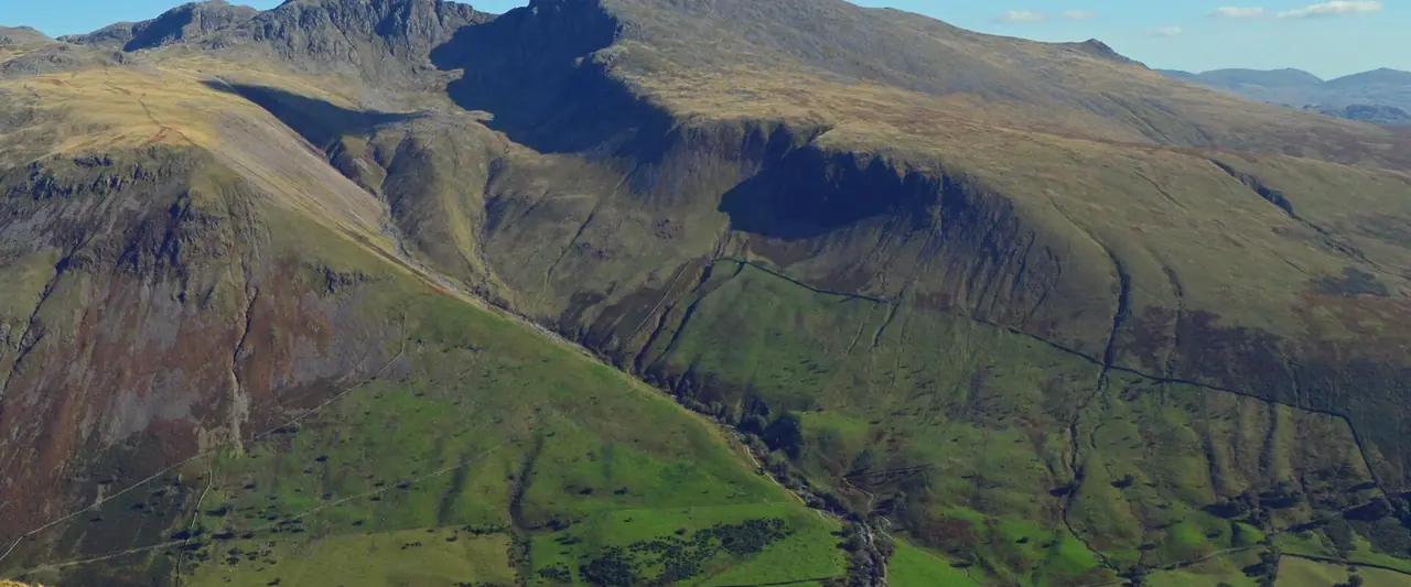
Have you ever wanted to stand on the roof of England? Scafell Pike is the highest mountain in England at 978 m. The shortest way to the top starts in Wasdale, a wild valley in the western Lake District. Here you have Wastwater, the deepest lake in England, the famous Screes and a ring of big fells all around. In 2007 ITV viewers even voted it Britain's Favourite View.
Scafell Pike has been on my bucket list for years, together with Ben Nevis and Snowdon. We haven't climbed it yet, but it's high on our list, so I've researched every detail for you. The Wasdale route is short in distance but very steep. You climb around 900 m from the valley floor to the summit. So it is a proper mountain day, not a stroll.
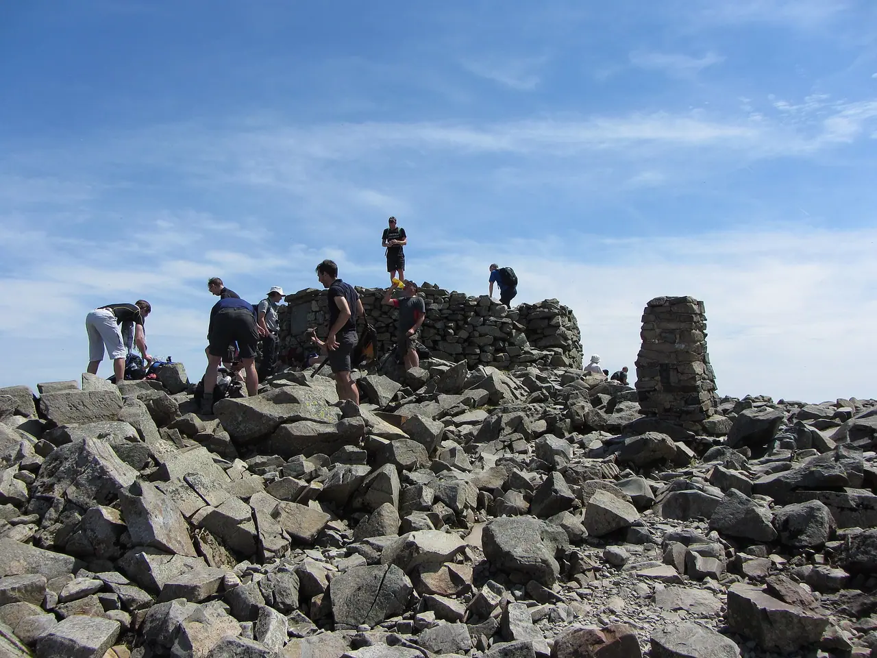
Here is a fun fact. The summit was given to the National Trust in 1919 by Lord Leconfield, as a memorial to the men of the Lake District who died in the First World War. You will find the memorial plaque on the summit. Below I describe the route from the Lake Head car park, how to get to Wasdale with or without a car and how to stay safe on the way up and down.
At a glance
- Distance: about 8.5–9.5 km return from Lake Head car park. Sources give between 5 and 6 miles
- Elevation gain: around 900 m. You start at about 80 m above sea level
- Allow 5–6 hours, plus stops
- Difficulty: Strenuous. A steep, rough path with a boulder field, a beck crossing and a rocky summit plateau that is easy to get lost on in mist
- Route type: Out and back (Lake Head → Hollow Stones → Lingmell Col → summit and the same way down)
- Start/finish: National Trust Lake Head car park, next to the Wasdale campsite (CA20 1EX)
- Best season: May–September. In winter the summit is often covered in snow and ice
- Prices: free to walk. You pay to park, but National Trust members park for free
- Toilets: temporary toilets at the Lake Head car park. Nothing on the mountain
- Suitable for children: only for fit teenagers who are used to long hill days. Not for pushchairs
- Dogs: welcome on a short lead, as sheep graze all over Wasdale. Only bring a dog that is used to long, rocky fell walks
Route description
Lake Head car park to the beck crossing
Go to the back of the Lake Head car park and take the footpath. Bear left and follow the waymarkers upstream. The beck stays on your right, and you walk past farmland with lots of Herdwick sheep. It is a gentle start, so enjoy it!
At about 300 m above sea level you reach the river crossing. When the beck is high it can be difficult, and after heavy rain it may even be impassable on your way back.
Brown Tongue and Hollow Stones
After the crossing, the stone-pitched path climbs steeply up Brown Tongue. This is the part where your legs will really start to burn. Take your time and look back often. The views over Wasdale get better with every step.
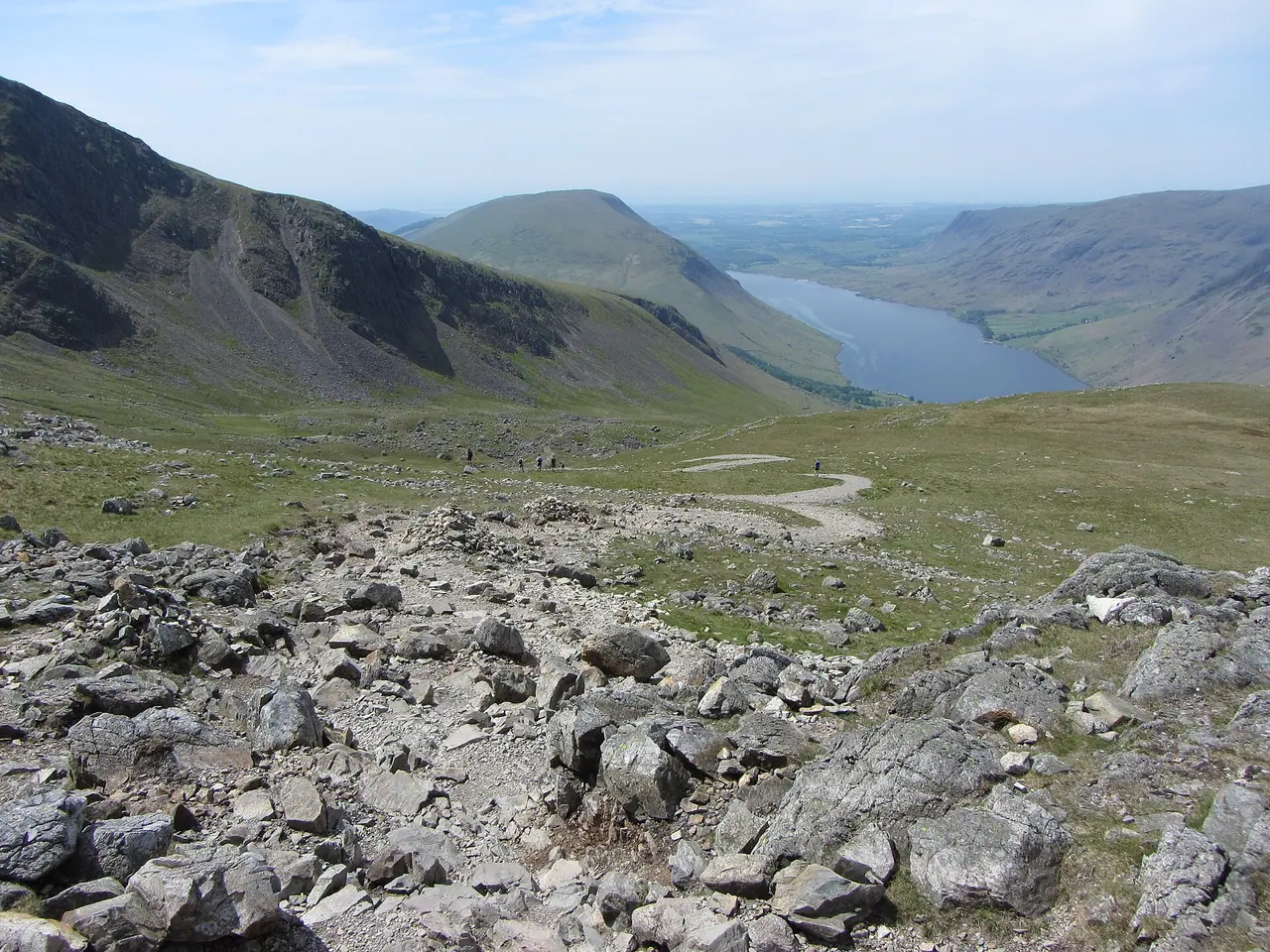
At about 504 m the path splits. Keep left for Hollow Stones. The right fork heads to Mickledore and goes over loose scree, which beginners struggle with. The left path winds through the Hollow Stones boulder field below the huge crags of Scafell. Then it zig-zags up to Lingmell Col.
Lingmell Col to the summit
Just above Lingmell Col (around 777 m) there is an important junction. Take the wider, rocky path straight ahead. The path on the left goes to Styhead Tarn. I highly recommend taking a photo of this junction, because you need to find it again on the way down.
From here the path is less formal. It crosses a rocky landscape of boulders and stones, and it is marked by cairns. Please don't build new cairns. They confuse other walkers, and the Fix the Fells team has to remove them.
The summit
The top of Scafell Pike is a rocky plateau with a huge summit cairn, a trig point and the war memorial. On a clear day you can see over the whole Lake District. It is a special feeling to know there is no higher ground in England. However, expect company! Around 250,000 people reached the summit in 2022.
The way down
Return the same way. In mist, the summit plateau is very confusing, as every direction looks the same. The National Trust gives this tip: from the trig point, take a bearing of 310 degrees and walk 100 m to a cairn. Then take a bearing of 290 degrees and follow the cairns. The path veers off this bearing after about 60 m.
At the junction above Lingmell Col, make sure you take the correct left turn towards the north-west. If you miss it, you can end up on steep ground above Piers Gill. A sign there tells you to turn back. Please do! Then retrace your steps through Hollow Stones, over the beck and back to the valley.
Experienced walkers sometimes go up or down by the Corridor Route instead. It is more interesting, but harder. It has a bedrock step that you must climb down, and it passes the head of Piers Gill, a known accident black spot. I suggest sticking to the Hollow Stones route for your first visit.
How to get there
By car and parking
Wasdale is about 5 miles east of the A595. Turn off at Gosforth and follow the narrow valley road past Wastwater to the head of the lake.
Parking: the National Trust Lake Head car park is next to the Wasdale campsite (postcode CA20 1EX). It is open 24 hours. It is pay and display, and free for National Trust members. On sunny weekends it fills up early. If it is full, the National Trust asks you to come back another day, as the valley road is very narrow and busy. Please don't park on the verges! There is also a little parking in Wasdale Head village. Mobile signal is poor here, so bring coins or set up the parking app before you leave home. Lift sharing helps a lot too.
By public transport
Getting to Wasdale without a car is tricky. However, in summer there is a lovely option. In 2026 the Wasdale Explorer minibus ran on Saturdays, Sundays and bank holidays from 2 May to 31 August. It runs from Ravenglass station via Muncaster Castle and Gosforth to Wasdale Head. It also stops at the road end of the National Trust campsite, which is right by the start of the walk.
Prices: £3 for all-day travel, and children travel free. Dogs are allowed, but not on the seats. Download the timetable before you travel, as there is little or no signal in parts of Wasdale. The 2026 season has now finished, and the park authority is planning next year's service with the Wasdale Action Group.
Ravenglass is on the Cumbrian Coast railway line. The X7 bus also serves Ravenglass and Gosforth. The nearest station to Wasdale is Seascale, but I couldn't find a regular bus from there.
Permits, fees & opening times
- You don't need a permit or ticket to climb Scafell Pike.
- Parking: pay and display at Lake Head, free for National Trust members. The fees support the National Trust rangers who look after the paths.
- Wasdale Explorer: weekends and bank holidays in summer only. Check the Lake District National Park website for next year's dates.
- Night walkers and Three Peaks groups: please avoid arriving between 11 pm and 7 am. If you do, keep your voices down and switch off engines and headlights. People are sleeping at the campsite next door.
When to go
In my opinion, late spring to early autumn is the best time. The days are long, and there is a better chance of clear views. Midweek is much quieter than weekends, especially in summer when Three Peaks Challenge groups arrive.
The weather on the summit can be completely different from the valley. Expect high winds, rain, low cloud and cold even in summer. Always check the Met Office mountain forecast or MWIS for the Lake District before you go. If it looks bad, choose a lower walk around Wastwater instead. In winter Scafell Pike is a serious mountain with snow and ice. Only go then if you have an ice axe, crampons and the skills to use them.
Hiking with kids
Suitable for children: honestly, I wouldn't bring young children up Scafell Pike. The climb is long and relentless, and the summit plateau is rough and exposed. Guides suggest it for adults and teenagers with good fitness. Fit older kids who already love hill walking can do it, but plan lots of breaks and turn back if they are struggling.
- Pushchairs: not suitable. The route is steep and rugged.
- Carriers: I don't recommend it. Carrying a child over the boulder field and the rocky plateau is risky for both of you.
- A better family day: have a picnic by Wastwater and look up at the big fells instead.
What to pack
- Walking boots with good grip and ankle support
- A waterproof jacket and trousers, plus warm layers, a hat and gloves
- OS Explorer OL6 (The English Lakes – South-western area), a compass and the skills to use them
- Plenty of water and food. There is nothing to buy after you leave the valley
- A head torch, a whistle and a fully charged phone
- Walking poles for the steep descent
- Sun cream and sunglasses in summer
For lunch on a long day I like something filling. Wayfayrer meals are one I recommend in my wild camping kit list. You can eat them hot or cold, so they work on a summit too.
Mobile signal is patchy in Wasdale. So I also suggest carrying an emergency device. In my guide to emergency GPS devices, the Garmin inReach Mini is my pick for hiking. It lets you send an SOS and messages without phone signal.
Safety tips
- Check the forecast and turn back if the weather turns. The mountain will still be there another day.
- Photograph the Lingmell Col junction on the way up. Missing it on the way down is a common mistake.
- Stay away from Piers Gill. Never try to descend into it.
- Watch the beck. After heavy rain the crossing at about 300 m may be impassable.
- Start early so you have plenty of daylight for the descent.
- Mountain rescue call-outs to Scafell Pike are a regular occurrence, especially in poor weather. In an emergency, call 999 and ask for Police, then Mountain Rescue.
Leave no trace & sustainable tips
- Stay on the pitched path. Path repairs on Scafell Pike cost up to £400 per metre. Fix the Fells spent over £100,000 here in just two years. You can donate to help them.
- Don't build cairns. Extra cairns mislead people in mist.
- Protect the fragile mountain habitat. Much of the route is a Site of Special Scientific Interest.
- Take all litter home, including banana skins and orange peel.
- Share a car or take the Wasdale Explorer in summer. The valley road is narrow, and the car park fills fast.
Where to stay & eat nearby
- National Trust Wasdale campsite is right next to the Lake Head car park. You can't get much closer to the start!
- Wasdale Head Inn at the head of the valley is the classic place for a pint and a meal after the climb.
- Nether Wasdale and Gosforth, further down the valley, have more accommodation and places to eat.
- For shops and supermarkets, stock up before you drive into the valley. There is very little at Wasdale Head itself.
More to explore nearby
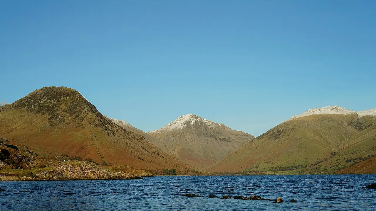
- Wastwater: walk along the shore below the Screes, or just enjoy the famous view of Great Gable at the head of the lake.
- Great Gable: another classic fell from Wasdale Head if you are hungry for more.
- Ravenglass: a little coastal village where the Wasdale Explorer starts.
- Muncaster Castle: a stop on the Wasdale Explorer, and your bus fare is deducted from the admission ticket.
FAQ
How long does it take to climb Scafell Pike from Wasdale?
Most people need 5–6 hours for the return trip from Lake Head car park. Fast, fit walkers can do it quicker, but allow plenty of time for breaks.
What is the easiest route up Scafell Pike?
The Wasdale Head route via Hollow Stones and Lingmell Col is the shortest and most direct. However, it is also very steep. Easy is not really the right word for any route up England's highest mountain.
Is there parking for Scafell Pike at Wasdale?
Yes, at the National Trust Lake Head car park next to the campsite. It is pay and display, free for National Trust members, and it fills up early on sunny weekends.
Can you get to Wasdale by bus?
Only in summer. In 2026 the Wasdale Explorer ran on weekends and bank holidays from Ravenglass station to Wasdale Head, from 2 May to 31 August.
Have you climbed Scafell Pike? Which route did you take? Let me know in the comments!
Photo credits (4)
All photos on this page are by other photographers and are used under free licences. Thank you for sharing them.
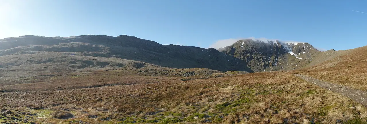
- Cover photo: Scafell massif enclosures.jpg by Dougsim, CC BY-SA 4.0, via Wikimedia Commons. Resized and cropped for this page.
- Photo 2: View towards Wast Water from Lingmell Col - geograph.org.uk - 4526307.jpg by Gareth James, CC BY-SA 2.0, via Wikimedia Commons. Resized for this page.
- Photo 3: Scafell Pike summit and trig point - geograph.org.uk - 4526571.jpg by Gareth James, CC BY-SA 2.0, via Wikimedia Commons. Resized for this page.
- Photo 4: Great Gable Beyond Wastwater (25296943642).jpg by Peter Trimming from Croydon, England, CC BY 2.0, via Wikimedia Commons. Resized for this page.


join the conversation
Comments
No comments yet. Be the first to share your thoughts!