🥾 Trail guide · Wales – Eryri National Park
Snowdon Pyg Track & Miners' Track: A Complete Guide to Climbing Yr Wyddfa

- Distance
- 12.5 km
- Ascent
- 750 m
- Time
- 5–7 hours
- Difficulty
- Strenuous
- Route
- Circular
- Best season
- May–September
👶 With kids: Not pushchair-friendly. Only for fit, experienced older children (roughly 10+) who are used to long, steep, rocky mountain days; the lower Miners' Track to Llyn Llydaw makes a good shorter outing for younger kids.
✅ Updated and fact-checked on 2 November 2026. Prices, timetables and rules can change, so check the official sources before you go.
This post contains affiliate links. If you book or buy through them, I may earn a small commission at no extra cost to you. More about this
Is climbing the highest mountain in Wales on your bucket list? At 1,085 metres, Yr Wyddfa (Snowdon) is one of the most-climbed peaks in Britain. The Eryri National Park Authority says more than 600,000 people head up it every year! There are six main paths to the top. Many walkers' favourite is the Pyg Track on the way up and the Miners' Track on the way down. Both start at Pen-y-Pass, which is already 359 metres above sea level, so you skip a chunk of the climbing. Together they make a loop where you never walk the same bit twice.
We've explored Eryri (Snowdonia) a few times and hiked the Carneddau, but we haven't made it to the top of Yr Wyddfa yet. On one trip we planned to, but it was rainy, so we only did a section of the Watkin Path. This route is high on our list for next time, so I've researched every detail for you.
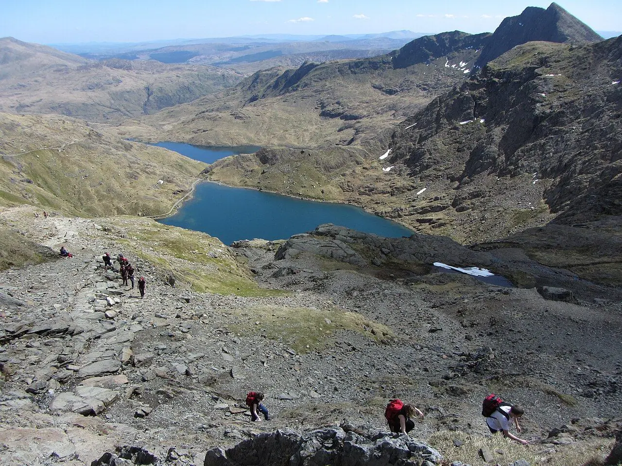
The Pyg Track is the rockier and more direct of the two. It runs along the side of Crib Goch, with huge views down to Llyn Llydaw, then zigzags up to the summit ridge. The Miners' Track starts gently on an old mine road. It passes three glacial lakes (Llyn Teyrn, Llyn Llydaw and the gorgeous blue-green Glaslyn) and the ruins of the Britannia copper mine. If you come down this way, you can enjoy the lakes slowly, with the hardest work behind you.
However, this is a proper mountain day, not a stroll. The National Park Authority grades both paths as hard/strenuous, for experienced walkers with good fitness. The weather on the summit can be completely different from the car park. Also, the top section is steep and rocky, and sometimes you need your hands. But with the right preparation (and a seat on the Sherpa'r Wyddfa bus instead of a fight for a parking space), it is one of the best walking days in the UK.
At a glance
- Distance: roughly 12–13 km for the loop. The Pyg Track is about 5.5 km to the summit, and the Miners' Track is about 6.5–7 km back.
- Elevation gain: around 725–770 m (Pen-y-Pass is at 359 m, and the summit is 1,085 m).
- Allow 5–7 hours including stops, and longer in poor weather or with a slower group.
- Difficulty: Strenuous. It is steep and rocky, with some easy scrambling near the top.
- Route type: Circular (up one path, down another, with the same start and finish).
- Start/finish: Pen-y-Pass, at the top of the Llanberis Pass (grid ref SH 647 557).
- Map: OS Explorer OL17 (Snowdon/Yr Wyddfa & Conwy Valley).
- Best season: May–September for most walkers. Winter ascents need an ice axe, crampons and the skills to use them.
- Prices: no permit needed. Pen-y-Pass parking must be pre-booked in the main season. The Sherpa'r Wyddfa bus is cheap, and you don't need to book it.
- Toilets: at Pen-y-Pass (open all year). There is a café and bar at YHA Snowdon Pen-y-Pass across the road. The café and toilets in Hafod Eryri on the summit are seasonal, and only open when the mountain railway is running.
- Suitable for children: only fit, experienced older children. It is not pushchair-friendly.
- Dogs: welcome, but keep them on a lead, as there are sheep on the mountain all year.
Route description
Pen-y-Pass to Bwlch y Moch
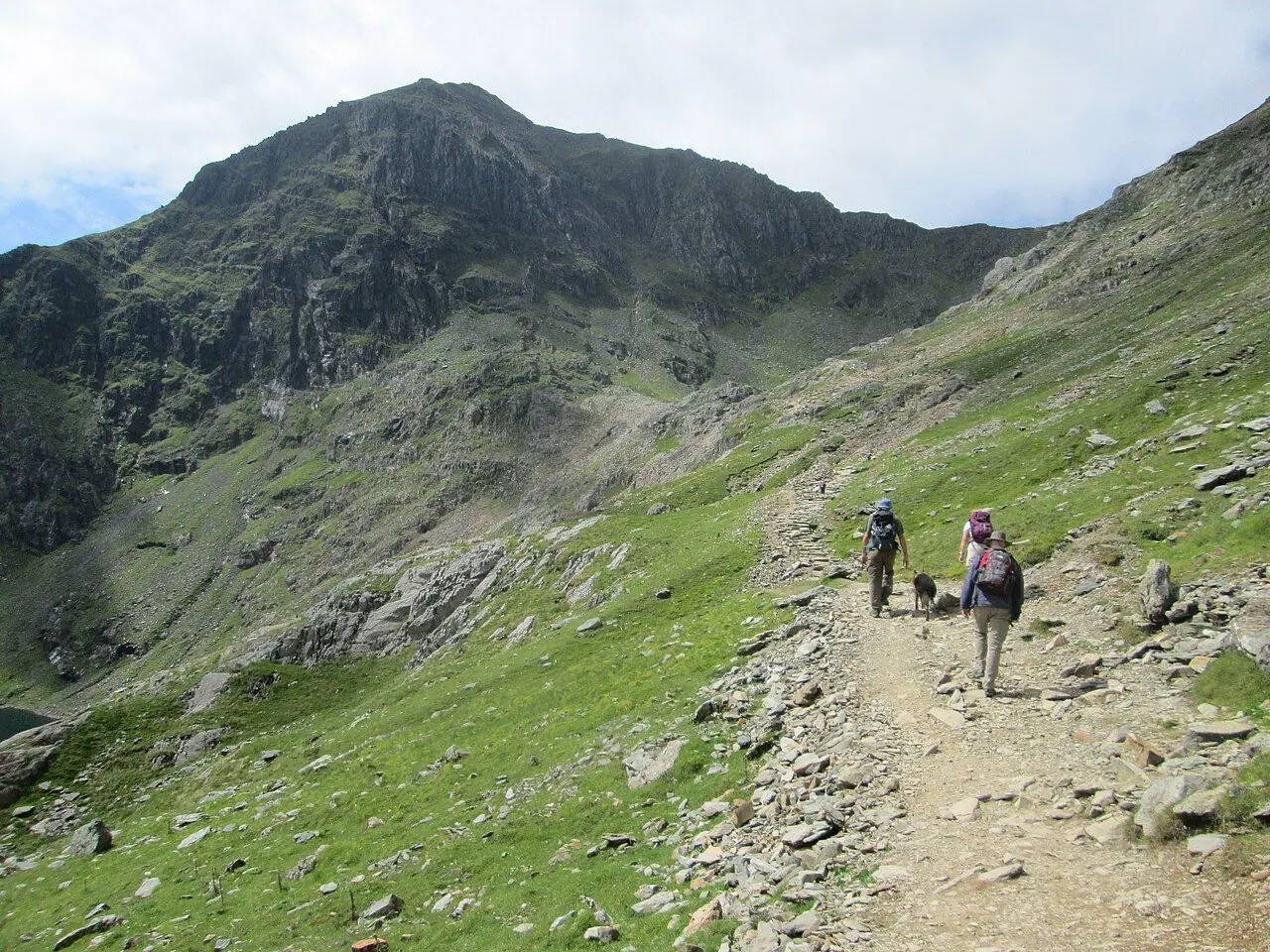
The Pyg Track leaves from the top (western) end of the Pen-y-Pass car park, behind the information point. Almost straight away you climb steeply on stone steps through boulders. The steepest steps in the first mile are nicknamed the "granny-stopper", so don't worry if your legs complain early! You gain height quickly, with views back down the Llanberis Pass.
After roughly 45 minutes to an hour you reach Bwlch y Moch ("Pass of the Pigs", around 500 m). This saddle gives the Pyg Track its name. Here the view suddenly opens up over Llyn Llydaw and its causeway below, with the summit of Yr Wyddfa ahead.
Important junction: at Bwlch y Moch a path heads right through a gap in the wall towards Crib Goch. It is a knife-edge ridge with no escape route. The National Park describes it as a serious undertaking for experienced scramblers only. Do not take it! Stay on the wide, well-made Pyg Track, cross the stile and continue ahead.
Along the flank of Crib Goch
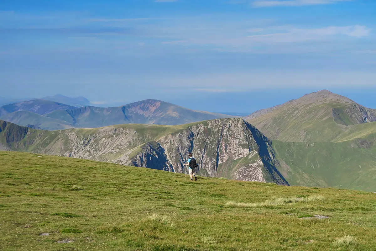
The next section is the best part of the Pyg Track. The path is rocky but easy to follow, and it crosses the hillside high above Llyn Llydaw and then Glaslyn. It goes up and down rather than climbing all the time, so it is a good place to find your rhythm. There are a few rough rock steps where you will use your hands for balance.
The Intersection and the zig-zags
At around 850 m the Miners' Track joins from below on the left, at a junction marked by a standing stone. Take a good look! This is where you will leave the Pyg Track on the way down, and it is easy to miss in cloud.
From here the path gets steeper, with a long series of stepped zig-zags up the back wall of the cwm. It is tiring but well built. The last stretch to the ridge is a bit narrower and more exposed. In winter, these zig-zags are a known accident blackspot when they are icy.
Bwlch Glas to the summit
You come out on the ridge at Bwlch Glas, marked by a tall standing stone (about 2.5 m high). Here the Pyg and Miners' Tracks meet the Llanberis Path and the Snowdon Mountain Railway. Turn left and follow the wide ridge for roughly 15–20 minutes to the summit, alongside the railway line. Never walk on the line, as it is private and dangerous.
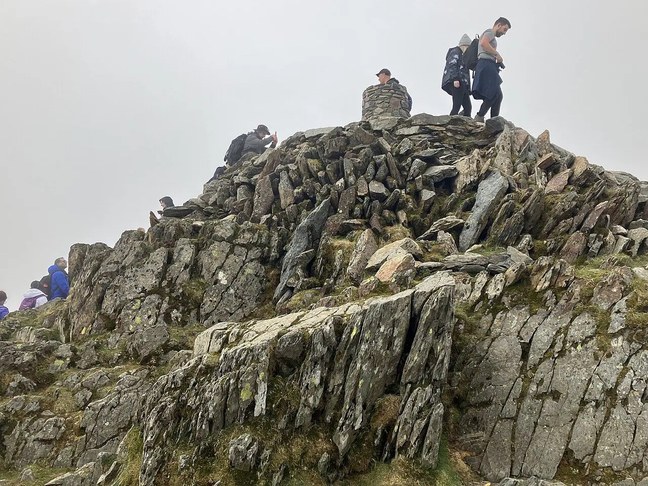
The summit pillar sits on a cairn at 1,085 m. On busy summer days there can be a queue for the steps up to it. However, the flat area in front gives you the same view without the wait. On a clear day you can see across Eryri to Anglesey, the Llŷn Peninsula and sometimes even Ireland. Just below is Hafod Eryri, the summit visitor centre. It is usually open daily from around May to October, when the trains are running.
Descent: Miners' Track
Go back down the ridge to the standing stone at Bwlch Glas. This is the key navigation point of the day. Turn right at the stone and go down the zig-zags. If you carry straight on, you will go down the wrong side of the mountain!
Go down the zig-zags to the standing stone at the Intersection. This time turn right, leaving the Pyg Track for the Miners' Track. The path drops steeply on rough rock steps towards Glaslyn. This is the trickiest descent of the day. Take it slowly, keep to the obvious path and avoid the eroded ground and old mine workings around it.
Glaslyn, Llyn Llydaw and Llyn Teyrn
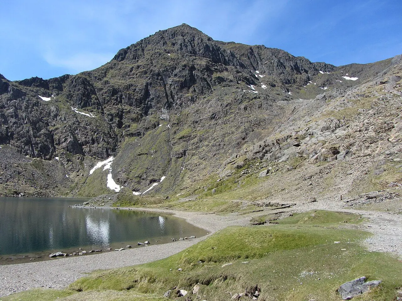
At Glaslyn, a deep glacial lake beneath the summit, you pass the ruined barracks of the Britannia copper mine. From here it gets easier. The track drops to Llyn Llydaw, past the remains of the mine's crushing mill. Then it crosses the lake on a stone causeway, built for the mine in the 1850s. It can feel very exposed in strong winds.
After the causeway, the Miners' Track becomes a wide, gentle old mine road. You will see the large pipeline that carries water from Llyn Llydaw down to the Cwm Dyli hydro-electric power station, opened in 1906. Pass above Llyn Teyrn, with more old miners' barracks by its shore, and follow the track gently back to Pen-y-Pass.
How to get there
By public transport
The Sherpa'r Wyddfa bus network (run for Gwynedd Council by Gwynfor Buses) is the easiest and most sustainable way to reach Pen-y-Pass. Also, you never have to worry about parking.
- From Llanberis or Nant Peris: services S1, S2 and, in high season, the S5 shuttle run up to Pen-y-Pass. It is around 15 minutes from Nant Peris (where there is a park and ride) and about 20 minutes from Llanberis. In the summer season, buses from the park and ride have run roughly every 15 minutes at weekends and in school holidays, and around every 30 minutes at other times. Check the current timetable.
- From Betws-y-Coed (on the Conwy Valley railway line): the S1 runs to Pen-y-Pass in around 20 minutes.
- From Bangor (main-line trains on the North Wales Coast Line): the S2 links Bangor with Llanberis and Pen-y-Pass.
- From Caernarfon: S1 via Llanberis, about 45 minutes.
- From Porthmadog/Beddgelert: the S4 goes to Pen-y-Pass.
Prices: fares are low. In 2026, an adult single to Pen-y-Pass was £3, a day return £5.50 and children £1. A 1Bws day ticket is also valid for travel across North Wales. Buses take cash and contactless, can't be pre-booked, carry dogs and have a wheelchair space. Summer timetables run roughly from late March to the end of October, with a reduced winter service. Times change, so check them on the Sherpa'r Wyddfa website or Traveline Cymru before you travel.
By car and parking
Parking: Pen-y-Pass car park must be pre-booked through JustPark during the busy season (the 2026 booking period ran until 1 November). In 2026, prices were £25 for up to 8 hours, £35 for 8–12 hours and £45 for a full day. You can't extend a booking, so book longer than you think you will need. Standard spaces fit vehicles up to 5 m. Blue Badge bays are first come, first served. Outside the booking season the car park goes back to pay and display (in winter 2026–27, £15 for 24 hours, card only).
Drop-offs are allowed at Pen-y-Pass, but drivers should leave promptly. I recommend parking at Nant Peris park and ride or in Llanberis and taking the Sherpa bus up instead. It is much cheaper and less stressful! Check current prices and booking dates on the Eryri National Park Authority website.
Permits, fees & opening times
- You don't need a permit or pay a fee to walk on Yr Wyddfa.
- Pen-y-Pass parking: pre-book on JustPark in season, or pay and display in winter. Check the Eryri National Park Authority's Pen-y-Pass page for current dates and prices.
- Hafod Eryri (summit café, shop and toilets): usually open daily from around early May to late October. It opens at about 10:00 and closes shortly before the last train leaves. It only opens when the railway is running to the top, and it may close in high winds. So don't rely on it for water, food or shelter. The Snowdon Mountain Railway publishes the times.
- Conditions: check the Yr Wyddfa Live website and the Met Office mountain forecast before you set out. In winter the National Park publishes a daily ground conditions report.
When to go
Late spring to early autumn (May–September) brings the longest days and the most settled weather, but also the crowds. On summer weekends and bank holidays there are queues at the summit and lots of people on both paths. So aim for a weekday, or set off early (the first Sherpa buses help here).
Even in summer the summit is much colder, wetter and windier than Pen-y-Pass, and cloud can roll in within minutes. From roughly November to March the upper mountain is often covered in snow and ice. Then it becomes a winter mountaineering route, and you need crampons, an ice axe and the experience to use them.
Hiking with kids
To be honest, this loop is too much for most young children. It is 12–13 km with around 750 m of ascent on steep, rocky ground, and you need to scramble with your hands in places at the top. It is only realistic for fit, confident older children who have already done several big hill days. A pushchair is a no-go. I also wouldn't carry a toddler in a back carrier on the steep, rocky steps of the Pyg Track or on the descent to Glaslyn.
For younger children, the lower Miners' Track is a great alternative. The wide old mine road from Pen-y-Pass to the causeway on Llyn Llydaw (around 2.5 km each way) is gentle, with lakes, ruins and huge mountain views. Turn around at the causeway or at Glaslyn. To keep kids busy, spot the Cwm Dyli pipeline, count the three lakes, hunt for mine ruins and watch the little mountain train crawling along the ridge far above.
What to pack
- Sturdy walking boots with good grip (not trainers)
- Waterproof jacket and trousers, plus warm layers, hat and gloves, even in July
- OS Explorer OL17 map and compass (and the skills to use them), plus a charged phone
- Plenty of water and food, as you can't rely on the summit café
- Head torch, small first aid kit and a whistle
- Walking poles for the steep descent to Glaslyn
- Winter: ice axe, crampons and the right experience
Safety tips
- Don't take the Crib Goch turn at Bwlch y Moch. It is a serious, exposed scramble.
- On the way down, turn right at the standing stone at Bwlch Glas to go down the zig-zags. Going straight on is a common navigation mistake.
- Remember the Intersection stone on the way up, so you recognise it in cloud on the way down.
- Stay on the path near the old Britannia copper mine workings, which are eroded and hazardous.
- Never walk on the railway line.
- Turn back if the weather becomes too much for your ability. The summit will still be there!
- In an emergency, call 999 and ask for the Police, then Mountain Rescue. If you can't make voice calls, register for emergency SMS in advance by texting "register" to 999.
Leave no trace & sustainable tips
- Take the Sherpa bus. It is cheaper than parking, cuts traffic in the Llanberis Pass and lets you finish wherever you like.
- Stay on the pitched paths. A lot of time and money goes into the stone steps you are walking on. Cutting corners on the zig-zags and around Glaslyn makes the erosion scars wider.
- Take all your litter home, including fruit peel and teabags. They don't break down quickly up high, and they attract scavenging birds.
- Keep dogs on leads around sheep.
- Use the toilets at Pen-y-Pass before you go. There are none on the paths, and the summit facilities are seasonal.
- Spend locally. Grab breakfast in Llanberis, buy supplies from local shops and stay in independent accommodation.
Where to stay & eat nearby
- YHA Snowdon Pen-y-Pass is right at the start of the walk. It has dorms and private rooms, plus a licensed café-bar open all year, so it is perfect for an early start.
- Llanberis has the widest choice of B&Bs, guesthouses, campsites and cafés. This includes the long-standing climbers' café Pete's Eats, a classic stop for a big meal after your hike.
- Betws-y-Coed is a handy base with a railway station, plenty of hotels, B&Bs and cafés, and direct Sherpa buses to Pen-y-Pass.
- Nant Peris and Nant Gwynant have small campsites close to the mountain.
More to explore nearby
- Snowdon Mountain Railway from Llanberis: another way to see the summit with young children (book ahead).
- Llyn Padarn and Dolbadarn Castle in Llanberis, with easy lakeside walking.
- National Slate Museum, Llanberis: free entry and great for families.
- Watkin Path from Nant Gwynant, with its waterfalls. The lower section is really pretty for a gentler day.
- Ogwen Valley: Llyn Idwal is a short, family-friendly circuit you can reach by bus.
FAQ
How long does it take to climb Snowdon via the Pyg and Miners' Tracks? Most walkers take 5–7 hours for the full loop, including a break at the summit. Fast, fit walkers may do it in under 5 hours. Allow more time in poor weather or with children.
Is the Pyg Track or Miners' Track easier? The Miners' Track has a gentler first half on a wide old mine road, but its climb from Glaslyn to the Pyg Track is steep and rough. The Pyg Track is rockier from the start but more direct. The National Park grades both as hard/strenuous.
Do I need to book parking at Pen-y-Pass? Yes. During the main season (roughly spring until 1 November) you must pre-book through JustPark. In winter it switches to pay and display. If you take the Sherpa'r Wyddfa bus from Nant Peris or Llanberis, you avoid the problem completely.
Can I get to Pen-y-Pass without a car? Yes. Sherpa'r Wyddfa buses run to Pen-y-Pass from Llanberis, Nant Peris, Betws-y-Coed (railway station), Bangor (railway station), Caernarfon and Porthmadog. Check the current timetable on the Sherpa'r Wyddfa website or Traveline Cymru.
Is there a café on the summit of Snowdon? Hafod Eryri, the summit visitor centre, usually opens from around May to October when the mountain railway is running. It is closed in winter and in strong winds, so always carry your own food and water.
Have you climbed Yr Wyddfa on the Pyg and Miners' Tracks? Which path did you prefer? Let me know in the comments!
Photo credits (4)
All photos on this page are by other photographers and are used under free licences. Thank you for sharing them.
- Cover photo: Glaslyn and Snowdon - geograph.org.uk - 3448960.jpg by Gareth James, CC BY-SA 2.0, via Wikimedia Commons. Resized and cropped for this page.
- Photo 2: Pyg Track en route to Snowdon - geograph.org.uk - 4757568.jpg by Peter S, CC BY-SA 2.0, via Wikimedia Commons. Resized for this page.
- Photo 3: Walkers on the Pyg-Miners' Track to Snowdon - geograph.org.uk - 3448997.jpg by Gareth James, CC BY-SA 2.0, via Wikimedia Commons. Resized for this page.
- Photo 4: Summit of Yr Wyddfa (Snowdon) - geograph.org.uk - 8032578.jpg by Anthony Foster, CC BY-SA 2.0, via Wikimedia Commons. Resized for this page.


join the conversation
Comments
No comments yet. Be the first to share your thoughts!