🥾 Trail guide · Northern Ostrobothnia – Kuusamo
Pieni Karhunkierros: A Complete Guide to the Little Bear's Ring in Oulanka National Park

- Distance
- 12 km
- Ascent
- 200 m
- Time
- 4–6 hours
- Difficulty
- Moderate
- Route
- Circular
- Best season
- June–early October (open all year, but icy in winter)
👶 With kids: Great for school-age kids used to walking, but the full loop has hundreds of steep steps and is not pushchair-friendly. The 3 km return walk from Juuma to Myllykoski is a lovely short option for younger families.
✅ Updated and fact-checked on 5 November 2026. Prices, timetables and rules can change, so check the official sources before you go.
This post contains affiliate links. If you book or buy through them, I may earn a small commission at no extra cost to you. More about this
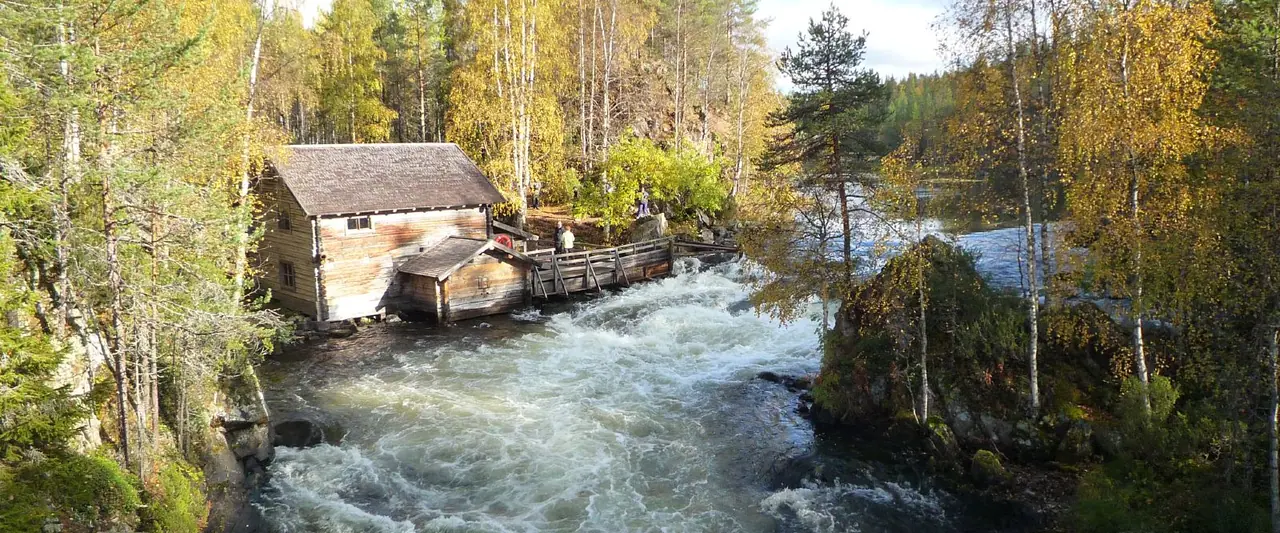
Have you ever seen a little wooden mill sitting right on the edge of roaring rapids? That is Myllykoski, and it may be the most photographed view in Finland. It is just one of the highlights of the Pieni Karhunkierros, or Little Bear's Ring. This 12 km loop in Oulanka National Park packs rapids, a waterfall, three suspension bridges, pine forest and a cliff-top lookout into one day. Metsähallitus, who look after Finland's national parks, call it a miniature model of the whole park. I think that is the perfect description.
We haven't hiked this one yet, but it is high on our bucket list, so I've researched every detail for you. The trail starts in the tiny village of Juuma in Kuusamo, in north-east Finland. It is one of the most popular day hikes in the country, and it is open all year. So will you go for the autumn colours, the light summer nights or the snowy silence of winter?
However, it is a proper hike. There are many long, steep wooden staircases, and Metsähallitus describe it as demanding because of its length and the ups and downs.
At a glance
- Distance: about 12 km (the official trail page gives 11.8 km)
- Elevation gain: modest overall. GPS sources give roughly 150–350 m of up and down, mostly on steep wooden stairs
- Allow 4–6 hours, plus stops for a campfire lunch
- Difficulty: Moderate. Metsähallitus rate it intermediate and partly demanding, with many stairs and a steep climb at Kallioportti
- Route type: Circular (a 1.5 km out-and-back section from Juuma to Myllykoski, then a loop)
- Start/finish: Juuma parking area, Juumantie 133, Kuusamo
- Markings: green paint marks on trees and wooden posts with reflectors
- Best season: June to early October for hiking. In winter it is a snowshoe and ice-grip walk
- Prices: free. There is no entry fee for Oulanka National Park
- Toilets: dry toilets at Myllykoski, Jyrävä and Harrisuvanto. The toilets at the start are 200 m away at the Ala-Juuma camping area and only open in summer (June–September)
- Dogs: allowed, but they must be on a lead at all times
Route description
Metsähallitus recommend walking the loop anticlockwise, so this is the direction I describe. The distances below come from the official trail map.
Juuma to Myllykoski
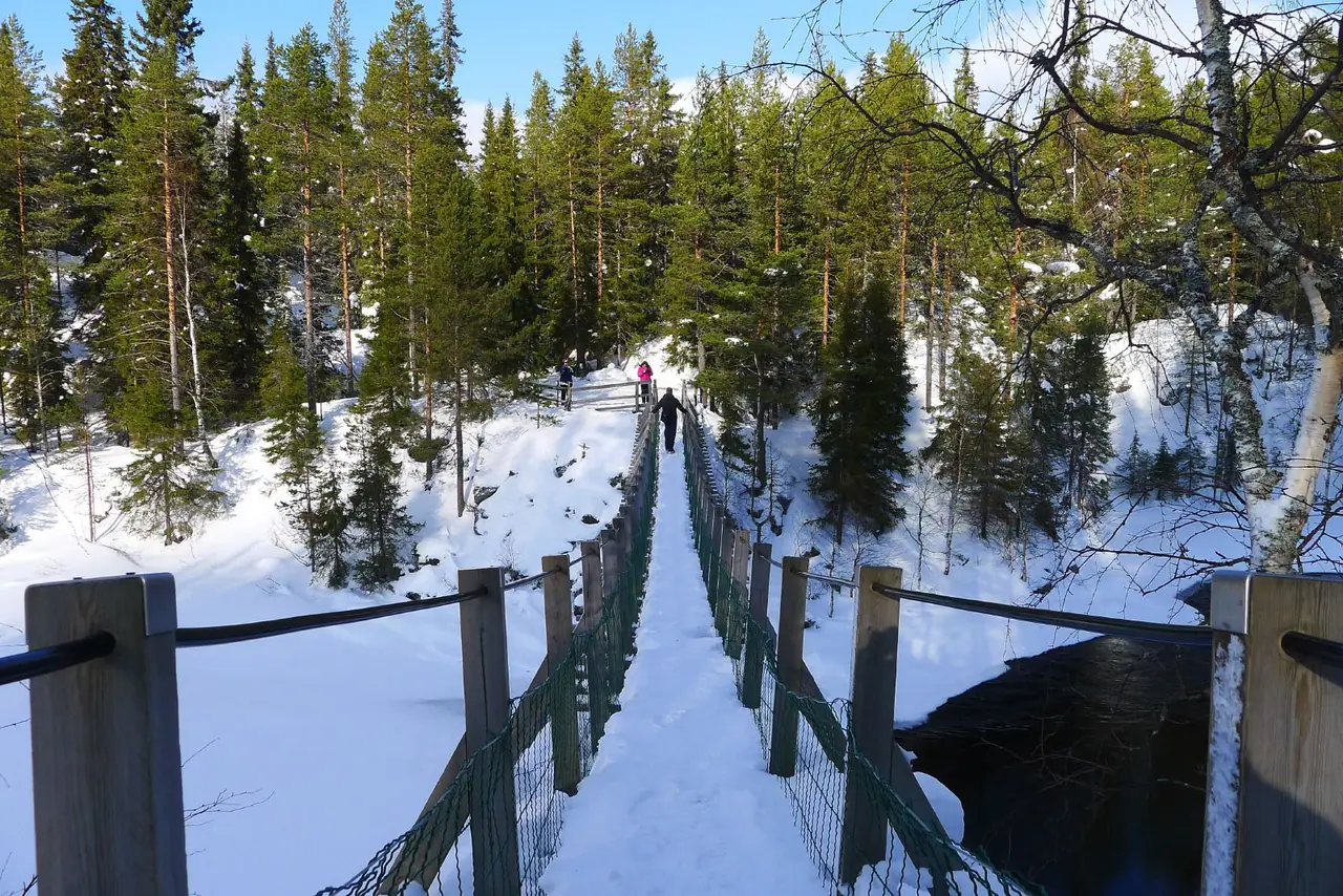
The trail starts under a wooden gate at the edge of the Juuma parking area. After only 350 m you reach the first suspension bridge, at Niskakoski. There are steep stairs down to the bridge and up again on the other side, so it is a good warm-up! After the bridge the path is easy. It passes the Basecamp Oulanka hotel and restaurant and reaches Myllykoski after 1.5 km.
Myllykoski means "mill rapids". The old wooden mill stands right next to the white water, and there is a day-use hut, a campfire site, a dry toilet and another suspension bridge. In winter, ice floes get trapped in the whirlpool below the rapids and spin round and round.
Myllykoski to Jyrävä
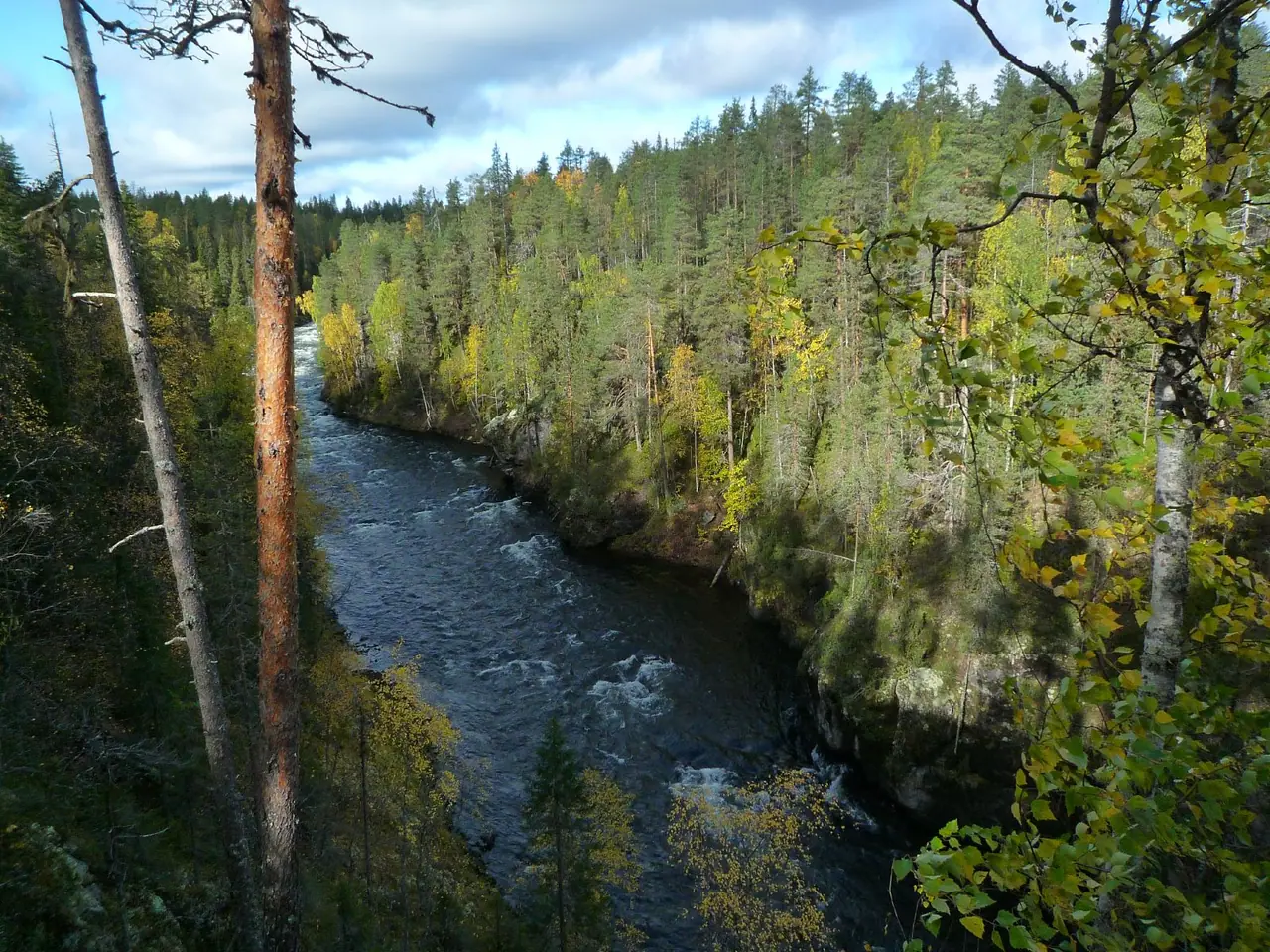
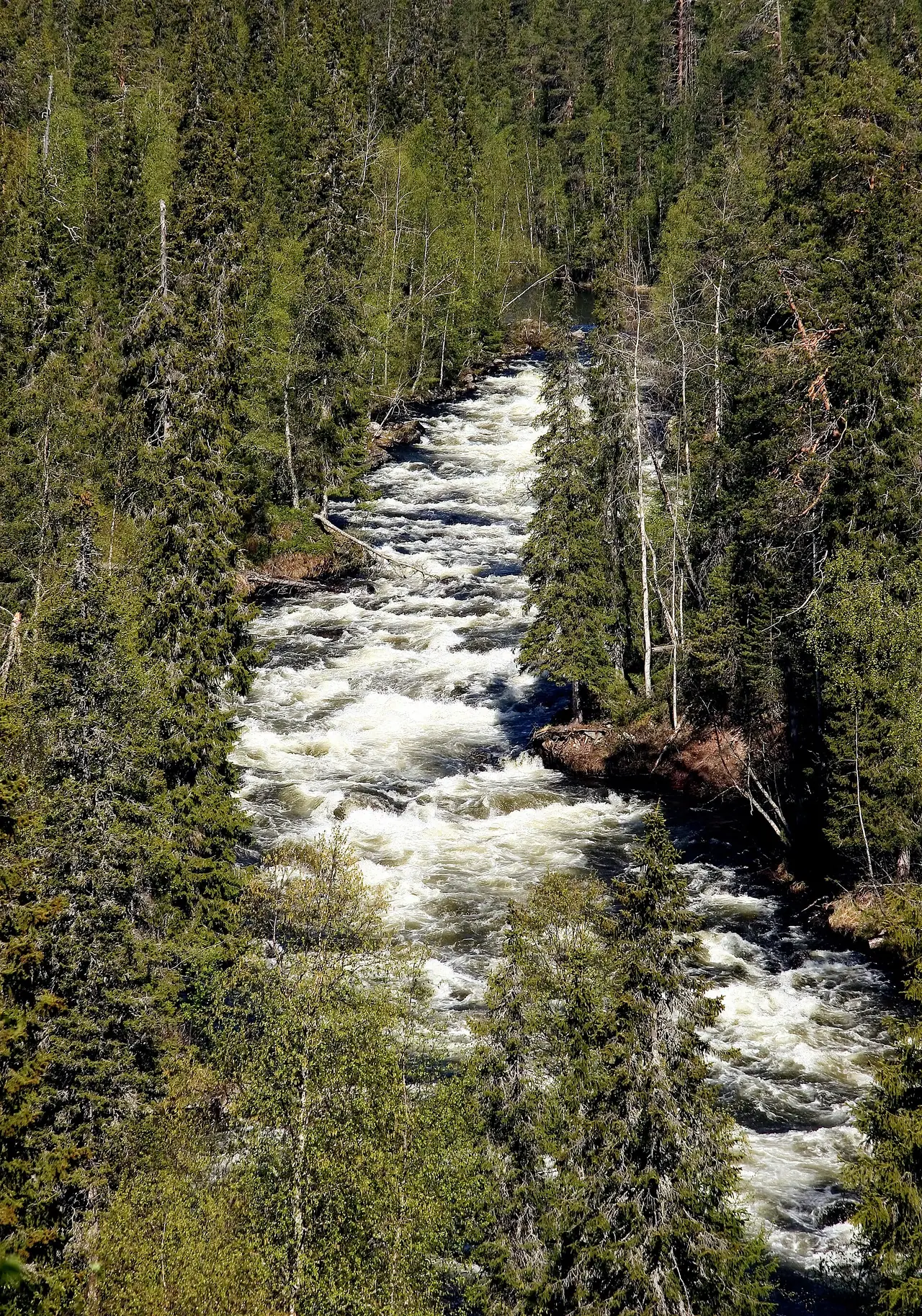
The loop begins at Myllykoski. Going anticlockwise, you start with stairs heading towards Jyrävä. It is 1.6 km from Myllykoski to Jyrävä. There are steep stairs right after Myllykoski and again as you arrive at Jyrävä, but the rest is fairly flat. On the way you can see Aallokkokoski, the longest series of rapids on the Kitkajoki river.
Jyrävä is a waterfall with a drop of 9 m over just a few metres. Next to the pool below it is the Siilastupa open wilderness hut. There is a campfire site by the hut and another one 60 m further on at the Jyrävä lean-to shelter. This is a lovely spot for lunch, but it gets busy in summer.
Jyrävä to Harrisuvanto
The next stretch to the campsite at Harrisuvanto is 3.9 km. It is the easiest part of the walk, through pine forest along the river. Along the way you can see the island of Kalliosaari. At Harrisuvanto you cross the longest suspension bridge on the trail. It bounces a bit, which kids will love!
Harrisuvanto to Kallioportti
After Harrisuvanto the trail heads to Kallioportti. Part of this section crosses a restricted zone, the Juuma mires. From 1 April to 31 December you may only walk on the marked trail here. At Kallioportti you climb the longest and steepest steps of the whole route, about 300 of them. Take your time. At the top there is a lookout point with a view far across the forest.
Kallioportti back to Juuma
From Kallioportti it is 2.2 km back to Myllykoski. There are some duckboards, and you pass the small round pond of Pyöreälampi and cross a footbridge over the Putaanoja stream. You cross a suspension bridge as you arrive back at Myllykoski. From there, you return to Juuma on the same 1.5 km path you came in on.
How to get there
By car
Oulanka is on the border of Kuusamo and Salla. It is about 30 km from the Ruka ski resort and 50 km from Kuusamo town. The Pieni Karhunkierros starts from the Juuma parking area at Juumantie 133, Kuusamo. Most people stay in Ruka or Kuusamo and drive over in the morning.
Parking: the Juuma parking area is open all year and is ploughed in winter. However, Metsähallitus warn that it can get congested in peak holiday seasons and in summer. Arrive early, especially on sunny weekends and during the autumn colours.
Public transport and taxis
Finnair flies from Helsinki to Kuusamo all year, and the flight takes about an hour. A pre-booked airport bus runs between Kuusamo airport and Ruka, timed with the flights. For a greener trip, take the night train from Helsinki to Kemijärvi, which has a bus connection to Ruka. There is no regular bus to Juuma, but local taxi companies run shared taxis from Ruka. In 2026, Rukan Taksipalvelu quoted from about €50 for 1–2 people. Otaxi quoted from about €55 for 1–4 people, with a daily shared taxi from Ruka village at 9:00. Check the current prices and seasons on the Ruka website.
Permits, fees & opening times
- You don't need a permit, and the trail is free to walk.
- The trail is open all year, but it has no winter maintenance. Snowshoers usually pack down the snow.
- Restricted area: in the Juuma mires you may only walk on the marked trail from 1 April to 31 December.
- Camping: only allowed right next to the marked rest areas, campfire sites and huts. Everyman's rights don't apply in the usual way inside the national park.
- Campfires: only at the maintained campfire sites, with the firewood provided. When a forest fire warning is in force, campfires are banned everywhere, but camping stoves are still allowed.
When to go
Summer is the busiest season. Metsähallitus say that on peak days you may even have to queue to cross the suspension bridges! The mosquito season usually runs from Midsummer week to early August, so pack repellent. In late summer the forest is full of bilberries.
In my opinion, September is the most beautiful time. The ruska (autumn colours) usually peak in Kuusamo from mid-September to early October. It is also busy, but outside the ruska weeks autumn is peaceful. Early October is still good for hiking, but the days get shorter and the stairs can get slippery.
In spring (early April to late May) the snow melts and the trails are wet and icy. The Pieni Karhunkierros may be passable, as the Kitkajoki doesn't flood as much as the Oulankajoki, but expect mud and ice.
Winter is stunning, with frozen waterfalls and snow-covered pines. However, the stairs can be extremely icy. Metsähallitus say traction cleats are essential and spiked shoes alone are not enough. Daylight is very short, so carry a head torch and start early.
Hiking with kids
Suitable for children: yes, for school-age kids who are used to walking. The full 12 km with hundreds of steps is a big day for little legs. However, the suspension bridges, rapids and campfire lunch make it really exciting.
- Shorten it: walk from Juuma to Myllykoski and back. It is about 3 km return, with the Niskakoski bridge, the mill and a campfire site. A great first taste for young families.
- Pushchairs: not suitable, because of the many stairs and suspension bridges. Use a back carrier for toddlers.
- Carriers: take extra care on the steep stairs, especially at Kallioportti and when they are wet or icy.
- Keep them engaged: count the suspension bridges, look out for Siberian jays and roast sausages for lunch. Hold small hands on the bridges and near the rapids.
What to pack
- Hiking boots with good grip, as roots and stairs can be slippery
- Ice grippers (and maybe snowshoes) in winter
- Plenty of water. There are no water points on the trail, and Metsähallitus recommend boiling river water for at least 5 minutes or using purification tablets
- Food for a picnic or campfire lunch, plus a bin bag, as there are no bins
- Mosquito repellent in June and July
- A waterproof jacket and warm layers
- A head torch from autumn to spring
Campfire sites get full in summer, and fires are banned during forest fire warnings. So a small stove is really handy for a hot drink or lunch. The Jetboil is the stove I recommend in my wild camping kit list. It boils water super fast.
If you want a warm meal at the Jyrävä lean-to, just add boiling water to a dehydrated meal. Turmat meals are filling and lightweight, and they are one of the options I recommend in the same kit list.
Safety tips
- Take the stairs slowly. They are long and steep, and slippery when wet or icy.
- Follow the green markings. The 82 km Karhunkierros (orange markings) shares part of the route, so check at every junction.
- Keep away from the edges at the rapids and the Jyrävä waterfall. The water is fast and very cold.
- Cross the suspension bridges one group at a time and hold children's hands.
- Watch the daylight in autumn and winter, and carry a head torch.
- In an emergency, call 112.
Leave no trace & sustainable tips
- Take all your rubbish home. There are no waste bins on the trail.
- Stay on the marked trail, especially in the Juuma mires restricted area.
- Use firewood sparingly and only at the campfire sites. Never collect wood from the forest. The last person to leave a campfire must put it out.
- Don't wash yourself or your dishes in the river.
- Share transport. Use the shared taxis from Ruka to keep the Juuma car park less crowded.
- Be considerate in the huts. Pets are only allowed inside with the agreement of the other people using them.
Where to stay & eat nearby
- Ruka is the best base, with lots of hotels, cabins, restaurants and shops. It is also where the shared taxis to Juuma leave from.
- Juuma is right at the trailhead. Basecamp Oulanka is a hotel and restaurant on the trail itself, between Niskakoski and Myllykoski. It sounds like a lovely place for a meal after the hike.
- Ala-Juuma camping area is 200 m from the start and open in summer.
- Siilastupa at Jyrävä is an open wilderness hut, and there are campsites along the loop if you want to turn it into a short overnight trip.
More to explore nearby
- Karhunkierros Trail: the famous 82 km Bear's Ring. Its official start and finish point has moved from Ruka village to Saarua in eastern Ruka.
- Kiutaköngäs: powerful rapids in the heart of the park on the Oulankajoki river. They are easy to reach even in spring.
- Oulanka Canyon: on the Salla side of the park, signposted from road 950. The road there is not maintained in winter.
- Rafting on the Kitkajoki: rafting trips run on the river in summer, and there is a rafting centre in Juuma.
FAQ
How long does the Pieni Karhunkierros take?
Most people need 4–6 hours for the 12 km loop, including a lunch stop. Fast hikers can do it in less, but there are a lot of stairs.
Which direction should I walk the Pieni Karhunkierros?
Metsähallitus recommend anticlockwise. Walk 1.5 km from Juuma to Myllykoski, then head to Jyrävä first and come back via Harrisuvanto and Kallioportti.
Can you hike the Pieni Karhunkierros in winter?
Yes. The trail usually stays open because snowshoers pack the snow, but there is no winter maintenance. You need ice grippers, maybe snowshoes, and a head torch for the short days.
Is there a fee to hike in Oulanka National Park?
No. The trail, the campfire sites and the open huts are free to use.
Can I get to Juuma without a car?
There is no regular bus, but shared taxis run from Ruka. In 2026 they started from about €50–55 per group, so check with the taxi companies.
Would you go for the autumn colours or the winter snow? Let me know in the comments!
Photo credits (4)
All photos on this page are by other photographers and are used under free licences. Thank you for sharing them.
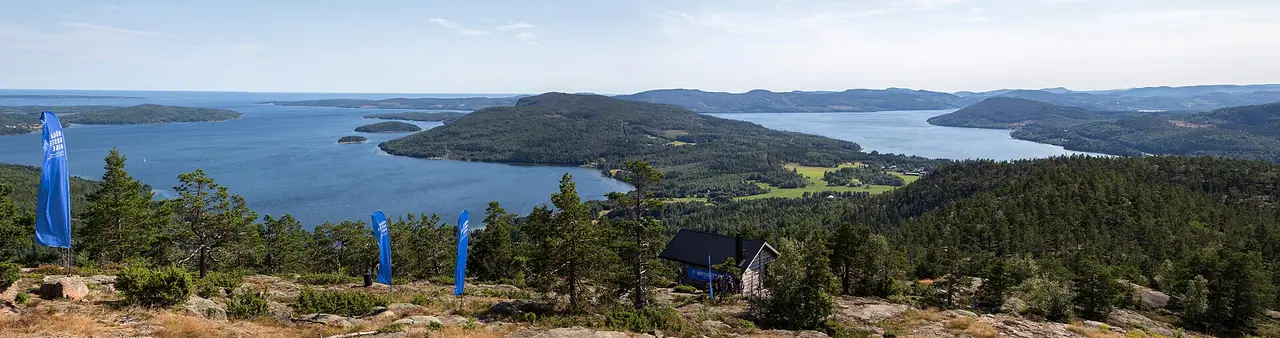
- Cover photo: Pieni Karhunkierros (3929028494).jpg by Timo Newton-Syms from Helsinki, Finland & Maidenhead, Berkshire, UK, CC BY-SA 2.0, via Wikimedia Commons. Resized and cropped for this page.
- Photo 2: Pieni Karhunkierros (3928250691).jpg by Timo Newton-Syms from Helsinki, Finland & Maidenhead, Berkshire, UK, CC BY-SA 2.0, via Wikimedia Commons. Resized for this page.
- Photo 3: Karhunkierros (173358369).jpg by /kallu from Helsinki, Finland, CC BY-SA 2.0, via Wikimedia Commons. Resized for this page.
- Photo 4: Pieni Karhunkierros (6973110995).jpg by Timo Newton-Syms from Helsinki, Finland and Chalfont St Giles, Bucks, UK, CC BY-SA 2.0, via Wikimedia Commons. Resized for this page.


join the conversation
Comments
No comments yet. Be the first to share your thoughts!