🥾 Trail guide · England – Peak District
Mam Tor and the Great Ridge: A Complete Guide to the Circular Walk from Castleton

- Distance
- 10.5 km
- Ascent
- 450 m
- Time
- 4–5 hours
- Difficulty
- Moderate
- Route
- Circular
- Best season
- All year in good weather (spring and autumn are quieter)
👶 With kids: Great for kids who are used to walking, and the short climb from Mam Nick makes an easy first summit. Not suitable for pushchairs because of the steps, so bring a back carrier for toddlers.
✅ Updated and fact-checked on 5 November 2026. Prices, timetables and rules can change, so check the official sources before you go.
This post contains affiliate links. If you book or buy through them, I may earn a small commission at no extra cost to you. More about this
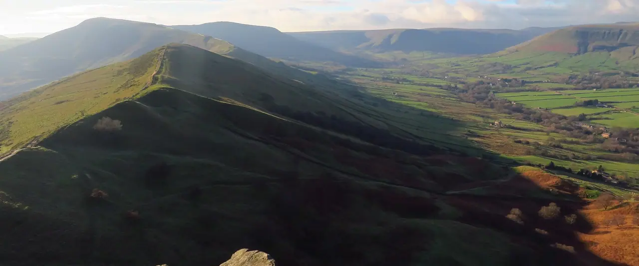
Which is the best ridge walk in the Peak District? For me, the Great Ridge is hard to beat. It runs from Mam Tor over Hollins Cross and Back Tor to Lose Hill. On one side you look down into the green Vale of Edale and up to Kinder Scout. On the other, you see the Hope Valley and the pretty village of Castleton below.
Mam Tor and Lose Hill are still some of my favourite Peak District hikes. We climbed Mam Tor from our campsite in Edale back in 2016. The sun was out the whole day, and the walk up was easy and quiet. But when we got to the top, it was very busy, as you can park a short walk below the summit! We also walked up Lose Hill from Hope on that trip, but it was so foggy that we couldn't see anything from the top. So we haven't walked the full Great Ridge loop from Castleton yet. It is high on our list, and I've researched every detail for you.
Mam Tor is 517 m high. People call it the Shivering Mountain, because its eastern face keeps slipping in landslides. There is also a Bronze Age and Iron Age hill fort on the summit. This loop from Castleton is a great way to see it all, with cafés and pubs waiting at the end.
At a glance
- Distance: about 10.5 km (6.5 miles) for the loop from Castleton. You can extend it to about 13 km (8 miles) via Hope
- Elevation gain: around 450 m
- Allow 4–5 hours, plus stops
- Difficulty: Moderate. Steep climbs to Mam Tor and Back Tor, but on good, clear paths
- Route type: Circular (Castleton → Mam Tor → Hollins Cross → Back Tor → Lose Hill → Castleton)
- Start/finish: the main car park in Castleton, next to the Castleton Visitor Centre
- Best season: all year in good weather. Spring to autumn is easiest
- Prices: free to walk. You pay to park in Castleton
- Toilets: at the Castleton car park. There are none on the ridge, and none at the Mam Nick car park either
- Suitable for children: yes, for kids who are used to walking. The short climb from Mam Nick is a great first summit
- Dogs: welcome. Keep them on a short lead, as there are sheep and cattle on the hills
Route description
Castleton to the show caves
From the main car park, walk up the main road through Castleton. Take the first right past the Castle Inn and another right near Castleton Hall. The route then heads west below the hills and passes Treak Cliff Cavern. Climb the steps beside it and continue to Blue John Cavern. These are two of the four show caves around the base of Mam Tor, where lead, Blue John stone and fluorspar were once mined.
Up to Mam Tor
Cross the Blue John Cavern car park and climb past a farm. A few gates and fields lead you to a road, then you go up some steps to another road. From here a stepped, stone-pitched path takes you up to the summit of Mam Tor.
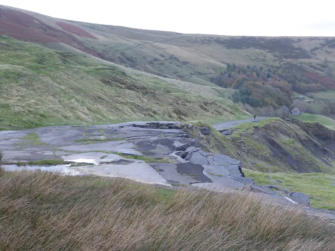
Close by you can also see the old road below the hill. It was a through road until 1979, when it closed for good because the landslip kept breaking it apart. The broken tarmac is still there, and it is quite a sight!
Mam Tor summit
The top of Mam Tor is crowned by a hill fort. People lived here from around 1200 BC, and there are also two Bronze Age burial mounds. Back in 1636, Thomas Hobbes even named Mam Tor one of the Seven Wonders of the Peak. On a windy day you will often see paragliders taking off from the slopes. I think it is a lovely spot for a snack, but expect lots of company.
Along the Great Ridge to Hollins Cross
Now the fun part begins. Follow the path east along the crest of the ridge. It drops gently to Hollins Cross, the lowest point of the ridge and a junction of several old paths. The views down into Edale are stunning. If you are short on time or energy, you can drop down to Castleton from here. Otherwise carry straight on.
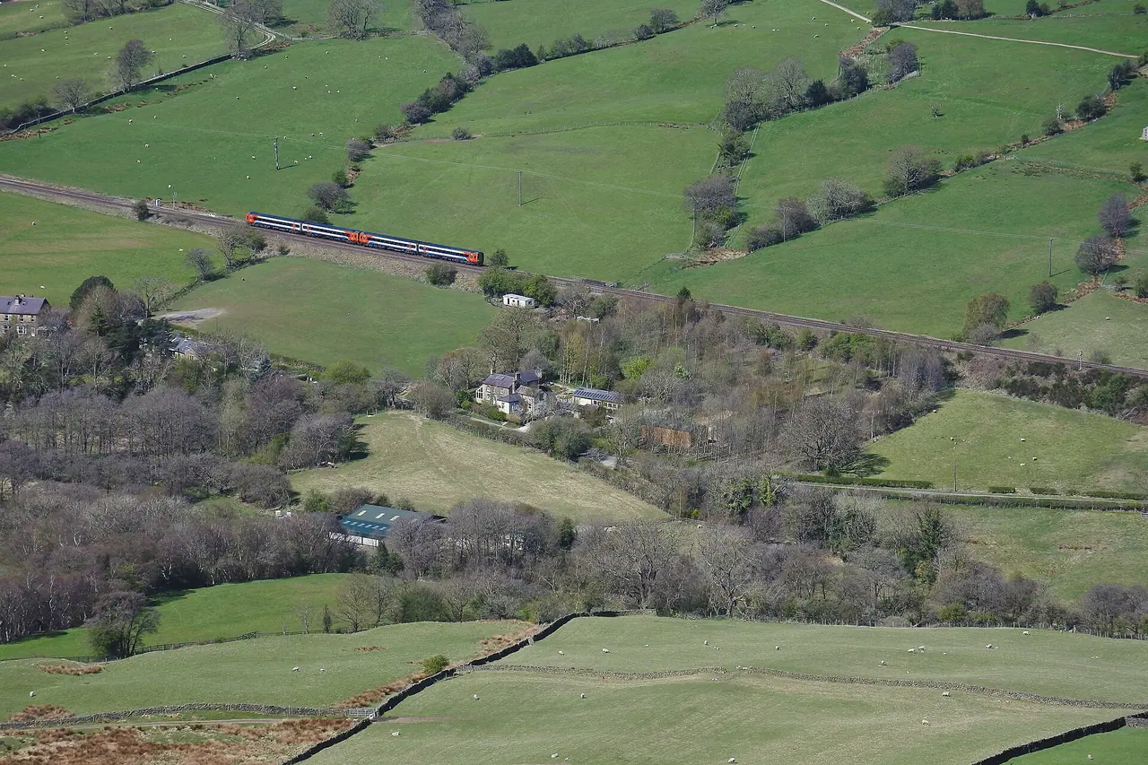
Back Tor and Lose Hill
After Hollins Cross there is a short, steep climb up Back Tor. Take care here, especially when it is wet. Then the path rises more gently to Lose Hill (476 m), the end of the Great Ridge. Part of the top is called Ward's Piece. Ramblers gave it to the access campaigner G. H. B. Ward in 1945, and he later gave it to the National Trust.
There is also a fun legend here. According to the story, two armies camped on Win Hill and Lose Hill in the 7th century. The army on Win Hill rolled boulders down onto their enemies, so they won. Historians say there is no evidence of a battle, but kids love it!
Back down to Castleton
From Lose Hill, follow the stone paths, stiles and a track down towards Spring House Farm. For the shorter loop, turn right after the farm and follow the tracks and a stony lane. A surfaced lane then takes you back into Castleton. For the longer version, turn left at the farm and cross the fields to Hope. Then follow the path above Peakshole Water back to Castleton.
How to get there
By car and parking
Castleton is on the A6187 in the Hope Valley, west of Hope and Hathersage.
Parking: the main car park is on Cross Street, next to the Castleton Visitor Centre (postcode S33 8WH). High Peak Borough Council runs it. It has 133 spaces, toilets and is open 24 hours. In the council's latest published tariff, over 4 hours (up to 10 hours) cost £6.80 and 24 hours cost £7.90. You can pay with coins (no change given), by card or with the PayByPhone app. On sunny weekends it fills up fast, so arrive early to avoid disappointment.
For a short walk, the National Trust's Mam Nick car park sits just below the summit of Mam Tor. However, it has no toilets, and it gets very busy.
By public transport
- Train: Hope station is on the Hope Valley line between Sheffield and Manchester Piccadilly. From Monday to Saturday there is usually one train an hour in each direction. You can walk to Castleton on field paths, or start the walk from Hope. Edale station is another option, if you want to climb up to the ridge from the north side like we did.
- Bus: the 271/272 runs from Sheffield Interchange to Castleton via Hathersage and Hope. In 2026 there were about 13 buses a day on weekdays and Saturdays and 11 on Sundays.
- Peak Sightseer: this seasonal bus links Castleton and Mam Tor with Hope, Hathersage and Chatsworth. In 2026 it ran daily from 23 May to 19 September, then on Saturdays until 10 October.
Permits, fees & opening times
- You don't need a permit or ticket to walk the Great Ridge.
- Parking: pay and display in Castleton, charged 24 hours a day, every day. Blue Badge holders park for free.
- Castleton Visitor Centre: usually open daily from 10 am to 4.30 pm. Its café and museum were closed for flood repairs until May 2026, but the car park and toilets stayed open.
- Show caves: Treak Cliff, Blue John, Speedwell and Peak Cavern all charge for tours. Check their own websites for times and prices.
When to go
You can walk the Great Ridge all year, but I think spring and autumn are the nicest. The light is lovely and there are fewer people. Summer weekends and school holidays are very busy, especially on Mam Tor itself. So start early or come midweek.
It can get really windy on the ridge, even when Castleton is calm. Take an extra layer, as we learned on Win Hill! In winter the paved path can be icy. Low cloud is common too, and as we found out on Lose Hill, you might not see a thing. Check the Met Office mountain forecast for the Peak District before you go.
Hiking with kids
Suitable for children: yes, the Great Ridge is a fantastic family walk for kids who are used to walking. The full loop from Castleton is long for little legs. So you could do a shorter version: climb Mam Tor from Mam Nick, walk to Hollins Cross and come back.
- Pushchairs: not suitable. The path from Mam Nick has steps with no handrails, and the summit path is stepped and stone-pitched.
- Carriers: a back carrier is the best way to bring toddlers. Take care on the steps and the steep slope at Back Tor.
- Keep them engaged: look for the ditches of the hill fort, watch the paragliders, tell the legend of Win Hill and Lose Hill, and visit one of the show caves after the walk.
What to pack
- Walking boots or trail shoes with good grip
- A windproof and waterproof jacket, plus a warm layer
- OS Explorer OL1 (The Peak District – Dark Peak area) or a navigation app
- Water and snacks, as there is nothing to buy on the ridge
- Coins or a card for parking
- Sun cream and a hat in summer, as there is no shade
If you want to make a weekend of it, you can camp in the valley like we did. On our car camping trips we now cook on our Cadac Safari Chef 2. It is a big upgrade from a tiny gas stove, and it even has a BBQ grid.
Safety tips
- Watch your step on the stone paths. The stones get slippery in the wet and icy in winter.
- Take care on Back Tor. The slope is short but steep and loose in places.
- Keep away from the steep east face of Mam Tor. The ground there is unstable.
- Be careful with cattle, especially if you have a dog. Never walk between a cow and her calf.
- Check the last bus and train times before you set off.
- In an emergency, call 999 and ask for Police, then Mountain Rescue.
Leave no trace & sustainable tips
- Come by train or bus. Hope and Edale stations are close, and the Castleton car park fills fast.
- Stay on the main path. The National Trust rebuilt the stepped path to the summit, so please don't walk on the edges or cut corners.
- Respect the hill fort. It is a Scheduled Ancient Monument, so don't move stones or dig.
- Follow the Countryside Code: keep dogs on a short lead, use stiles and gates, and leave gates as you find them.
- No BBQs or fires on the hills, and take all litter home.
- Support local: have a drink in a Castleton pub or a cuppa in a tea room after your walk.
Where to stay & eat nearby
- Castleton has pubs, tea rooms and cafés, including the Cheshire Cheese Inn and the Castle Inn, plus B&Bs and holiday cottages.
- Hope also has tea rooms and pubs. We camped at Laneside Caravan Park in Hope on our trip.
- Edale is a lovely base for walkers. We stayed at Fieldhead Campsite, right in the village.
- Hathersage, a few miles east, has more places to stay and is on the same train line.
More to explore nearby
- The show caves: Treak Cliff, Blue John, Speedwell and Peak Cavern are all near Castleton.
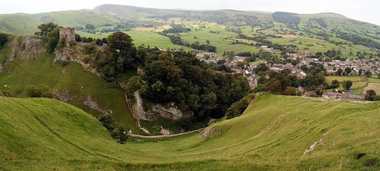
- Peveril Castle: the ruins of a Norman castle above Castleton.
- Win Hill and Ladybower Reservoir: one of our favourite walks from Hope.
- Kinder Scout and Jacob's Ladder: a lovely walk on the Pennine Way from Edale.
- Stanage Edge: a famous gritstone edge above Hathersage.
FAQ
How long is the Mam Tor and Great Ridge walk from Castleton?
The loop is about 10.5 km (6.5 miles) with around 450 m of ascent. Allow 4–5 hours. Going back via Hope makes it about 13 km (8 miles).
What is the easiest way up Mam Tor?
From the National Trust's Mam Nick car park. A short, stepped and stone-pitched path takes you to the summit. It is steep in places but very short.
Can I walk the Great Ridge without a car?
Yes. Take the train to Hope or Edale, or the 271/272 bus from Sheffield to Castleton. In summer the Peak Sightseer bus also stops at Castleton and Mam Tor.
Is Mam Tor suitable for pushchairs?
Not really. There are steps from the Mam Nick car park and a stepped path to the summit. A back carrier is a better choice.
Why is Mam Tor called the Shivering Mountain?
Because its eastern face keeps slipping. A landslide that started about 4,000 years ago is still moving, and it destroyed the old main road, which closed in 1979.
Have you walked the Great Ridge? Did you get clear views or fog like we did on Lose Hill? Let me know in the comments!
Photo credits (4)
All photos on this page are by other photographers and are used under free licences. Thank you for sharing them.
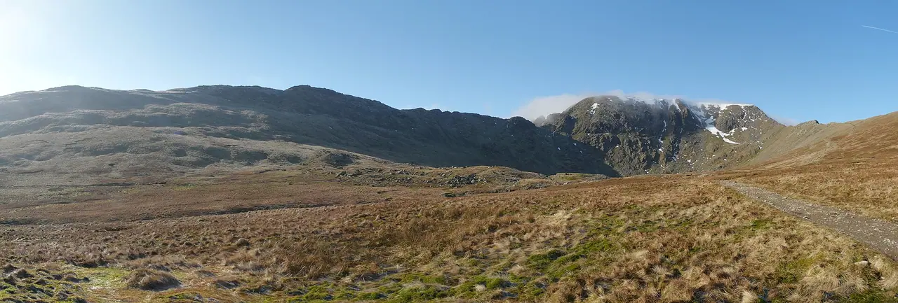
- Cover photo: On Back Tor - ridge running towards Mam Tor - geograph.org.uk - 7679692.jpg by Colin Park, CC BY-SA 2.0, via Wikimedia Commons. Resized and cropped for this page.
- Photo 2: The broken road below Mam Tor - geograph.org.uk - 5590068.jpg by Marathon, CC BY-SA 2.0, via Wikimedia Commons. Resized for this page.
- Photo 3: Vale of Edale from Hollins Cross.jpg by Donnchadh H, CC BY 2.0, via Wikimedia Commons. Resized for this page.
- Photo 4: Peveril Castle over the town of Castleton, 2008.jpg by Steven Newton, CC BY 2.0, via Wikimedia Commons. Resized for this page.


join the conversation
Comments
No comments yet. Be the first to share your thoughts!