🥾 Trail guide · Dolomites – Veneto/South Tyrol border (Tre Cime Nature Park)
Tre Cime di Lavaredo Loop: A Complete Guide to the Dolomites' Most Famous Hike (Without a Car)

- Distance
- 10 km
- Ascent
- 400 m
- Time
- 3–4 hours
- Difficulty
- Moderate
- Route
- Circular
- Best season
- Late June–September (huts open; road and buses run roughly late May–early October)
👶 With kids: The first 2 km to Rifugio Lavaredo is a wide gravel track that a rugged all-terrain pushchair can manage; the full loop is carrier territory. Good for active kids 6+ on foot, with hut stops.
✅ Updated and fact-checked on 2 November 2026. Prices, timetables and rules can change, so check the official sources before you go.
This post contains affiliate links. If you book or buy through them, I may earn a small commission at no extra cost to you. More about this
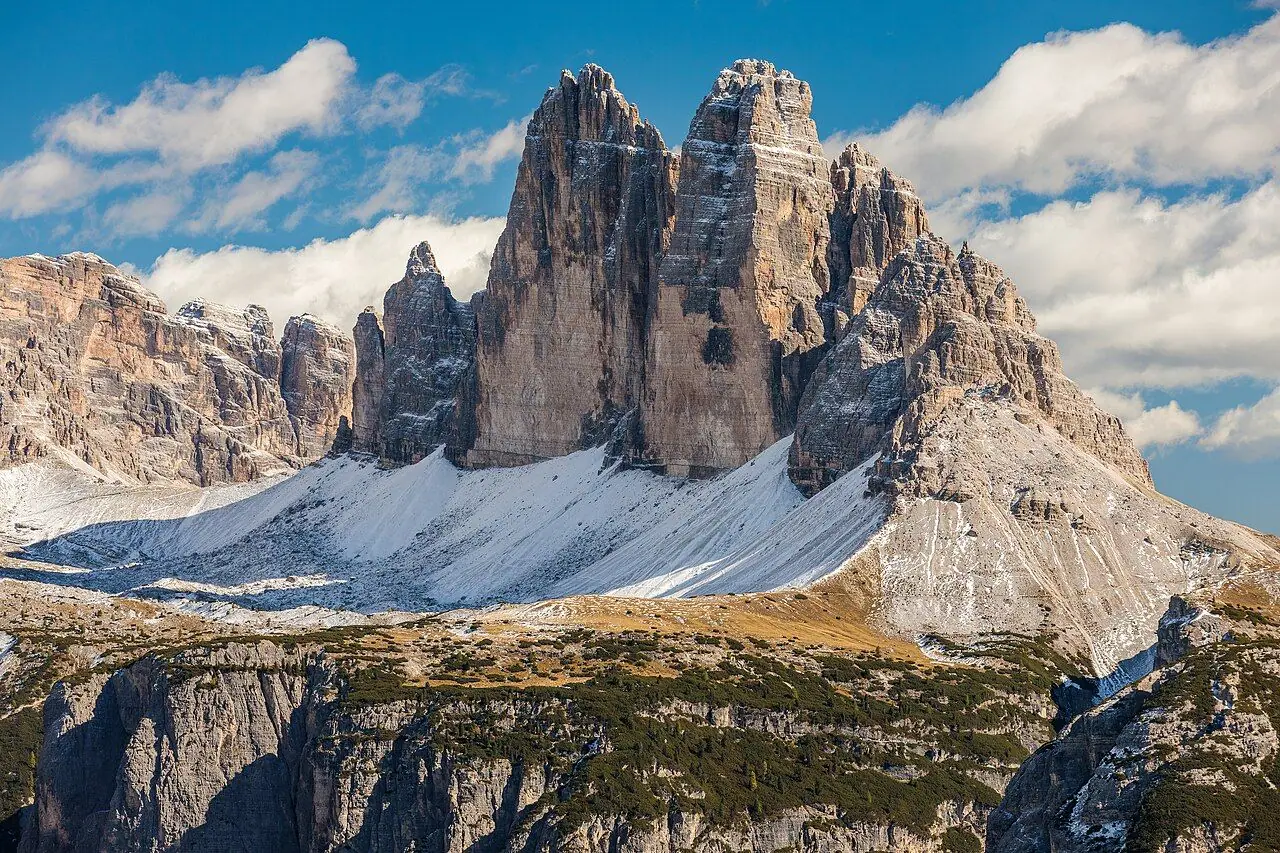
Have you seen the Tre Cime di Lavaredo on Instagram? These three sheer towers of pale dolomite rock (the Drei Zinnen in German) rise straight out of the scree. The tallest, Cima Grande, reaches 2,999 m. They have become a symbol of the UNESCO-listed Dolomites. The loop around their base is one of the most popular high-altitude walks in the Alps.
We've hiked in the quieter mountains of Lombardy, near Lake Iseo, but we haven't made it to the Dolomites yet. The Tre Cime loop is high on our bucket list, so I've researched every detail for you.
The good thing is that the circuit starts high, at Rifugio Auronzo (around 2,320–2,333 m). So you get big mountain scenery without a huge climb. As you walk, the peaks change shape. From the south they look like a solid wall. Only when you go round Forcella Lavaredo do the famous north faces appear side by side, just like on the postcards. Along the way there are mountain huts, little lakes, grazing pastures and the remains of First World War trenches and tunnels. Fun fact: the front line between Austria-Hungary and Italy ran right through these rocks.
Unfortunately, getting there has become more complicated. Driving to the trailhead now needs an online booking and costs €40 per car, and the shuttle buses are busier than ever. Luckily, frequent buses run up in summer, so you can do it car-free if you plan ahead. This guide covers the current rules as of 2026.
At a glance
- Distance: about 9.5–10 km.
- Elevation gain: roughly 300–400 m.
- Allow 3–4 hours of walking, or 5 hours with hut stops.
- Difficulty: Moderate (graded E, a standard hiking path), with a few narrow, slightly exposed stretches.
- Route type: Circular.
- Start/finish: Rifugio Auronzo car park and bus stop.
- Highest point: Forcella Lavaredo, about 2,454 m.
- Best season: late June to September, when all the huts are open. The road usually opens in late May and buses run until early October.
- Prices: walking is free. Car access is €40 (2026, booked online). Shuttle buses are €10 (Misurina) or €22 return (Dobbiaco).
- Toilets: at the huts at Auronzo, Lavaredo, Locatelli and Malga Langalm, which also serve food (seasonal).
- Pushchairs: only on the wide track to Rifugio Lavaredo. Use a carrier for the full loop.
- Dogs: people often walk dogs on the loop. Keep them on a lead around livestock. The Dobbiaco shuttle charges a pet fare.
Route description
Most people walk the loop anticlockwise. This way you get the classic north-face view in the middle of the walk. The paths are well signed: 101 to Rifugio Locatelli, then 105 back.
Rifugio Auronzo to Rifugio Lavaredo (about 30 min, 1.7 km)
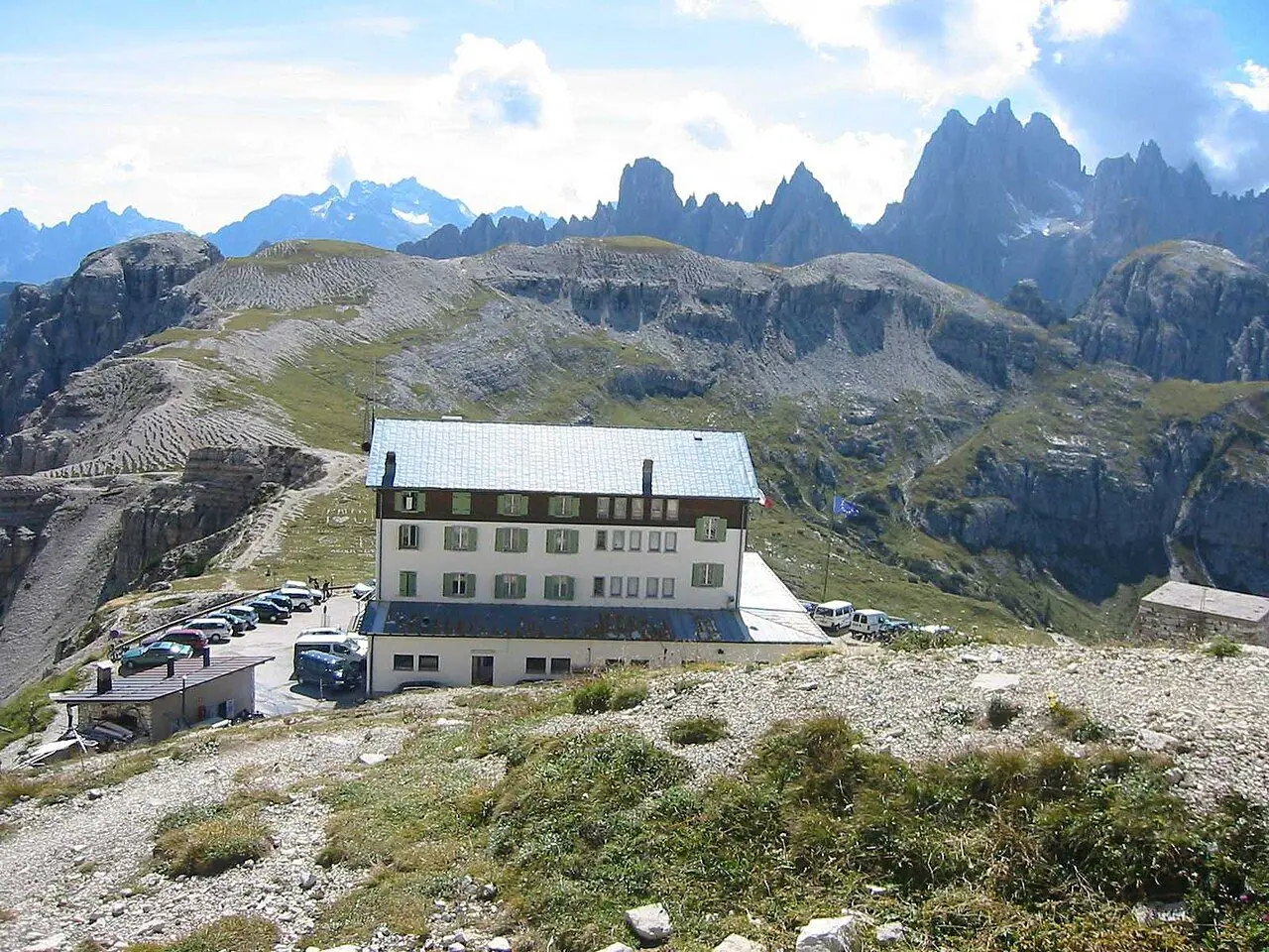
From the car park and Rifugio Auronzo, follow the wide gravel track (path 101) heading east beneath the south faces of the peaks. It is almost flat and very busy, but the towers above you are huge! After about 15 minutes you pass a small chapel dedicated to Maria Ausiliatrice. Then you reach Rifugio Lavaredo (2,344 m).
Up to Forcella Lavaredo (about 20 min, 1 km)
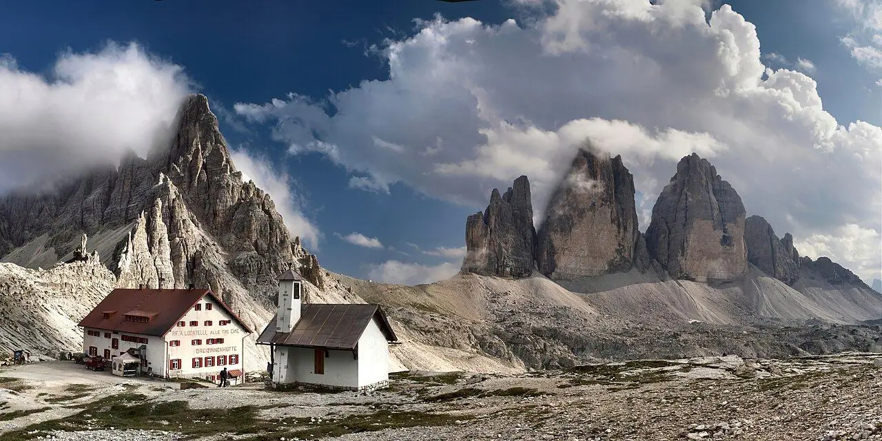
After Lavaredo, the track gets narrower and climbs steadily on loose gravel to Forcella Lavaredo (about 2,454 m). This is the highest point of the loop. Step over the saddle and the view changes completely. The three north faces stand together in a row, with the Cadini di Misurina and Sexten Dolomites around them. This is the view most people come for.
Forcella Lavaredo to Rifugio Locatelli (about 40 min, 1.9 km)
The path goes gently down and runs level beneath Monte Paterno (Paternkofel). Then it climbs to Rifugio Locatelli – Sepp Innerkofler (2,405–2,438 m), which sits on a saddle right opposite the north faces. The first hut here was built in 1883, and Italian artillery destroyed it in 1915. It is partly named after Sepp Innerkofler, a famous mountain guide from Sexten and the hut's former keeper. He died on the summit of Monte Paterno in July 1915. Around the hut you will find old wartime tunnels and positions in the rock and a small memorial chapel. Just below are the Laghi dei Piani lakes.
Locatelli to Malga Langalm (about 1 hr 15 min, 2.8 km)
Take path 105 down into the grassy basin north of the peaks. This side is wilder and quieter than the south, with streams and little lakes. The source of the Rienza river is nearby too. The path leads to Malga Langalm (2,283 m), a small summer pasture hut serving hearty food.
Back to Auronzo via Forcella Col di Mezzo (about 35 min, 2.1 km)
From Langalm, climb steadily west beneath the huge Cima Ovest to Forcella Col di Mezzo (about 2,315 m). One or two stretches are narrow and a little exposed. From the saddle, the path leads gently back to Rifugio Auronzo in about 20 minutes, with views south over Misurina and the Cadini.
How to get there
By public transport
Plan ahead: in 2026 you needed to book the Dobbiaco shuttle online in advance, in both directions.
- From Dobbiaco/Toblach (South Tyrol): Dobbiaco has a station on the Val Pusteria railway (trains from Fortezza/Franzensfeste and San Candido/Innichen). SAD shuttle line 444 runs from Dobbiaco bus station to Rifugio Auronzo in summer (31 May–11 October 2026). In 2026 the adult return fare was €22. You had to reserve and pay for seats online in advance. South Tyrol travel passes are not accepted, and even Südtirol Pass holders must reserve. Book via the Drei Zinnen/3 Zinnen tourism website.
- From Misurina (Veneto): DolomitiBus runs a shuttle from Misurina via Lago Antorno to Rifugio Auronzo daily from 30 May 2026, all day from 7.30am to 8pm. A day ticket costs €10. You can pay contactless on board, in the app or at the Misurina ticket machine (no cash on board). In July 2026, there were such long queues at Misurina that they added an extra early bus. So start early!
- To Misurina: DolomitiBus line 51 connects Cortina d'Ampezzo with Misurina in high summer, and line 50 runs from Auronzo di Cadore. From Calalzo railway station (trains from Venice via Belluno), line 30 runs to Cortina. Outside high summer there are few connections, so check timetables at dolomitibus.it.
- From Cortina via South Tyrol: SAD line 445 runs from Cortina to Lago di Landro (Dürrensee), where you can change to line 444 (booking required).
- On foot: you can also hike up from Misurina/Lago Antorno or from the Val Fiscalina (Fischleintal) near Sexten for a longer day. Both avoid the bus queues completely.
By car and parking
The toll road climbs about 7 km from near Lago Antorno, above Misurina, to the car park at Rifugio Auronzo.
Parking: since 2025 you must book online in advance with the Municipality of Auronzo (pass.auronzo.info). No reservation, no entry! In 2026 the fees were €40 per car, €26 per motorbike and €60 per camper van. This covers a 12-hour window from your chosen entry time, and you pay extra if you stay longer. Bookings open about a month ahead. The road opened on 23 May 2026, weather permitting, and it can close for a while because of snow or other hazards.
Permits, fees & opening times
- Hiking: free, no permit needed.
- Toll road and car park: online booking only, €40 per car (2026), valid for 12 hours.
- Shuttle buses: €10 day ticket from Misurina (DolomitiBus), or €22 return from Dobbiaco (SAD line 444, booking required).
- Huts: generally open from June to late September. Rifugio Locatelli usually opens from late June. Check each hut's website before you rely on it for food or toilets.
Prices and rules change every year, so check auronzo.info, dolomitibus.it and the Drei Zinnen tourism site before you go.
When to go
July to mid-September is peak season. All the huts are open and the paths are usually snow-free. However, in August up to 7,000–8,000 people a day visit, and the shuttle queues can be long. Late June and the second half of September are quieter. But snow can stay on north-facing slopes early in the season. Afternoon thunderstorms are common in summer, so start early and be off the high ground by mid-afternoon. Early mornings and evenings bring the best light on the rock and far fewer people.
Hiking with kids
- Pushchairs: the wide gravel track from Auronzo to Rifugio Lavaredo (about 1.7 km, almost flat) is manageable with a sturdy all-terrain pushchair. It makes a lovely short outing. Beyond that, use a carrier.
- Suitable for children: active kids of around 6+ can usually manage the full loop, and the hut stops break it up nicely. Turning back at Forcella Lavaredo or Rifugio Locatelli is a great shorter option.
- Altitude: you are at around 2,300–2,450 m the whole time. Take it slowly, keep kids hydrated and watch for tiredness or headaches.
- Keep it fun: hunt for wartime tunnels near Locatelli (with a torch and a grown-up), spot marmots in the meadows near Langalm and watch the three peaks change shape as you walk around them.
What to pack
- Sturdy walking shoes or boots with good grip (there is loose gravel on the climbs)
- Warm layer, windproof and waterproof, as it can be cold and windy even in August
- Sun cream, hat and sunglasses, as the sun is strong up high
- Water and snacks (the huts get very busy at lunch)
- Head torch if you plan to peek into the wartime tunnels
- Your bus or parking booking saved offline
Safety tips
- Watch the weather, as thunderstorms build quickly. Avoid exposed saddles and ridges in a storm.
- Stay on the marked paths. The scree slopes below the peaks are loose, and rockfall is possible.
- The wartime tunnels are uneven and dark, so use a torch and keep children close.
- The via ferrata routes on Monte Paterno are only for equipped, experienced climbers.
- Emergency number in Italy: 112.
Leave no trace & sustainable tips
- Take the bus or walk up. The area is overwhelmed by traffic in summer, which is why the toll and booking system exist.
- Stay on the paths. With this many visitors, erosion of the fragile alpine grass is a real problem.
- Take all your rubbish back down, as there are few bins on the loop.
- Don't build cairns, move stones or take souvenirs from the wartime sites.
- Buy lunch at the huts. They depend on summer visitors, and many use local produce.
Where to stay & eat nearby
On the mountain: Rifugio Auronzo, Rifugio Lavaredo and Rifugio Locatelli all offer meals and overnight stays (book well ahead for summer). Malga Langalm serves food in summer. I think staying a night would be really special, as you can see the peaks at sunrise and sunset without the crowds.
In the valleys: Dobbiaco/Toblach and San Candido/Innichen have good rail links, campsites and family-friendly hotels. Misurina has a few hotels by its lake. Auronzo di Cadore and Cortina d'Ampezzo offer more choice.
More to explore nearby
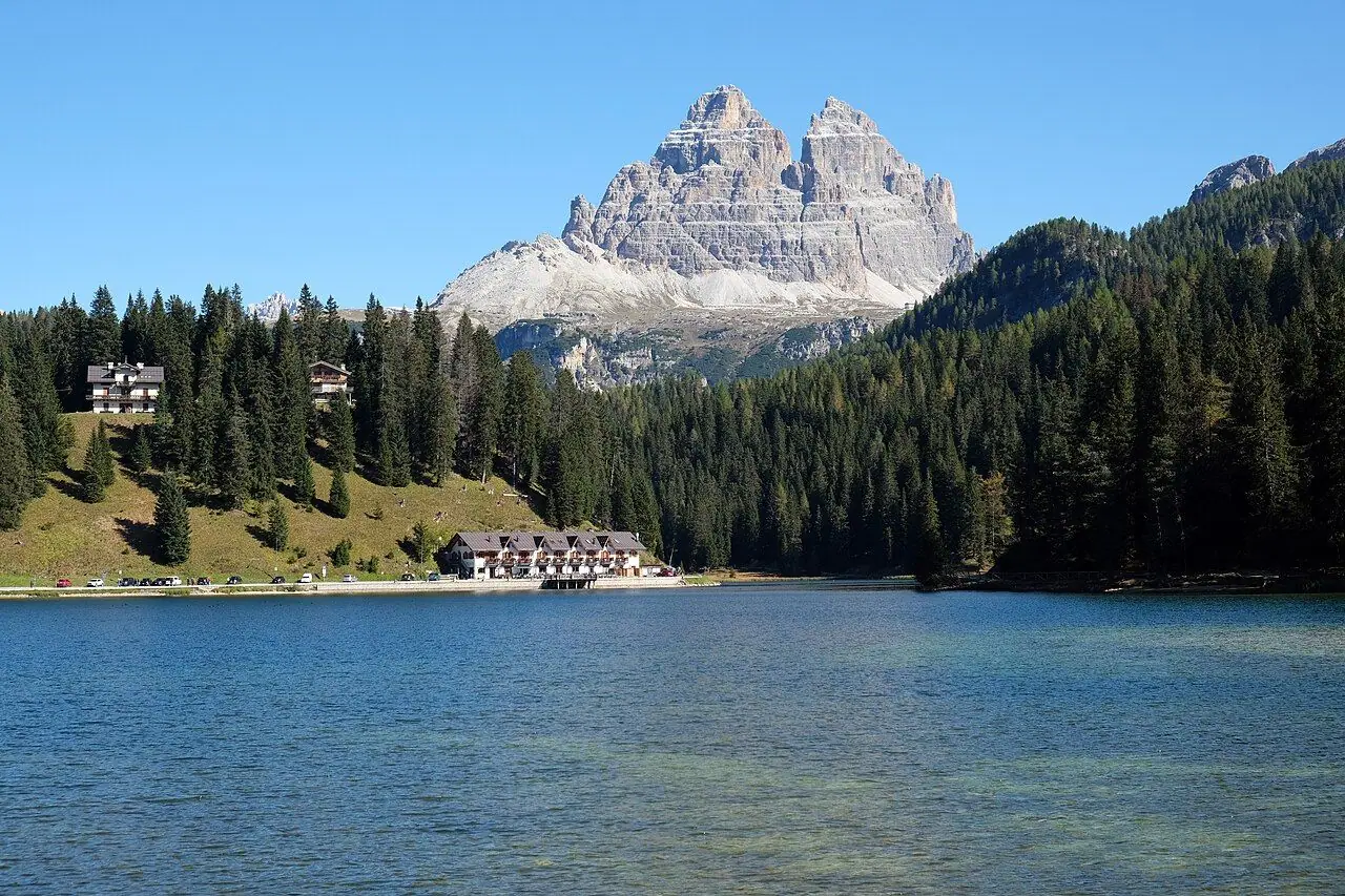
- Lago di Misurina and Lago Antorno: easy lakeside walks with views of the Tre Cime.
- Cadini di Misurina viewpoint: a short but steep, exposed path from the Auronzo area to a famous view of jagged spires.
- Lago di Braies (Pragser Wildsee): the famous emerald lake. You can get there by bus from the Val Pusteria (it also has summer access restrictions).
- Val Fiscalina (Fischleintal): a gentle valley near Sexten, ideal for families, with the Tre Cime visible from its upper end.
- Drava cycle path: a gentle, family-friendly downhill ride from San Candido into Austria, with trains back.
FAQ
Do I need to book to visit Tre Cime di Lavaredo? Not to hike. But if you drive, you must book the toll road and car park online in advance (€40 per car in 2026). The Dobbiaco shuttle bus (line 444) also needs an advance online booking.
How long is the Tre Cime di Lavaredo loop? About 9.5–10 km with roughly 300–400 m of ascent. It takes 3–4 hours of walking, or around 5 hours with stops.
Can you get to Tre Cime by public transport? Yes. In summer, SAD line 444 runs from Dobbiaco station, and DolomitiBus runs a shuttle from Misurina to Rifugio Auronzo. Check timetables and book where required.
Which direction is best for the Tre Cime loop? Most people walk anticlockwise, via Rifugio Lavaredo and Forcella Lavaredo first. This brings you to the famous north-face view at Rifugio Locatelli in the middle of the hike.
When is the toll road to Rifugio Auronzo open? Usually from late May to October, weather permitting. In 2026 it opened on 23 May. Check auronzo.info for current dates.
Have you walked the Tre Cime loop? Did you go by bus or by car? Let me know in the comments!
Photo credits (4)
All photos on this page are by other photographers and are used under free licences. Thank you for sharing them.
- Cover photo: Tre Cime di Lavaredo from Monte Specie, Val Pusteria, Trentino-Alto Adige, Italy, 2025 October.jpg by Ximonic (Simo Räsänen), CC BY-SA 4.0, via Wikimedia Commons. Resized and cropped for this page.
- Photo 2: Tre cime - rifugio Locatelli.jpg by Elio Pallard, CC BY-SA 4.0, via Wikimedia Commons. Resized for this page.
- Photo 3: Rifugio Auronzo 2.JPG by Fantasy, CC BY-SA 3.0, via Wikimedia Commons. Resized for this page.
- Photo 4: Lago di Misurina Tre Cime di Lavaredo 1.jpg by kallerna, CC BY-SA 4.0, via Wikimedia Commons. Resized for this page.


join the conversation
Comments
No comments yet. Be the first to share your thoughts!