🥾 Trail guide · Scotland – Glencoe
The Lost Valley Walk, Glencoe: A Complete Guide to Coire Gabhail

- Distance
- 5 km
- Ascent
- 350 m
- Time
- 2.5–4 hours
- Difficulty
- Challenging
- Route
- Out-and-back
- Best season
- May–September
👶 With kids: Not pushchair-friendly and not suitable for carriers – the path is very rough with hands-on scrambling, a narrow section above a gorge and a stream crossing on stepping stones. Only for confident, sure-footed kids (roughly 10+) with close supervision, and only in dry weather with low water.
✅ Updated and fact-checked on 5 November 2026. Prices, timetables and rules can change, so check the official sources before you go.
This post contains affiliate links. If you book or buy through them, I may earn a small commission at no extra cost to you. More about this
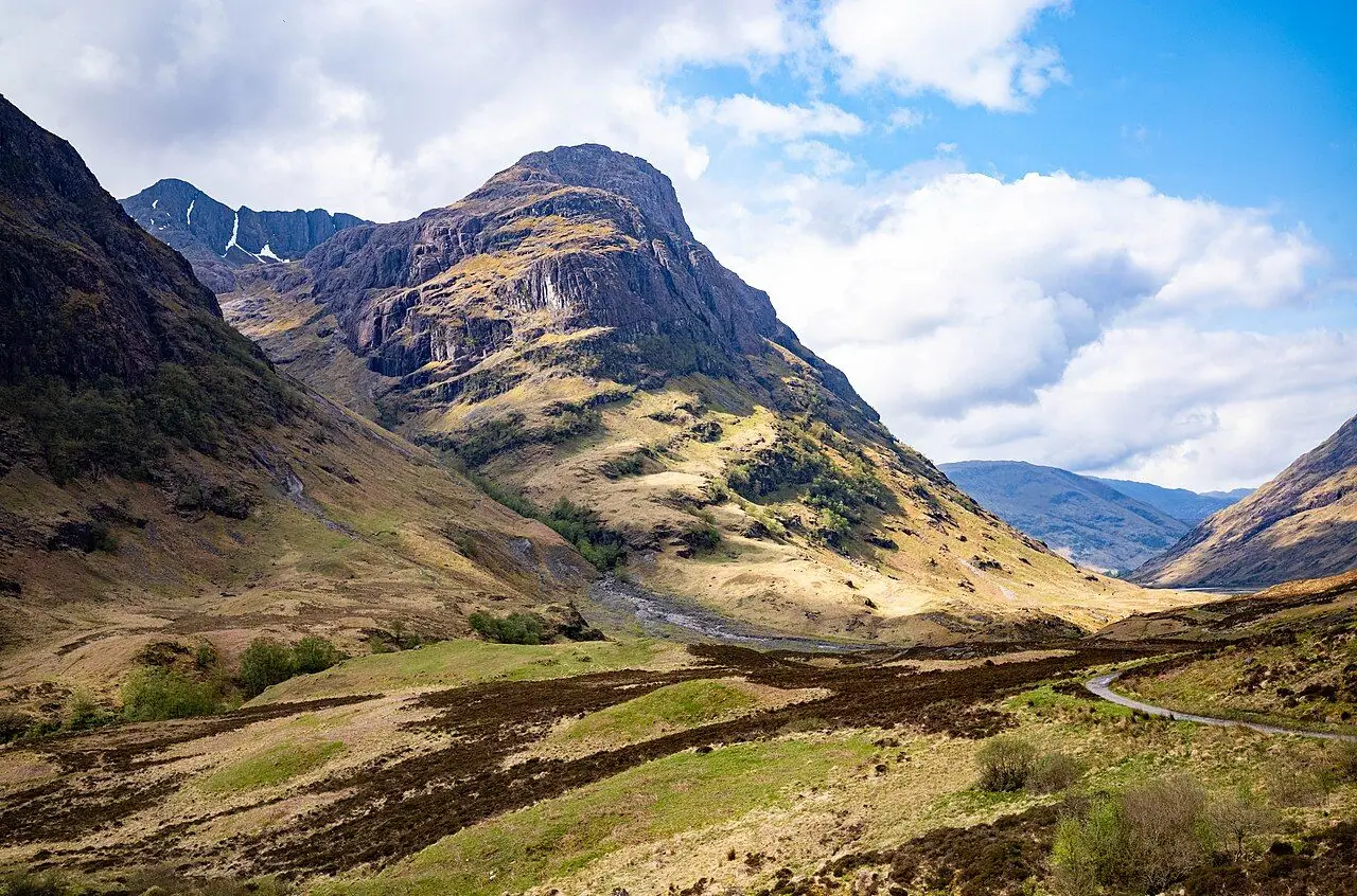
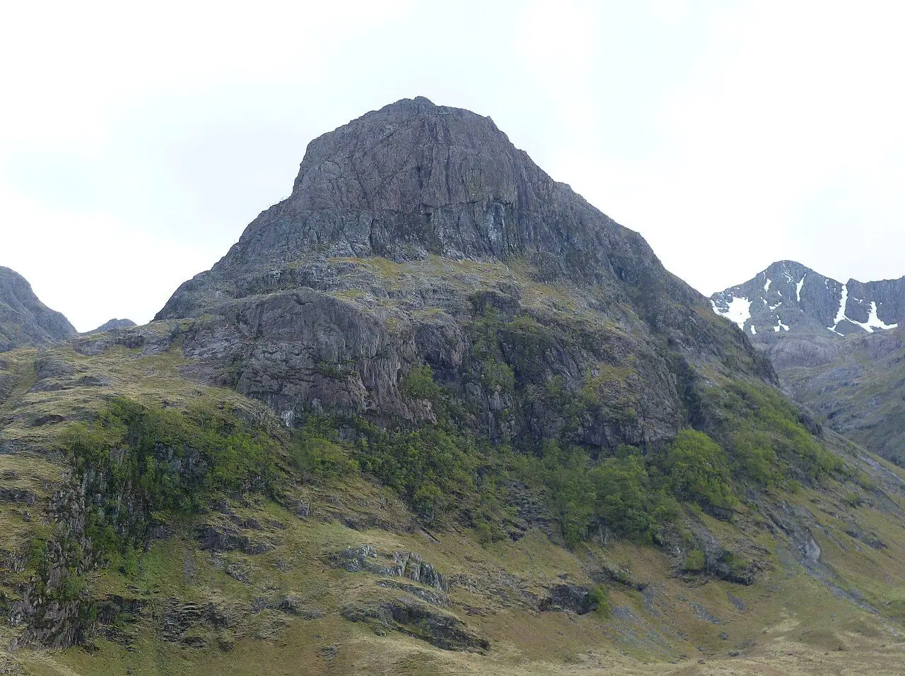
Glencoe is one of the most dramatic places in Britain. It is a deep, steep-sided glen surrounded by huge mountains, and it is full of history. Hidden among these mountains, out of sight from the road, is Coire Gabhail, the Lost Valley. To reach it, you cross the River Coe and climb a rough path through a wooded gorge between two of the famous Three Sisters, Gearr Aonach and Beinn Fhada. Then suddenly the ground levels off, and you step out onto a wide, flat valley floor. It is surrounded by cliffs, with Bidean nam Bian, the highest peak in Argyll, at the top.
The Lost Valley was one of my favourite walks on our Scotland road trip. You get a great view of the Three Sisters right from the car park. We even had the valley to ourselves for a few minutes, and it was so peaceful.
So why is it called the Lost Valley? The Gaelic name means something like "hollow of the capture" (or "of the booty"). According to tradition, the MacDonalds of Glencoe hid cattle they had raided from their neighbours here. The entrance is blocked by a huge pile of fallen boulders, some as big as houses, so the valley is almost invisible from below. It is also linked to the darkest chapter in Glencoe's history. After the Massacre of Glencoe in February 1692, some survivors are said to have fled into the hills through deep snow, and many died of exposure.
It is a short walk on paper, but don't underestimate it. The path is rough and rocky. There is some scrambling where you need your hands, a narrow section above a gorge, and a stream crossing that can become impassable after rain. However, with good boots, dry weather and a careful approach, it is one of the most rewarding short hikes in Scotland.
At a glance
- Distance: about 4–7 km out and back, depending on how far you explore the valley floor (around 5 km is typical)
- Elevation gain: around 300–420 m
- Allow 2.5–4 hours
- Difficulty: challenging for its length. The path is very rough, steep and rocky, with mild scrambling, a narrow section above a gorge and a stepping-stone stream crossing.
- Route type: out-and-back
- Start/finish: Three Sisters viewpoint car park on the A82 in the Pass of Glencoe (around grid ref NN 171 568)
- Best season: May–September in dry spells. Avoid it after heavy rain.
- Prices: free to walk. Check current parking arrangements at the Three Sisters car park.
- Toilets: none at the start. There are toilets and a café at the National Trust for Scotland Glencoe Visitor Centre, and pubs and shops in Glencoe village.
- Suitable for children: not for pushchairs or baby carriers. Only for confident older children.
- Dogs: allowed under close control. They will need help on the scrambles and the stream crossing. Keep them on a lead around livestock and deer.
Route description
Three Sisters car park to the River Coe
From the Three Sisters viewpoint car park (the larger of the two parking areas beside the A82), take the path down towards the bottom of the glen. You will reach the old road along the valley. Turn left along it for a short while, then follow the path down the steps towards the river. Below you, the River Coe meets two other streams at a spot called "the Meeting of the Three Waters".
Cross the River Coe on the wooden footbridge over a small gorge. It is a beautiful spot, with the water rushing through the rocks below.
Through the gorge
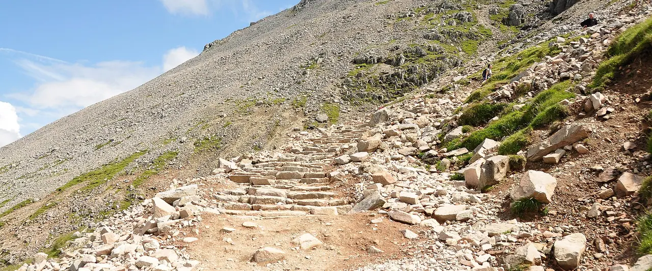
After the bridge, the path climbs steeply through birch woods into the narrow gap between Gearr Aonach on your right and Beinn Fhada on your left. This is the toughest section. Expect stone steps, tree roots, rock slabs polished by lots of boots, and a few spots where you will need to use your hands. At one point the path runs high above a deep, rocky gorge (the Allt Coire Gabhail), with a steep drop on one side. There is a short stretch with a handrail on a rock step. Take your time, especially when it is wet.
The stream crossing
Higher up, the path drops down to cross the Allt Coire Gabhail on large stepping stones. In dry weather it is easy. However, after rain the burn can quickly turn into a rushing torrent and cover the stones. If the stones are under water or the current looks strong, turn back. It is not worth the risk!
This crossing confused us, and lots of other hikers around us too. We missed the proper spot on the way up and crossed somewhere else, which was quite challenging. On the way back we found the right place, but it was still tricky stepping on the stones. Walking poles would have made it much easier! Some people took their boots off and walked across barefoot, which is probably a good way of doing it.
Boulder field and into the Lost Valley
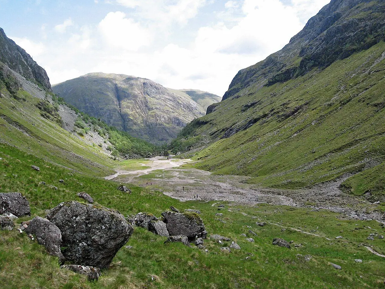
Across the stream, the path keeps climbing over rocks and stone steps. It winds through the huge boulders of an ancient rockfall that has dammed the valley. Geologists think it is one of the largest rockfalls in Britain. Then you reach the top of the last rise, and suddenly the Lost Valley opens up in front of you.
The valley floor is wide, flat and grassy. It is built up from the gravel and silt that collected behind the boulder dam. The stream often disappears underground here. Cliffs rise on all sides, with the high ridge of Bidean nam Bian and Stob Coire Sgreamhach at the head of the valley. It feels really remote, even though the busy A82 is only a couple of kilometres away.
Exploring and returning
Wander across the valley floor as far as you like. The path continues faintly towards the head of the coire, where it climbs much steeper ground towards the ridge. That part is only for properly equipped hillwalkers. The weather was not great when we were there, so we did not go further. Find a sheltered boulder for a picnic and look out for red deer. When you are ready, return the same way. Be extra careful going down through the gorge, as it is easy to slip on the polished rock.
How to get there
By public transport
Long-distance coaches run along the A82 through Glencoe between Glasgow and Fort William. These are Scottish Citylink 915 and Ember services on the Edinburgh/Glasgow–Fort William routes. They stop at the Glencoe Visitor Centre junction and in Glencoe village, both several kilometres west of the start. Unfortunately there is no official bus stop at the Three Sisters car park. The A82 is a fast, busy road with no safe path along most of it, so please don't plan to walk along it. Shiel Buses' 44 links Fort William, Glencoe village and Kinlochleven.
The nearest railway stations are Fort William and Bridge of Orchy on the West Highland Line. From Fort William, coaches run through Glencoe. Check current timetables on Scottish Citylink, Ember and Traveline Scotland. A taxi from Glencoe village or Ballachulish to the Three Sisters is the most practical car-free option.
By car and parking
Parking: the Three Sisters viewpoint car park is beside the A82 in the Pass of Glencoe. The National Trust for Scotland has recently resurfaced and reorganised it, with marked bays in the larger car park and a separate area for coaches. It is really popular with sightseers and often full by mid-morning in summer, so I suggest arriving early. There are other lay-bys further along the glen. However, do not park on the A82 verges, as it is dangerous and enforced. Check the National Trust for Scotland website for any current parking charges.
Good to know
- No permits are needed. Glencoe is a National Nature Reserve owned by the National Trust for Scotland, and access is under the Scottish Outdoor Access Code.
- Glencoe Visitor Centre (NTS) has exhibitions, a café and toilets. In winter 2025–26 it was open daily 9:30 am–4 pm, and summer hours are longer. Parking there was £4 per car (free for NTS members), including entry to the centre. Check the NTS website for current times.
- Deer stalking takes place on estates in and around Glencoe, mostly in autumn. It is usually arranged around walkers on popular routes, but follow any signs.
- Glencoe Orbital Trail and Greenway: in 2025 the NTS opened a new traffic-free path linking Glencoe village, the Visitor Centre and the Clachaig Inn. It is lovely for a gentler day.
When to go
Late spring to early autumn (May–September) gives you the best chance of dry paths and low water at the stream crossing, plus long days. Summer brings crowds and, on still, damp days, midges. So bring repellent and a head net! Spring and autumn are quieter and really atmospheric, but check the forecast carefully.
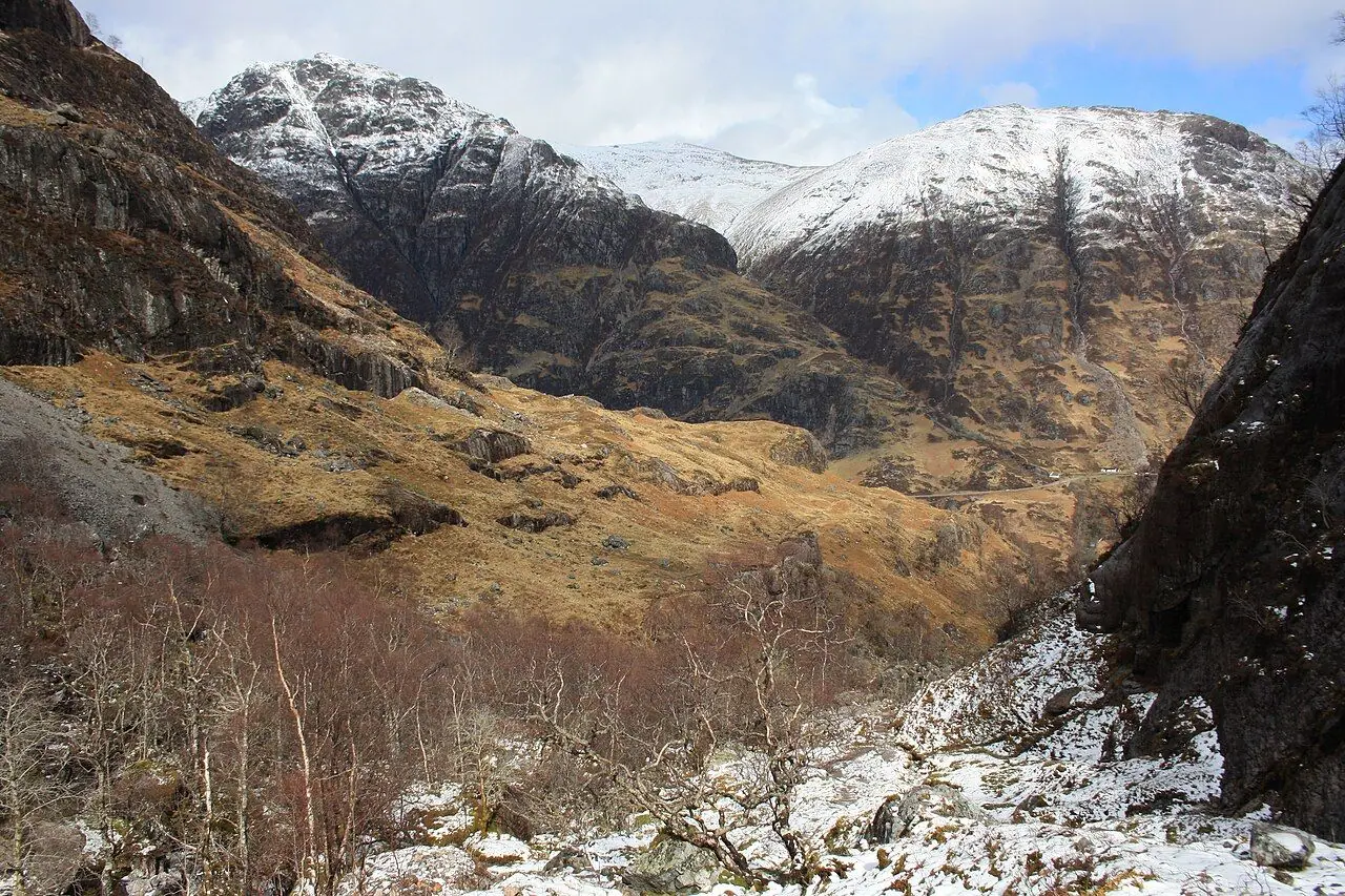
The most important thing is recent rainfall. Glencoe gets a lot of rain, and the Allt Coire Gabhail rises fast. After heavy rain, the stepping stones disappear and the polished rock in the gorge gets very slippery. In winter, ice and snow can make the path a serious undertaking that needs crampons, and the valley floor can be covered in snow.
Hiking with kids
I want to be honest here. The Lost Valley is not a family stroll. The path through the gorge is steep and rocky, with scrambling and a narrow section with a big drop, and the stream crossing can be tricky. It is not suitable for pushchairs. It is also not safe with a child in a back carrier, as you need your hands free and good balance.
Confident, sure-footed children of around 10 and up who have done some scrambling can manage it in dry weather, if an adult watches them closely. With younger kids, I suggest one of the gentler walks around the Glencoe Visitor Centre, the Glencoe Lochan trails above Glencoe village, or the new Greenway. We walked the Lochan trail after the Lost Valley, and it was a lovely, relaxing 30-minute walk. You can still enjoy the view of the Three Sisters from the viewpoint at the start of the Lost Valley walk.
Older kids will love the legends: a secret valley for hiding stolen cattle, boulders as big as houses, and a stream that disappears underground. Also look out for red deer grazing on the valley floor.
What to pack
- Walking boots with really good grip, not trainers
- Waterproof jacket and trousers, plus a warm layer, hat and gloves
- Midge repellent and head net (June–September)
- Water and snacks
- Map (OS Explorer 384 or Harvey Glen Coe) and compass, or an offline navigation app
- Walking poles (useful on the descent and the stream crossing, but put them away for the scrambles)
- A small first aid kit and a charged phone
Safety tips
- Check the forecast and recent rainfall. If the stream is high, don't cross.
- Take extra care in the gorge, especially where the path runs above the drop and on polished rock.
- Allow plenty of time for the return. Going down the rough path is often slower than going up.
- Don't continue up from the head of the valley unless you are an experienced, properly equipped hillwalker. The ground above leads to serious mountain terrain.
- Mobile signal is patchy in the glen, so tell someone your plans.
- People have died on this route. It is short, but it deserves respect.
- In an emergency, call 999 and ask for Police, then Mountain Rescue.
Leave no trace & sustainable tips
- Stay on the path. Erosion is a real problem in Glencoe, and the NTS is spending a lot on repairs.
- Never park on the verges of the A82. Use designated parking, or come by bus and taxi.
- Take all litter home, including fruit peel and teabags. Use the NTS waste points where there are any.
- Toilets: use the ones at the Visitor Centre or in Glencoe village before you go.
- Wildlife: don't disturb deer or nesting birds, and keep dogs under close control.
- Support local: eat and stay in Glencoe village, Ballachulish or Kinlochleven, and visit the NTS Visitor Centre. Your money supports conservation in the glen.
Where to stay & eat nearby
- Glencoe village has B&Bs, guesthouses, self-catering cottages, a youth hostel and campsites, plus a small shop and cafés.
- The Clachaig Inn, in the heart of the glen, is a famous walkers' and climbers' pub with food and rooms. It is a classic stop after a hike.
- Glencoe Visitor Centre has the Highland Coo Café.
- Ballachulish and Kinlochleven have more places to stay and eat.
- Kingshouse Hotel, at the eastern end of the glen near Rannoch Moor, has food and rooms with views of Buachaille Etive Mòr.
More to explore nearby
- Glencoe Visitor Centre, with exhibitions on the glen's geology, wildlife and the 1692 massacre.
- Glencoe Folk Museum in Glencoe village.
- Signal Rock and An Torr woodland walks, gentle trails near the Clachaig Inn.
- Glencoe Lochan, an easy, family-friendly woodland and lochside walk above the village.
- Buachaille Etive Mòr and Glen Etive, iconic scenery at the eastern end of the glen.
- Steall Falls in Glen Nevis, near Fort William.
FAQ
How long is the Lost Valley walk in Glencoe? It is roughly 4–7 km out and back, depending on how far you explore the valley floor. Most people take 2.5–4 hours.
Is the Lost Valley walk difficult? Yes, for its length. The path is very rough, with steep rocky steps, some mild scrambling, a narrow section above a gorge and a stream crossing on stepping stones. It is best done in dry weather by fairly fit, sure-footed walkers.
Where does the Lost Valley walk start? At the Three Sisters viewpoint car park on the A82 in the Pass of Glencoe. Arrive early, as it fills quickly in summer.
Can I do the Lost Valley walk after rain? It is best avoided after heavy rain. The Allt Coire Gabhail can flood and cover the stepping stones, and the rock in the gorge becomes very slippery. If the stones are under water, turn back.
Why is it called the Lost Valley? Its hidden, flat floor can't be seen from the road, and a huge rockfall blocks the entrance. The Gaelic name Coire Gabhail is linked to the tradition that the MacDonalds of Glencoe hid stolen cattle here.
Have you hiked to the Lost Valley? Did you find the right place to cross the stream? Let me know in the comments!
Photo credits (4)
All photos on this page are by other photographers and are used under free licences. Thank you for sharing them.
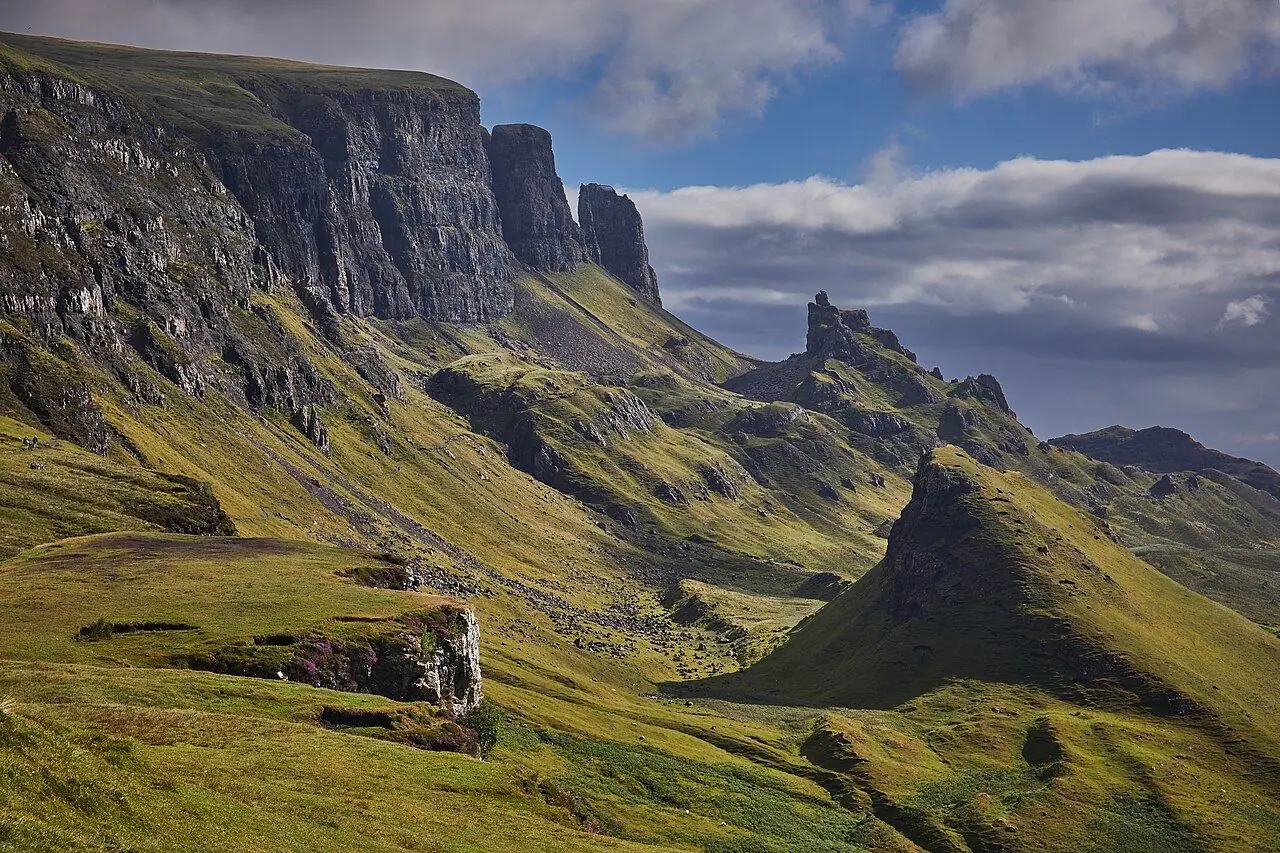
- Cover photo: The Three Sisters Valley, Glencoe, Scotland - 53744377929.jpg by rboed*, CC BY 2.0, via Wikimedia Commons. Resized and cropped for this page.
- Photo 2: Coire Gabhail looking north to Aonach Eagach.jpg by dave souza, CC BY-SA 4.0, via Wikimedia Commons. Resized for this page.
- Photo 3: View down Coire Gabhail towards A'Chailleach and Glen Coe.jpg by LittleDwangs, CC BY-SA 4.0, via Wikimedia Commons. Resized for this page.
- Photo 4: Gearr Aonach, Glencoe.JPG by Kim Traynor, CC BY-SA 3.0, via Wikimedia Commons. Resized for this page.


join the conversation
Comments
No comments yet. Be the first to share your thoughts!