🥾 Trail guide · Andalusia – Málaga province
Caminito del Rey: A Complete Guide to Spain's Famous Cliffside Walkway

- Distance
- 7.7 km
- Ascent
- 330 m
- Time
- 3–4 hours
- Difficulty
- Moderate
- Route
- Point-to-point
- Best season
- March–May and October–November
👶 With kids: Minimum age 8 with official ID; no pushchairs, no carrying children and no dogs. Fine for confident, steady kids 8+ who are happy with heights.
✅ Updated and fact-checked on 2 November 2026. Prices, timetables and rules can change, so check the official sources before you go.
This post contains affiliate links. If you book or buy through them, I may earn a small commission at no extra cost to you. More about this
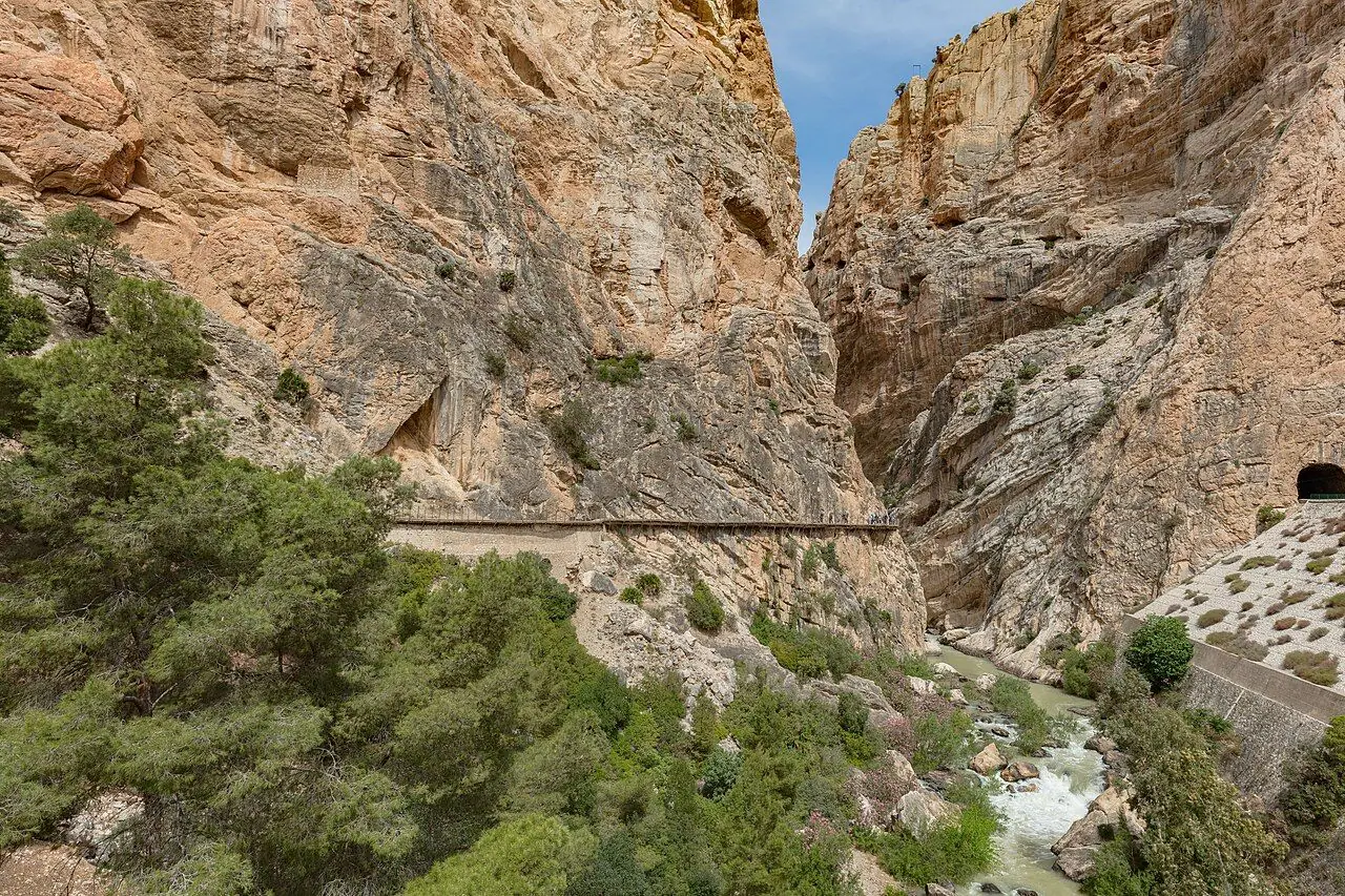
Would you walk along a narrow boardwalk bolted to a cliff, 100 metres above a river? For decades the Caminito del Rey was known as one of the most dangerous footpaths in the world: a crumbling concrete ledge with gaps where you could see straight down to the river. Luckily, today a sturdy timber boardwalk runs just above the remains of the old path. The walk through the Desfiladero de los Gaitanes is now one of the most popular day trips in Andalusia. It is still thrilling, but safe enough for anyone with a head for heights and decent shoes.
We haven't walked it ourselves yet, but it is high on our bucket list, so I've researched every detail for you.
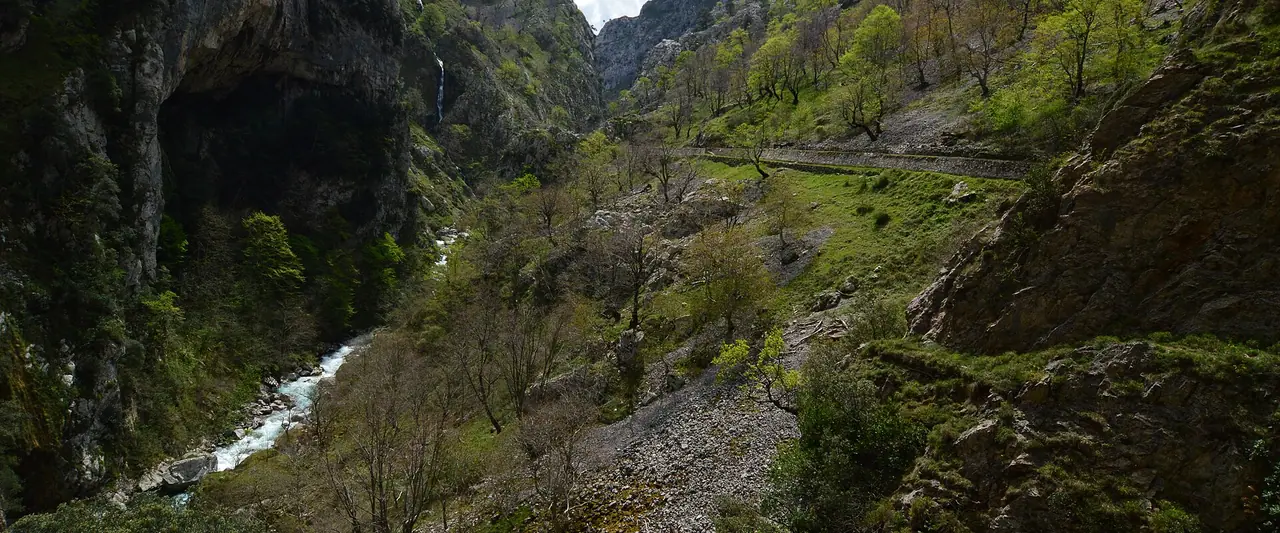
The path was built in the early 20th century for workers moving between the Gaitanejo dam and the El Chorro hydroelectric plant. King Alfonso XIII walked it in 1921 to open a new dam, and that is how the "King's Little Path" got its name. You pass through two narrow limestone gorges, where the walls rise hundreds of metres and the boardwalk hangs up to around 100 metres above the turquoise Guadalhorce river. In between, the canyon opens into a peaceful valley full of pines and wild herbs. Also, keep an eye on the sky, as vultures often circle the cliffs.
I love that you can do this walk without a car. The route ends a few minutes from El Chorro railway station, and a shuttle bus links the station to the start. So book your ticket, check the train times and you can do the whole day from Málaga by public transport.
At a glance
- Distance: about 7.7 km in total. This includes roughly 4.8 km of access paths and 2.9 km on the gorge section (official figures).
- Elevation: around 300–350 m of ascent, with more descent overall as you walk north to south.
- Allow 3–4 hours, plus the shuttle bus back.
- Difficulty: Moderate. The path itself isn't technical, but the exposure is real and the access paths include short climbs.
- Route type: point-to-point and one way only, from the northern access near Ardales to the southern end at El Chorro (Álora).
- Start: El Kiosko restaurant area, northern access, Ardales.
- Finish: El Chorro – Caminito del Rey railway station.
- Best season: spring and autumn. Summer is very hot and there is little shade.
- Prices: €10 general entry, €18 official guided visit, €2.50 shuttle bus (2026 prices, check the official site).
- Booking: timed tickets, bought on the official website, caminitodelrey.info.
- Opening days: Tuesday to Sunday, plus some special Mondays. Closed on 24, 25 and 31 December and 1 January.
- Toilets: only at the access points and at the end. There are no toilets, bins or food on the route.
- Suitable for children: minimum age 8 (official ID required). Pushchairs are banned, and you can't carry a child on the boardwalks.
- Dogs: not allowed, including assistance dogs.
Route description
From El Kiosko to the entrance booth
The walk starts on the reservoir side of the hills near Ardales, around El Kiosko restaurant. This is where the shuttle bus drops you off. You then have two options to reach the reception booth by the Gaitanejo dam:
- Access 1, via the large tunnel (Gaitanejo path): about 2.7 km and 50 minutes. Go through the big road tunnel beside El Kiosko. Then follow a pleasant woodland path along the reservoir, through pines and over a few gentle rises.
- Access 2, via the pedestrian tunnel: about 1.5 km and 20–25 minutes. This starts roughly 200 m past El Kiosko. It goes through a narrow tunnel and then follows a track to the booth.
Allow plenty of time! You need to be at the entrance at least 30 minutes before your slot. So don't plan a tight connection between the bus and your booking time.
The first gorge: Gaitanejo
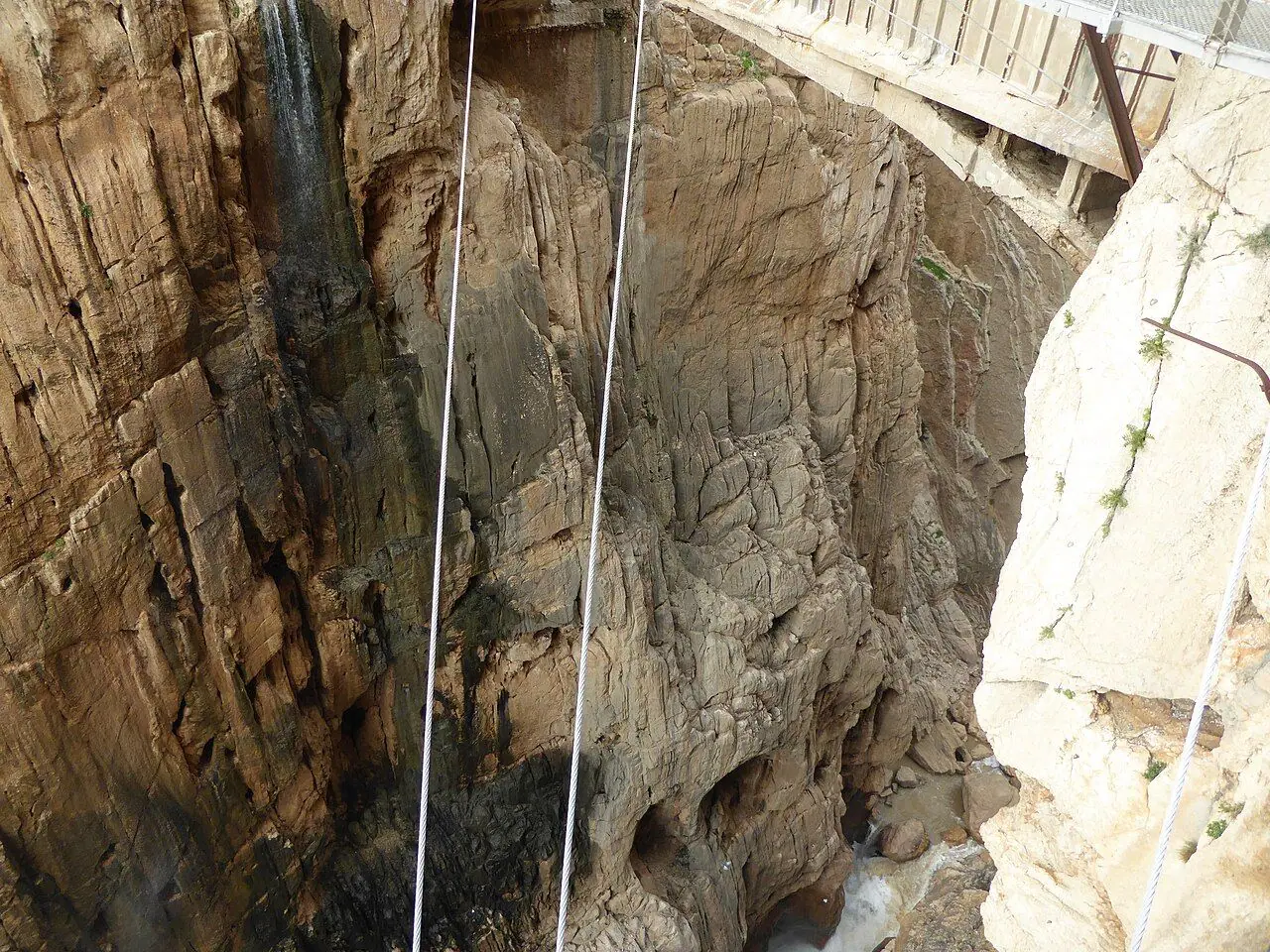
At the reception booth they check your ticket and give you a short safety briefing. You also get a helmet, which you have to keep on for the whole route. Almost straight away the boardwalk turns the corner into the Gaitanejo gorge. The walls close in and the river rushes below. You can see pieces of the original path, broken and rusted, hanging just under your feet. Small metal markers on the boardwalk count the metres as you go. The final one, at the southern gate, reads 3,200 m.
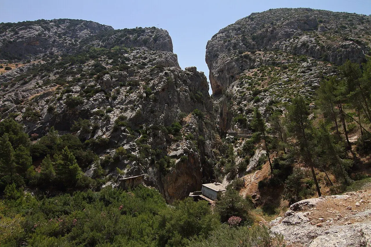
Valle del Hoyo
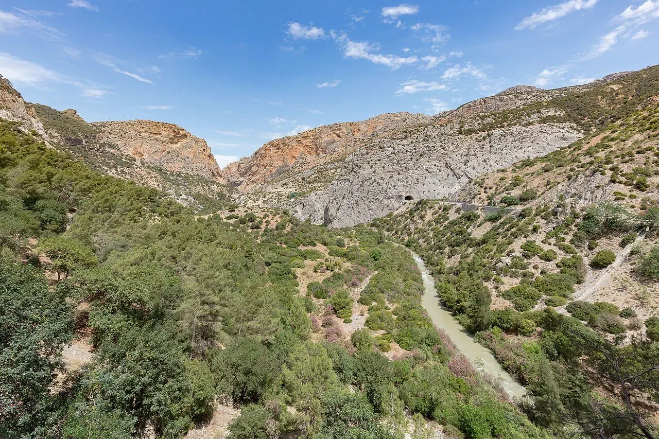
The gorge then opens into the Valle del Hoyo. It is a broad, sunny valley where the boardwalk becomes an ordinary footpath through the trees. This is a lovely change of pace. The cliffs open out, the views get wider and you can see the old canal on the hillside, which once fed the hydroelectric plant. However, you have to stay on the authorised path through this section, so this isn't the place to wander off for a picnic.
The second gorge: Desfiladero de los Gaitanes
The best part of the walk comes last. The boardwalk goes back onto the cliff face in the main gorge. It is narrow, extremely deep and in places less than 10 m wide. The highlights come one after another. First there is a glass-floored viewing platform sticking out over the drop. Then you get a view of the railway bridge and tunnels high above the gorge. If you are lucky, a train will rattle through! Finally you cross the narrow metal suspension bridge across the canyon. This is where the most famous photo of the walk is taken.
Exit to El Chorro
After the southern gate, a path of about 2.1 km leads mostly downhill to El Chorro, where you hand back your helmet. Since June 2026 there is also a new 110-metre suspension bridge near the end. According to the regional authorities, it is the longest of its kind in Spain. It gives you an alternative to nearly a kilometre of steeper descent. The original exit path is still open too. You finish beside the reservoir at El Chorro, a few hundred metres from the railway station and the shuttle bus stop.
How to get there
By train and shuttle bus
El Chorro – Caminito del Rey station (in Álora) is served by Renfe trains on the Málaga–Córdoba/Seville line. The journey from Málaga María Zambrano takes about 50 minutes. A few trains a day also run from Seville Santa Justa. There aren't many services, so check the current timetable on the Renfe website and plan your entry slot around it. Another option is the frequent Cercanías C2 train from Málaga to Álora, and then a local bus or taxi to El Chorro.
From El Chorro station, the Caminito del Rey shuttle bus takes you back up to the northern start (El Kiosko and the Visitors' Reception Centre). The road trip is about 12 km and takes 15–20 minutes. The fare is €2.50, and one ticket covers unlimited trips in both directions that day. You can buy it online with your entry ticket or pay the driver in cash only. The official site lists services roughly every 30 minutes during opening hours. The shuttle is run separately from the Caminito, so check the latest times on caminitodelrey.info.
I think the best car-free plan is this: arrive at El Chorro by train, take the shuttle up to the start, walk back down to the station and catch your train home. Easy!
By car
From Málaga it is about 59 km (just under an hour) via the A-357 through Cártama, Pizarra and Ardales.
Parking: the Visitors' Reception Centre car park at Puerto de las Atalayas costs €2 per day. You can reserve it online when you buy your ticket. From there you take the shuttle or walk to the start, as you can't drive to the beginning of the path. If you park at El Chorro instead, take the shuttle up to the start and walk back to your car.
Permits, fees & opening times
- Prices: €10 general entry, €18 official guided visit (groups of up to 30, in Spanish and English). Only buy tickets through the official website, as tickets from unofficial resellers aren't guaranteed.
- Book early: weekends, holidays and spring dates sell out well in advance. Many visitors book weeks or even months ahead.
- Opening hours: from 9:00. The last access is between about 14:50 and 17:20, depending on the season. Check the timetable page before you book.
- Closures: generally closed on Mondays (with some exceptions) and on 24, 25 and 31 December and 1 January. Heavy rain or strong wind can also close the path. Closures are announced by email, SMS, Telegram and social media.
- Refunds: unfortunately tickets aren't refundable. However, if the path closes because of the weather, you can move your booking to another date through your personal area on the website, subject to availability.
When to go
Spring (March–May) brings green slopes, wildflowers and comfortable temperatures. October and November are just as good, with warm, settled days and fewer school groups. Winter can be bright and pleasant, but entry times are shorter and rain is more likely to close the path. Summer is popular but very hot. The southern part of the route is exposed rock with little shade, so in July and August I suggest booking the earliest slot you can.
Weekend mornings are the busiest. On a weekday you will have more space on the boardwalks and at the photo spots.
Hiking with kids
Unfortunately this isn't one for little ones. The rules are strict: no children under 8, and anyone aged 8–17 needs official ID and must be with an adult. Pushchairs, prams and baby carriers are ruled out too, because you are not allowed to carry anyone in your arms on the boardwalks. If you have a toddler, save this walk for later. Or one parent can do it while the other explores El Chorro.
For kids aged 8 and over, it is a fantastic adventure. The distance is manageable and the metre markers make a fun countdown game. There is also plenty to spot: vultures, trains going into tunnels, old bits of path hanging off the cliffs and the remains of the canal. However, talk about the heights before you go. The walkway is solid and fenced, but some children (and adults) find the drop unsettling. Once you are in the gorge, you can't easily turn back.
What to pack
- Sturdy trainers or walking shoes that are secured at the heel. Flip-flops and loose sandals aren't allowed.
- A small daypack. Large backpacks and bags are banned.
- At least 1–1.5 litres of water per person, more in summer.
- Snacks and fruit. There are no bins, so bring a bag for your rubbish.
- Sun cream, sunglasses and a hat for after you take off the helmet.
- A light raincoat if showers are forecast. Umbrellas aren't allowed.
- Original photo ID for everyone, especially children.
- Cash for the shuttle if you haven't prebooked it.
Safety tips
- Vertigo: the official site advises against the walk if you suffer from vertigo, or from heart or lung conditions.
- Keep the helmet on for the whole route and keep to the right on the boardwalks. Don't lean over the railings or try to clip onto the safety cable.
- Heat is the most common problem. Start early in summer, drink regularly and check the weather page on the official site.
- Watch for closure messages the day before. If you've had no notice 24 hours ahead, the visit usually goes ahead. But it can still be stopped on the day for safety.
- No swimming in the river or its pools, and stay out of the old canal tunnels.
Leave no trace & sustainable tips
- Go by train. El Chorro has its own station, and thanks to the shuttle bus you don't need to drive at all.
- Carry everything out. There are no bins on the route, so take a reusable container and a bag for your rubbish.
- Stay on the path through the Valle del Hoyo. Leave plants, rocks and fossils where they are, as the gorge is a protected natural area.
- Keep the noise down. Shouting and loud music are banned, and birds of prey nest on the cliffs.
- Spend locally. Have lunch in El Chorro or Ardales, or book a guide from a local company. This way more of your money stays in the valley.
Where to stay & eat nearby
- El Chorro: the small village at the southern end has a few places to stay and eat. La Garganta is a hotel and restaurant about 100 m from the station, and they also run guided Caminito tours. The area is popular with climbers too, so you will find simple hostels and guesthouses.
- Northern access: El Kiosko restaurant is right by the start, and El Mirador de Ardales is a short way along the road. Both are handy for a coffee before you set off.
- Ardales and Álora: both are traditional white villages with tapas bars, guesthouses and rural cottages. They make a quieter base than Málaga.
More to explore nearby
- Cueva de Ardales: a cave with prehistoric art, which you can visit on a guided tour.
- Bobastro: the ruins of a rock-cut Mozarabic church on a hilltop above El Chorro.
- The Guadalhorce reservoirs: pine-shaded shores near the northern access, lovely for a picnic.
- Antequera: UNESCO-listed dolmens and the stunning limestone landscape of El Torcal. You can get there by train via Bobadilla.
- Gran Senda de Málaga: a long-distance trail around the province, with stages close to the Caminito.
FAQ
Do I need to book the Caminito del Rey in advance? Yes, definitely. Entry is by timed ticket and popular dates sell out. So book on the official website as early as you can, especially for spring weekends and holidays.
Can I get to the Caminito del Rey without a car? Yes. Take a Renfe train to El Chorro – Caminito del Rey station, then the €2.50 shuttle bus up to the northern start. The walk ends close to the station, so you can catch the train home from there.
What is the minimum age? Children must be at least 8 and carry official ID. Visitors aged 8–17 must be with an adult. Pushchairs aren't allowed, and you can't carry a child on the walkway.
Is the Caminito del Rey scary? It is very safe, with fenced boardwalks and helmets for everyone. But the drops are huge! If you are uneasy with heights, the glass-floored platform and the suspension bridge will test you. People with vertigo are advised not to go.
How long does the Caminito del Rey take? Allow 3–4 hours from the northern access to El Chorro, including the access path. You also need time for the shuttle bus and the 30-minute check-in before your slot.
Is the Caminito del Rey on your bucket list too? Let me know in the comments!
Photo credits (4)
All photos on this page are by other photographers and are used under free licences. Thank you for sharing them.
- Cover photo: Caminito del Rey, Málaga, España, 2023-05-18, DD 27.jpg by Diego Delso, CC BY-SA 4.0, via Wikimedia Commons. Resized and cropped for this page.
- Photo 2: Caminito del Rey, entrada norte al Desfiladero de Los Gaitanes.jpg by Malopez 21, CC BY-SA 4.0, via Wikimedia Commons. Resized for this page.
- Photo 3: Caminito del Rey, Málaga, España, 2023-05-18, DD 37.jpg by Diego Delso, CC BY-SA 4.0, via Wikimedia Commons. Resized for this page.
- Photo 4: Desfiladero de Los Gaitanes 104.jpg by Millars, CC BY-SA 4.0, via Wikimedia Commons. Resized for this page.



join the conversation
Comments
No comments yet. Be the first to share your thoughts!