🥾 Trail guide · Asturias & León – Picos de Europa
Ruta del Cares: A Complete Guide to Hiking the Cares Gorge in the Picos de Europa

- Distance
- 22 km
- Ascent
- 830 m
- Time
- 6.5–8 hours return (3–3.5 hours one way)
- Difficulty
- Challenging
- Route
- Out and back
- Best season
- April–June and September–October (open all year)
👶 With kids: Turismo Asturias recommends it for children over 12, and under-8s should always hold an adult's hand, as most of the path has no railings. Not pushchair-friendly. A short section from Caín is the best option with younger kids.
✅ Updated and fact-checked on 5 November 2026. Prices, timetables and rules can change, so check the official sources before you go.
This post contains affiliate links. If you book or buy through them, I may earn a small commission at no extra cost to you. More about this
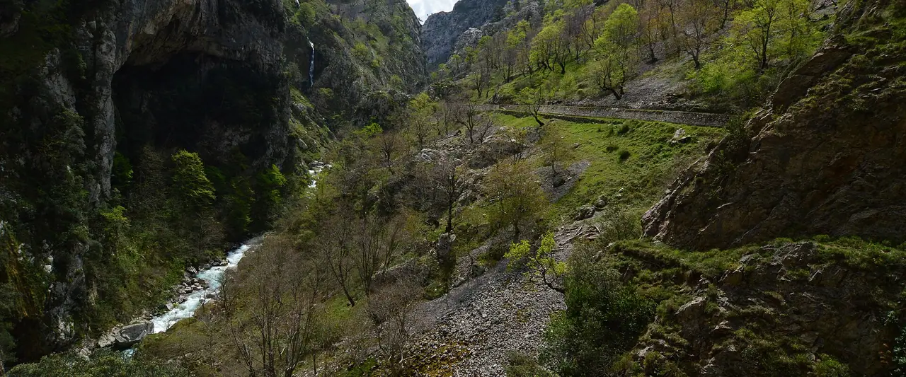
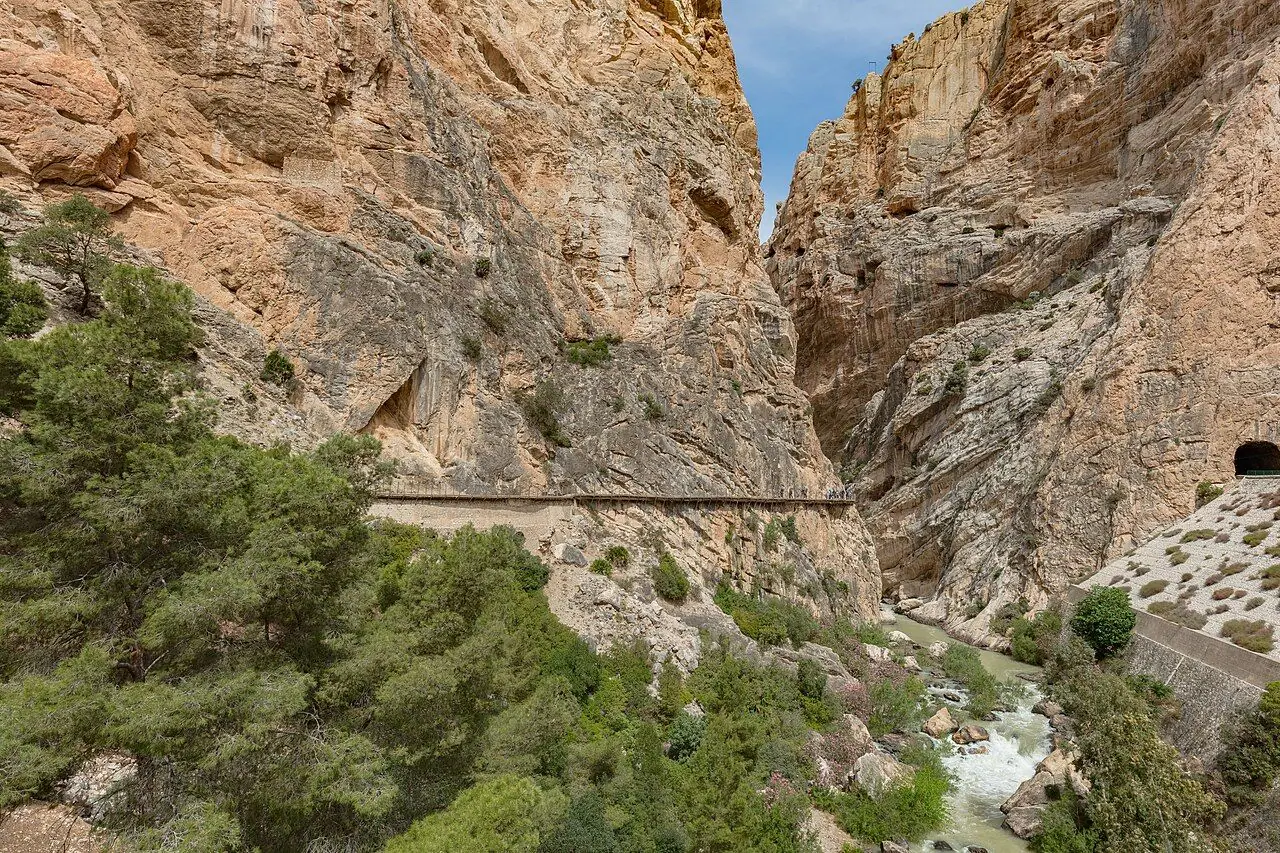
Can you imagine a path carved straight into the side of a limestone gorge, hundreds of metres above a turquoise river? That is the Ruta del Cares. It runs through the Cares Gorge in the Picos de Europa National Park, between the hamlet of Poncebos in Asturias and the village of Caín in León. Locals call it "la Garganta Divina", the divine gorge. With tunnels, bridges and sheer rock walls all the way, it is one of the most famous walks in Spain.
We haven't hiked the Ruta del Cares yet, but it's high on our bucket list, so I've researched every detail for you. The path was not built for hikers at all. Between 1916 and around 1921, workers dug a canal through the gorge to carry water from Caín to a hydroelectric plant at Camarmeña, near Poncebos. More than 5,500 m of it runs through tunnels! In 1945 a service path was built along the canal for maintenance. That path is today's Ruta del Cares.
However, it is a long day out and it needs some planning. There are no railings along most of the drop, no drinking water on the way and no road between the two ends. So which way should you walk? And how do you get back? Below I explain the route, the 2026 bus and parking plan, and the recent closure you should know about.
At a glance
- Distance: about 11–12 km one way between Poncebos and Caín, or about 22 km if you walk there and back
- Elevation gain: around 830 m of ups and downs for the return walk from Poncebos. Most of it is the climb out of Poncebos at the start (and again on the way back)
- Allow 3–3.5 hours one way and 6.5–8 hours for the return walk, with breaks
- Difficulty: Challenging as a return walk because of the length. Turismo Asturias rates the full return walk as "very hard". The path itself is not technical, but it is exposed
- Route type: Out and back (or point to point with a transfer)
- Start/finish: Poncebos (Asturias), next to the Bulnes funicular, or Caín (León)
- Highest point: around 530 m, above Poncebos at Los Collaos
- Best season: spring and autumn. It is open all year, but summer is hot and very busy
- Prices: the walk is free. In 2026 the shuttle bus from Arenas de Cabrales to Poncebos cost €1.55 each way
- Toilets: none along the gorge. Use the facilities in Poncebos or Caín
- Suitable for children: Turismo Asturias recommends it for children over 12. Not suitable for pushchairs
- Dogs: allowed on a short, fixed lead. Extendable leads are not allowed
Route description
Most people start in Poncebos, walk to Caín and either come back the same way or arrange a transfer. I describe it in that direction. If you start from Caín instead, the walk begins with a gentle descent and you face the steep part near the end.
Poncebos to Los Collaos
The trail starts next to the car park of the Bulnes funicular in Poncebos. After crossing a small bridge, the path climbs steadily between limestone cliffs for the first 2 km or so. This is the hardest part of the whole walk, and it is fully exposed to the sun. It takes about 45 minutes and gains close to 300 m. Take it slowly, especially on a hot day!
Through the heart of the gorge
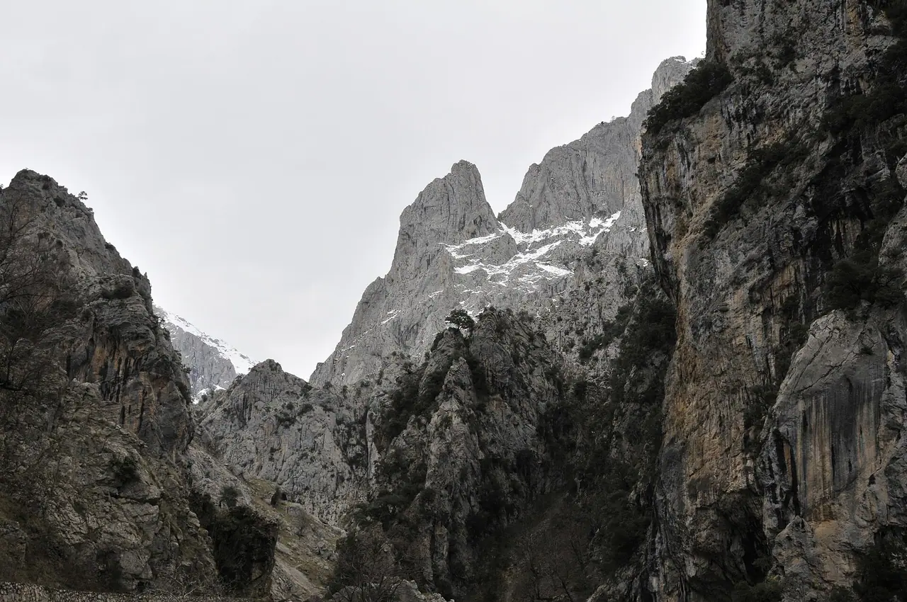
After Los Collaos the views open up. The path levels out and follows the line of the old canal, high above the Cares river. In many places it is cut directly into the rock. It is about 1.5 m wide, and there is usually no fence between you and the drop. The river glitters far below, and the walls of the gorge rise up on both sides. Keep your eyes open for mountain goats on the slopes.
The bridges of Bolín and Los Rebecos
Further on, the path crosses the gorge on bridges, including the Puente Bolín and the Puente de los Rebecos. Somewhere around here you also cross from Asturias into León. This middle section looks like so much fun, with the trail switching from one side of the gorge to the other.
Good to know: in October 2026 a rockfall damaged a footbridge near the Puente de los Rebecos, and the whole route was closed for 16 days. The Junta de Castilla y León installed a new 9 m metal footbridge, flying the materials in by helicopter, and the trail reopened on 30 October 2026. It is a good reminder to check the national park's notices before you go.
Tunnels and arrival in Caín
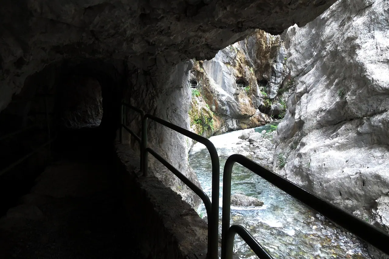
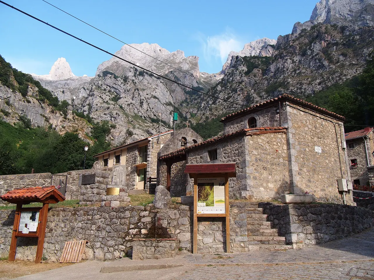
The last stretch before Caín is the most dramatic. The gorge narrows, and the path goes through a series of short tunnels with "windows" cut into the rock, looking out over the river. Some sections have railings here. Then you cross the dam and walk into the tiny village of Caín, surrounded by huge peaks. It has a couple of places to eat and drink, so it is a perfect place for lunch before you decide how to get back.
Getting back
You have two options. Or, if you are not used to long hikes, the national park suggests walking just part of the route and turning back.
- Walk back the same way. It is the cheapest and simplest option. You get to see the gorge in different light, and the return to Poncebos ends with a steep descent.
- Book a transfer. There is no road through the gorge, so the drive between Caín and Poncebos takes about 2–2.5 hours around the mountains. Local taxi and 4x4 companies run transfers. Book well in advance.
How to get there
By car and parking
Poncebos is a few kilometres south of Arenas de Cabrales, on the Asturian side. Caín is at the end of the LE-2711, a narrow road down from Posada de Valdeón in León.
Parking: during the 2026 access plan (see below), the car park next to the Bulnes funicular in Poncebos was reserved for Bulnes residents and buses. You park in one of the three car parks in Arenas de Cabrales and take the shuttle bus. There is also the Ovar car park, about 1.2 km before Poncebos, with around 146 spaces. However, it fills up and there is no guarantee of a space. Outside the plan dates you can drive to Poncebos, but parking is still limited, so arrive early. Parking in Caín is also limited, and the access road is narrow, so please don't park on the verges.
By shuttle bus from Arenas de Cabrales
Asturias runs a special transport plan for the Ruta del Cares and Collado Pandébano. In 2026 it ran over Easter (28 March to 5 April), from 1 to 3 May, every weekend in May and every day from 1 June to 12 October.
- Buses leave Arenas de Cabrales roughly every hour from 8 am to 1 pm and from 5 pm to 7 pm.
- The trip to Poncebos takes about 15 minutes and stops at the Ovar car park.
- Prices: €1.55 one way or €3.10 return to Poncebos (2026).
- Buy your tickets in advance from ALSA. You can only buy on board if there are seats left.
- Pets travel in a carrier on the bus.
Getting to the Picos de Europa
The closest airports are Asturias and Santander. You will really need a car to explore the area, or a good plan with buses and transfers. Arenas de Cabrales is the best base on the Asturian side, and Posada de Valdeón on the León side.
Permits, fees & opening times
- The Ruta del Cares is free and open all year. You don't need a permit.
- It is waymarked as PR-PNPE 3 by the national park and as PR-AS 229 in Asturias.
- Cycling is strictly forbidden on the path.
- Bulnes funicular (optional, from Poncebos): in 2026 a return cost €22.16 for adults and €6.71 for children aged 4–12. It runs all year, every 30 minutes from 10 am to 8 pm, with a first departure at 8:30 am.
- Closures can happen after rockfalls, as in October 2026. Check the Picos de Europa National Park website before you go.
When to go
In my opinion, spring and autumn are the best times. The temperatures are pleasant and the gorge is quieter. Summer is very hot on the exposed climb from Poncebos, and July, August, Easter and long weekends are extremely busy. If you go in summer, start before 9 am to beat the crowds and the heat.
The route is open all year. In winter Poncebos usually has no snow, but Caín can be cut off if it snows. Also, the risk of falling stones goes up on rainy and windy days and in the days after, so avoid walking just after a storm.
Hiking with kids
Suitable for children: Turismo Asturias recommends the Ruta del Cares for children over 12. The national park advises that children under 8 should always hold an adult's hand. The path is wide and mostly level, but there is no protection from the drop.
- Keep them on the inside: younger children should walk on the wall side of the path, holding your hand.
- Pushchairs: not suitable. The path is stony and uneven.
- Carriers: a baby or toddler carrier is an option, but watch your footing and your head in the tunnels.
- Shorten it: with kids, I suggest starting from Caín and walking just to the tunnels and back. It is the most exciting part and avoids the hot climb from Poncebos.
- Keep it fun: count the tunnels, look for goats on the cliffs and spot the old canal running beside the path.
What to pack
- Hiking boots with good grip. The national park recommends proper mountain boots
- At least 2 litres of water per person, as there is no drinking water along the route
- A packed lunch, or cash for lunch in Caín
- Sun hat, sunglasses and sun cream
- A light waterproof, as the weather changes quickly in the Picos
- A head torch is handy for the tunnels
- Your bus ticket or transfer booking
It is a long day, so pack plenty of snacks too. Nuts, energy bars and dried fruit give you a quick boost before the climb back to Los Collaos. You can find my favourites in my guide to the best food for expeditions.
Also, phone reception is patchy in many parts of the gorge. A satellite messenger lets you send an SOS even without signal. The Garmin inReach Mini is one I recommend in my guide to the best personal locator beacons.
Safety tips
- Stay away from the edge. Most of the path has no railings, and the drop is huge. Keep children on the inside!
- Watch for falling stones, both natural and knocked down by goats. Don't hang around under steep rock walls.
- Carry enough water. The park also advises against drinking from springs near livestock.
- Keep away from sheepdogs. If you see mastiffs guarding a flock, don't approach, pet or feed them.
- Plan your return before you set off, and know the time of the last bus or your transfer.
- In an emergency, call 112.
Leave no trace & sustainable tips
- Use the shuttle bus. The access plan helps keep traffic off the narrow road to Poncebos.
- Take all your rubbish home, including organic waste like fruit peel.
- Respect the signs and the instructions of the national park staff.
- Keep dogs on a short lead and away from the livestock that graze in the gorge.
- Support local: buy Cabrales cheese in Arenas and eat in the village restaurants.
Where to stay & eat nearby
- Arenas de Cabrales is the most practical base on the Asturian side. It has hotels, guesthouses, restaurants and cider bars, and the shuttle bus leaves from here.
- Poncebos has a few places to stay and eat right at the start of the trail.
- Caín has a handful of guesthouses and restaurants. Staying here means you can walk the gorge early, before the crowds arrive from Poncebos.
- Posada de Valdeón is the main village on the León side, with more accommodation.
- Cangas de Onís is a bigger town with lots of choice, and a good base for the whole of the Picos.
More to explore nearby
- Bulnes: a tiny mountain village with no road, reached by the funicular from Poncebos or on foot.
- Collado Pandébano: a classic viewpoint for the Naranjo de Bulnes (Picu Urriellu), the symbol of the Picos de Europa.
- Cabrales cheese caves: learn how the famous blue cheese is matured in caves in Arenas de Cabrales.
- Lakes of Covadonga: two beautiful mountain lakes above Cangas de Onís, with their own access rules in summer.
- Posada de Valdeón: the start of the longer version of the Ruta del Cares, through the Valdeón valley.
FAQ
How long is the Ruta del Cares?
Between Poncebos and Caín it is about 11–12 km one way, or about 22 km there and back. The full official route from Posada de Valdeón to Poncebos is 21 km.
Is the Ruta del Cares dangerous?
It is not technical, but it is exposed. Most of the path has no railings, and stones can fall from above. In dry weather and with care, most fit walkers manage it without problems.
Is the Ruta del Cares open?
It closed from 14 to 30 October 2026 after a rockfall damaged a footbridge near the Puente de los Rebecos. It reopened on 30 October with a new footbridge. Check the national park website for the latest news before you go.
Can I do the Ruta del Cares one way?
Yes, but there is no road through the gorge. The drive back is about 2–2.5 hours, so you need to book a taxi or 4x4 transfer in advance.
Have you walked the Ruta del Cares? Did you go there and back or arrange a transfer? Let me know in the comments!
Photo credits (4)
All photos on this page are by other photographers and are used under free licences. Thank you for sharing them.
- Cover photo: Ruta del cares (14072443456).jpg by Javier Mendia García from leioa, CC BY 2.0, via Wikimedia Commons. Resized and cropped for this page.
- Photo 2: GARGANTA DEL CARES DESDE EL REBECO - panoramio.jpg by Manuel Velazquez, CC BY 3.0, via Wikimedia Commons. Resized for this page.
- Photo 3: S00 048 Garganta del Cares.jpg by Falk2, CC BY-SA 4.0, via Wikimedia Commons. Resized for this page.
- Photo 4: Caín Village - 2013.07 - panoramio.jpg by rheins, CC BY 3.0, via Wikimedia Commons. Resized for this page.


join the conversation
Comments
No comments yet. Be the first to share your thoughts!