🥾 Trail guide · Saxony – Saxon Switzerland National Park
Bastei Bridge Hike from Rathen: A Complete Guide to the Bastei & Schwedenlöcher Loop

- Distance
- 6.4 km
- Ascent
- 380 m
- Time
- 2.5–3.5 hours
- Difficulty
- Moderate
- Route
- Circular
- Best season
- April–October
👶 With kids: Not pushchair-friendly (hundreds of steps and two steep ladders). Great for sure-footed kids 5+ on foot; younger ones in a carrier.
✅ Updated and fact-checked on 2 November 2026. Prices, timetables and rules can change, so check the official sources before you go.
This post contains affiliate links. If you book or buy through them, I may earn a small commission at no extra cost to you. More about this
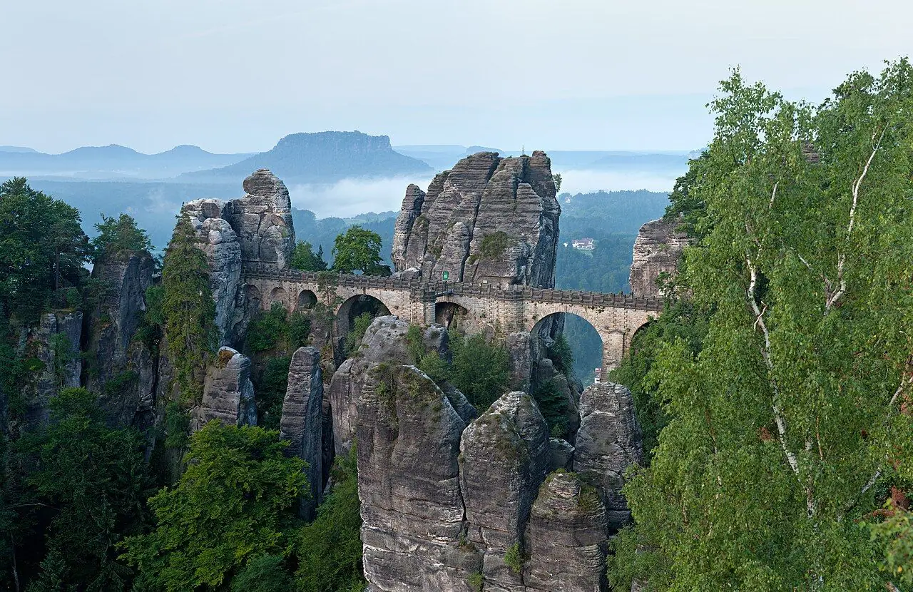
Have you ever seen a place that looks almost too perfect to be real? The Bastei is one of them. Tall sandstone towers rise out of the forest high above the Elbe, and an old stone bridge from 1851 links them together. Below, the river winds past tiny villages. Across the valley you can see the flat-topped "table mountains" of Saxon Switzerland. Romantic painters like Caspar David Friedrich came here for inspiration. Today it is the most visited spot in the Saxon Switzerland National Park.
We haven't hiked this one ourselves yet, but it's high on our bucket list, so I've researched every detail for you. You can reach the Bastei by bus or car and walk to the viewpoints in five minutes. However, I really recommend walking up from the little spa village of Kurort Rathen on the river below. The classic loop climbs the Basteiweg past lots of viewpoints to the bridge. Then it drops down through the Schwedenlöcher, a narrow, mossy gorge with about 700 steps, footbridges and ladders. According to the legend, local people hid here from Swedish troops during the Thirty Years' War. The loop finishes by the Amselsee lake in the Amselgrund valley and takes you back to the village.
The best part? You don't need a car at all. The S-Bahn runs from Dresden to Rathen station, a small cable ferry takes you across the Elbe, and you are on the trail.
Current status (autumn 2026): A violent storm on 31 July 2026 brought down huge numbers of trees around Rathen. The Basteiweg to the Bastei Bridge and the Schwedenlöcher have reopened. However, the lower Amselgrund between Rathen (the Felsenbühne ticket office) and the Schwedenlöcher junction, including the Amselsee, was still closed at the time of writing while trees were cleared. Until it reopens, follow the official diversion I describe below. Please check the latest notices on saechsische-schweiz.de before you go. This guide follows the classic loop from Kurort Rathen and shows you how to do it all without a car.
At a glance
- Distance: about 6.4 km for the classic loop. The official alternative via Rathewalde, which avoids the closed lower Amselgrund, is about 8.7 km
- Elevation: roughly 380 m of ascent and descent. You climb from about 115 m by the Elbe to just over 300 m at the Bastei
- Allow 2.5 hours of walking for the classic loop, or more like 3.5 hours with viewpoints and breaks. Allow about 3.5–4 hours for the alternative
- Difficulty: Moderate. There are lots of steps, plus steep iron ladders in the Schwedenlöcher
- Route type: Circular
- Start/finish: Kurort Rathen S-Bahn station (Oberrathen), across the river from the village
- Best season: April to October. Autumn colours peak around October
- Prices: the Bastei and Schwedenlöcher are free to visit. The Elbe ferry costs about €1.50–2 one way or €3 return
- Toilets: at the Berghotel and panorama restaurant at the Bastei. There are also cafés and hotels in Rathen
- Suitable for children: yes, but not for pushchairs. A carrier is best for little ones
- Dogs: the tourism board marks this loop as unsuitable for dogs because of the steps and ladders
Route description
Station, ferry and village
From Kurort Rathen station, walk down to the riverbank and take the small cable ferry across the Elbe to Niederrathen. It uses the current to pull itself across along a cable, which is a fun start. Buy your ticket on board. Rathen is a lovely little village of half-timbered houses, guesthouses and cafés squeezed between the river and the cliffs. It is mostly traffic-free. Follow the signs for the Bastei through the village.
The Basteiweg climb
The path (blue waymarks) climbs steadily up a rocky ravine on stone steps, with plenty of handrails. Keep left at the fork to stay on the blue trail. The climb is only about 190 m, but it is steep in places. I suggest taking short detours to the Tiedgestein for your first view over the Elbe valley, and higher up to the Kanapee viewpoint. You will also pass the Neurathener Felsentor. This natural rock arch was painted by Caspar David Friedrich. Soon after, you come out onto the rocks around the bridge.
The Bastei Bridge and viewpoints
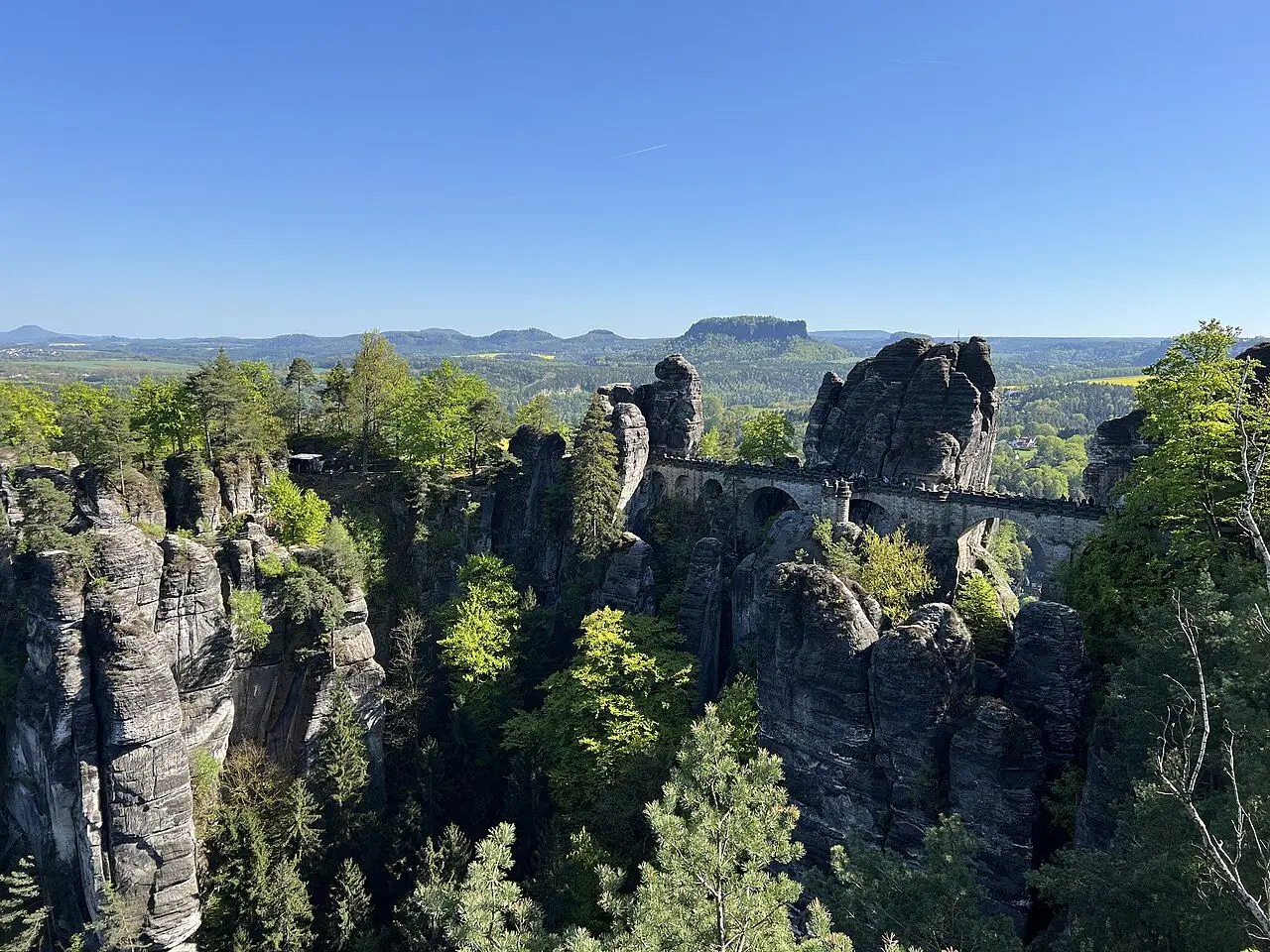
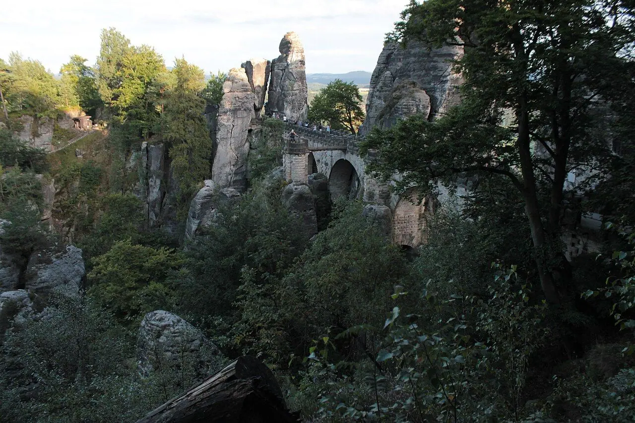
The Basteibrücke is 76.5 m long and crosses a gorge about 40 m deep. Sandstone pillars drop away on both sides. Straight after the bridge, turn right for the Ferdinand viewpoint. Then head to the main Bastei viewpoint, a platform sticking out above the Elbe. From here you can see the river, the Lilienstein and Königstein table mountains, and far into the national park. It is open at all times and it is free.
Unfortunately, the Felsenburg Neurathen is closed until further notice because of safety problems. These are the remains of a medieval rock castle, reached by metal walkways next to the bridge. Luckily, the walk over the bridge isn't affected.
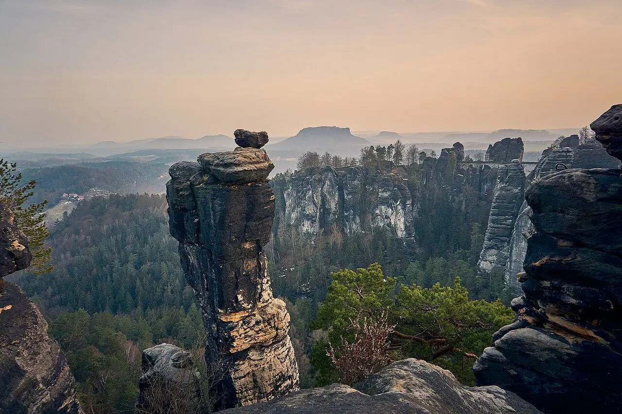
Behind the Berghotel, look for the hidden Wehlstein viewpoint. Then follow the forest path parallel to the road to the Pavillon viewpoint. In my opinion this is the one not to miss, as it gives the best side-on view of the Bastei rocks and bridge.
Down through the Schwedenlöcher
From near the Pavillon viewpoint, follow the blue waymarks down the Gansweg into the Schwedenlöcher. For many walkers this is the highlight. The gorge narrows to a gap only a few metres wide between mossy sandstone walls. About 700 steps, small footbridges and two steep iron ladders take you down to the floor of the Amselgrund. The tourism board rates this section as difficult. It can be treacherous in snow or ice.
Back via the Amselgrund (classic loop)
When it is open, you turn right at the bottom (green waymarks) and follow the Grünbach stream down the Amselgrund. You pass the Amselsee, a small lake below the cliffs that normally has rowing boats for hire in season. Then you pass the Felsenbühne open-air theatre and return to Rathen and the ferry. Unfortunately, the July 2026 storm badly damaged the kiosk and boat hire at the Amselsee. This lower section was still closed in autumn 2026.
Diversion while the lower Amselgrund is closed
The tourism board's alternative Schwedenlöcher loop is about 8.7 km and takes roughly 3.5 hours. At the bottom of the Schwedenlöcher, turn left instead and follow the Malerweg waymarks up the upper Amselgrund to Rathewalde. From the village above the Rathewalder Mühle, follow the yellow waymarks along the Rathewalder footpath back to the Bastei. Then return to Rathen the way you came up, on the Basteiweg. It is longer, but it is a lovely, quieter route through the forest. Also, you get to see the bridge twice!
Another option is to go up and down the Basteiweg as an out-and-back (about 4 km). The Schwedenlöcher are then an optional extra from the Bastei, but you will have to climb back up all those steps.
How to get there
By S-Bahn and ferry (recommended)
The S1 S-Bahn runs from Dresden Hauptbahnhof towards Pirna, Bad Schandau and Schöna every 30 minutes. Get off at Kurort Rathen, on the south bank of the Elbe. The journey takes well under an hour. You can check times in the DB or VVO journey planners. A VVO day ticket (Tageskarte) covers the train. However, the Rathen ferry isn't part of the VVO network, so VVO tickets and the Deutschlandticket aren't accepted. Buy a separate ticket on board. The ferry runs throughout the day, from early morning to around midnight.
By bus to the Bastei
Regional buses run to the Bastei car park at the top: the 237 and 254 from Pirna station, and the 239 from Stadt Wehlen. So you could start the walk there and do the loop "upside down". Walk down via the Schwedenlöcher or the Basteiweg to Rathen, and finish with the ferry and train.
By car
Parking: The easiest place to park for this loop is the paid car park by the ferry landing in Oberrathen on the left bank of the Elbe. Then take the ferry across. There is also parking near the Bastei, including a park-and-ride about 3 km away with a shuttle bus. However, space is limited and fills up early on busy days. Public transport is strongly encouraged.
Good to know
- Free entry: the Bastei, its viewpoints, the bridge and the Schwedenlöcher are free to visit. The Felsenburg Neurathen normally charges a small entry fee, but it is currently closed.
- Ferry fares: about €1.50–2 one way and €3 return for adults, with reduced fares for children. Overnight guests with a Rathen guest card travel free.
- Storm damage closures: after the July 2026 storm, the district authority (Landratsamt Sächsische Schweiz-Osterzgebirge) closed many forest paths around Rathen. Some have reopened, but others were still closed in autumn 2026. Fines for entering closed areas can be steep! Before you go, check the notices on saechsische-schweiz.de, or call the national park centre on +49 35022 50240.
- Wayfinding: the paths are well signposted with coloured waymarks (blue and green stripes, and yellow on the alternative). A 1:10,000 hiking map of the Bastei–Rathen area is useful.
When to go
The Bastei is busiest from May to October, especially at weekends, on public holidays and during school holidays. Tour coaches pour in from late morning. If you want the bridge to yourself, take an early train and be at the top by 9 am, or come in the evening light. Autumn is gorgeous, with golden beech woods and early-morning mist in the Elbe valley. Winter walks are possible too. However, the Schwedenlöcher steps and ladders can be icy, and the tourism board suggests poles and microspikes. In summer, check for forest fire warnings, as parts of the national park can be closed in drought.
Hiking with kids
Kids usually love this walk. There is a ferry ride, a castle-like bridge, rocks to clamber over (safely, behind the railings) and a "secret" gorge full of stairs and ladders. What's not to like? The tourism board describes it as suitable for sure-footed children. For most families, that means walking it from about 5 years old with an adult close by on the ladders. Toddlers are best in a back carrier.
Unfortunately, it isn't a pushchair or bike-trailer walk, as the Basteiweg and Schwedenlöcher are almost all steps. If you need a buggy-friendly option, take the bus to the Bastei car park. From there you can push along the level paths to the viewpoints and the new, step-free Bastei viewpoint. The bridge itself has steps.
To keep the kids motivated, count the steps in the Schwedenlöcher (the official estimate is about 700). They can also look for the arch from the old paintings, spot climbers on the rock towers, and look forward to a ferry ride home.
What to pack
- Walking shoes or boots with good grip, as sandstone steps can be slippery when wet
- Water and snacks, although there are refreshments at the Bastei
- A light waterproof
- Cash for the ferry
- A back carrier for small children
- Poles and microspikes in winter
- A camera for the bridge, ideally in early or late light
Safety tips
- Check for closures before setting off, especially while storm-damaged areas are being cleared. Don't enter closed paths, as falling trees and branches are a real risk.
- Stay behind the railings at viewpoints. The drops are sheer!
- Take the ladders slowly in the Schwedenlöcher, one person at a time, and face the ladder on the way down.
- Avoid the gorge in ice and snow unless you are properly equipped.
- In an emergency, call 112 and give the name of the nearest viewpoint or signpost.
Leave no trace & sustainable tips
- Arrive by train. The S1 and the ferry are the easiest and greenest way to get here. They also stop the car parks at the top from overflowing.
- Stay on marked paths. This is a national park with strict rules, and the soft sandstone erodes easily.
- Keep noise down so you don't disturb wildlife, and leave dogs at home for this route.
- No fires and no smoking in the forest, especially during dry spells.
- Take your litter home.
- Support Rathen's cafés and guesthouses. They have had a tough time after the 2026 storm.
Where to stay & eat nearby
- Kurort Rathen: a small spa village with hotels and guesthouses, including the Hotel Amselgrundschlößchen near the start of the Amselgrund. There are also cafés and a trout smokehouse on the way into the valley. If you stay overnight, the guest card gives you free ferry crossings.
- Bastei: the Berghotel & Panoramarestaurant Bastei right at the top has a terrace with views. In winter it opens daily from midday.
- Rathewalde: if you take the diversion, the Rathewalder Mühle is a handy stop for refreshments.
- Dresden, Pirna and Bad Schandau: larger bases on the S1 line with plenty of accommodation.
More to explore nearby
- Festung Königstein: a huge hilltop fortress a few stops further along the S1.
- Lilienstein: a table mountain with a wide summit plateau, across the river from Königstein.
- The Malerweg: the multi-day "Painters' Way" through Saxon Switzerland. Stage 2 passes the Bastei.
- Kirnitzschtal tram and the Lichtenhain waterfall: a historic tram line from Bad Schandau into a forested valley.
- Pravčická brána: a huge natural sandstone arch just over the border in the Czech Bohemian Switzerland.
FAQ
How do I get from Dresden to the Bastei without a car? Take the S1 S-Bahn from Dresden Hauptbahnhof to Kurort Rathen and cross the Elbe on the cable ferry (separate ticket). Then walk up the Basteiweg, which takes around 40 minutes. Buses also run from Pirna and Stadt Wehlen to the Bastei car park.
Is the Bastei free? Yes. The bridge and viewpoints are free. Only the Felsenburg Neurathen rock castle charges an entry fee, and it is currently closed.
Are the Schwedenlöcher open? They reopened in August 2026 after storm damage. However, the lower Amselgrund between Rathen and the Schwedenlöcher junction was still closed in autumn 2026. Check the latest notices on saechsische-schweiz.de before you go.
Can I take a pushchair on the Bastei walk? Not on this loop, which has hundreds of steps and two ladders. For a buggy-friendly visit, take the bus to the Bastei car park and push to the viewpoints.
How long does the Bastei and Schwedenlöcher loop take? Around 2.5 hours of walking for the 6.4 km classic loop, or 3–3.5 hours with stops. The diversion via Rathewalde takes about an hour longer.
Have you walked to the Bastei Bridge, or is it on your list too? Let me know in the comments!
Photo credits (4)
All photos on this page are by other photographers and are used under free licences. Thank you for sharing them.
- Cover photo: Basteibrücke morgens.jpg by Thomas Wolf , www.foto-tw.de, CC BY-SA 3.0 de, via Wikimedia Commons. Resized and cropped for this page.
- Photo 2: Nationalpark Sächsische Schweiz Bastei lub 2025-04-27 img02 Brücke.jpg by Lukas Beck, CC BY 4.0, via Wikimedia Commons. Resized for this page.
- Photo 3: Bastei Bridge and Wehlnadel South View from Viewpoint Kleine Gans.jpg by Robert Ahner, CC BY-SA 4.0, via Wikimedia Commons. Resized for this page.
- Photo 4: Basteibrücke 10.jpg by John Samuel, CC BY-SA 4.0, via Wikimedia Commons. Resized for this page.


join the conversation
Comments
No comments yet. Be the first to share your thoughts!