🥾 Trail guide · Valais – Aletsch Arena
Aletsch Panoramaweg: How to Hike from Moosfluh to Fiescheralp Along the Aletsch Glacier

- Distance
- 13.5 km
- Ascent
- 510 m
- Time
- 4.5–5.5 hours
- Difficulty
- Challenging
- Route
- Point to point
- Best season
- July–September (lifts run early June–late October)
👶 With kids: The full route is long, high and rocky, so it suits fit, sure-footed kids aged about 10+. Younger children will enjoy the Moosfluh viewpoint or the easy Aletschpromenade more. Not for pushchairs.
✅ Updated and fact-checked on 5 November 2026. Prices, timetables and rules can change, so check the official sources before you go.
This post contains affiliate links. If you book or buy through them, I may earn a small commission at no extra cost to you. More about this
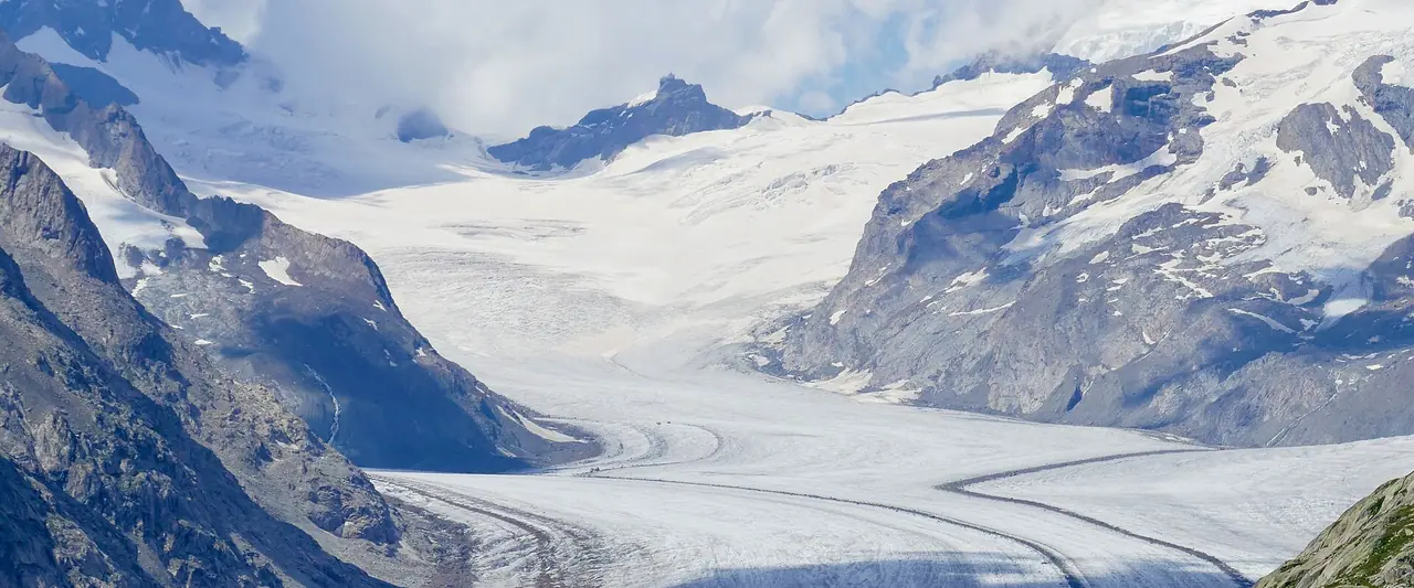
Have you ever walked next to a river of ice? The Great Aletsch Glacier is the largest glacier in the Alps. It is about 23 km long and flows in a huge curve from the Jungfrau region down towards the Rhône valley in Valais. The Aletsch Panoramaweg follows the mountainside high above it. For hours you walk with the glacier right below you, and with its stripes of dark rock running down the middle like a motorway.
We've hiked a lot in Switzerland, but we haven't made it to the Aletsch Arena yet. It's high on our bucket list, so I've researched every detail for you. In this guide I describe my favourite section of the trail. You take the gondola up to Moosfluh above Riederalp, walk along the glacier to the little lake of Märjelensee, go through a 1 km long tunnel and finish at Fiescheralp, below the Eggishorn. From there a cable car takes you back down to the valley.
The whole area is part of the Swiss Alps Jungfrau-Aletsch UNESCO World Heritage Site. However, the glacier is melting fast, and the slopes around it are moving. So there are a few important things to check before you go. I explain everything below.
At a glance
- Distance: about 13–14 km one way from Moosfluh to Fiescheralp
- Elevation: around 510 m up and 630 m down
- Allow 4.5–5.5 hours with stops. MySwitzerland gives 3 hours 45 minutes of pure walking, but you will want lots of photo breaks
- Difficulty: Challenging. It is a long day on a mountain path at around 2,300–2,500 m, with rocky and narrow parts. You need to be sure-footed
- Route type: Point to point (Moosfluh → Hohbalm → Märjelensee → Tälligrat tunnel → Fiescheralp)
- Highest point: about 2,490 m at Hohbalm
- Best season: July to September. The lifts ran from early June to late October in 2026
- Prices: the trail is free, but you need the cable cars. The Aletsch Explorer day pass costs CHF 55 for adults (2026)
- Toilets: at the cable car stations and at the Gletscherstube at Märjela. There is nothing else on the trail
- Dogs: allowed. They need a ticket for the cable cars, and keep them on a lead near grazing animals and wildlife
Route description
Riederalp to Moosfluh
From the car-free village of Riederalp, take the gondola up to Moosfluh (2,333 m). Step out of the station and you are right on the edge of the Great Aletsch Glacier. The view up the glacier towards the Jungfrau region is stunning. This is one of the official viewpoints of the Aletsch Arena, so take your time here.
Here is something interesting. The whole slope below Moosfluh is slowly sliding downhill! As the glacier melts and gets thinner, it no longer holds up the mountainside. Scientists have measured the slope moving much faster since the 1990s, with deep cracks and rockfall. So paths around Moosfluh are sometimes closed or moved. Always follow the signs and never take shortcuts here.
Moosfluh to Hohbalm
Follow the yellow signs for the Aletsch Panoramaweg (route 39) east towards Biel and Hohbalm. The path climbs gently above the glacier. Hohbalm (around 2,490 m) is the highest point of the walk and a junction of several paths. From here you can also walk down to Bettmeralp or Riederalp if the weather changes.
Hohbalm to Märjelensee
This is the most beautiful part of the walk. The trail runs along the steep northern slopes of the Bettmerhorn and Eggishorn, past Roti Chumme, with the glacier below you the whole time. The path is narrow and rocky in places, and you will cross some boulder fields. There are a few small ups and downs, but nothing too steep. Look out for marmots on the slopes!
Important: in the past, the section between Hohbalm and Märjela has been closed after a landslide. Always check the live status page of the Aletsch Arena before you set off.
Märjelensee and the Gletscherstube
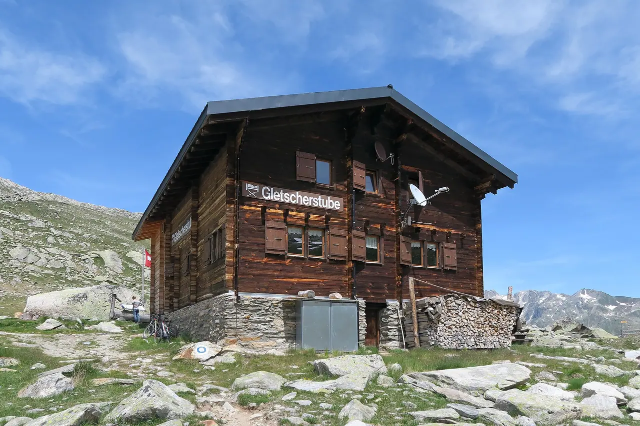
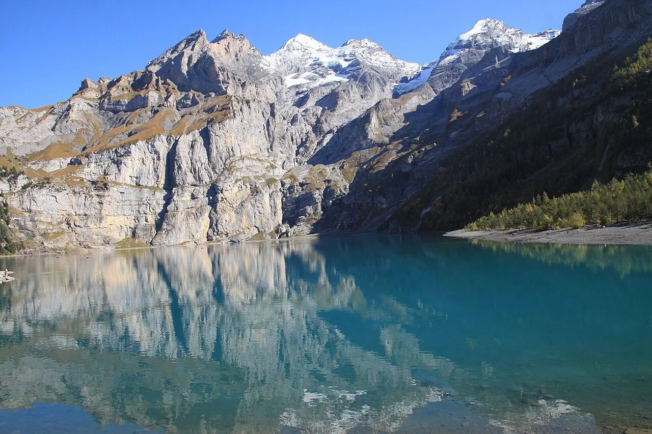
At the eastern end of the glacier you reach Märjela, a high, rocky basin with small lakes. Märjelensee (around 2,300 m) sits right next to the glacier, and a little further on is the Gletscherstube, a simple wooden mountain inn at 2,364 m. It serves food and drinks in summer and has beds if you want to stay the night. I think it would be the perfect lunch stop.
Through the Tälligrat tunnel to Fiescheralp
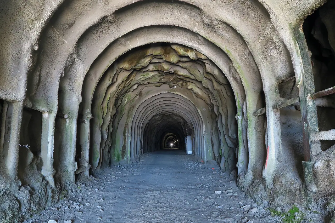
From Märjela, follow the signs for Fiescheralp to the Tälligrat tunnel. This cool tunnel goes straight through the mountain for about 1,010 m. It was first built in the 1890s as an overflow to drain the lake, and today it carries a water pipe. It is lit, but it is a bit damp, with puddles on the ground. A head torch is still handy. In the middle there is a little altar to the Virgin Mary in a side tunnel. The tunnel is locked in winter.
On the other side, a wide path leads down across the sunny alpine meadows to Fiescheralp (around 2,200 m). Here you will find restaurants and the cable car down to Fiesch.
Option: start from the Eggishorn
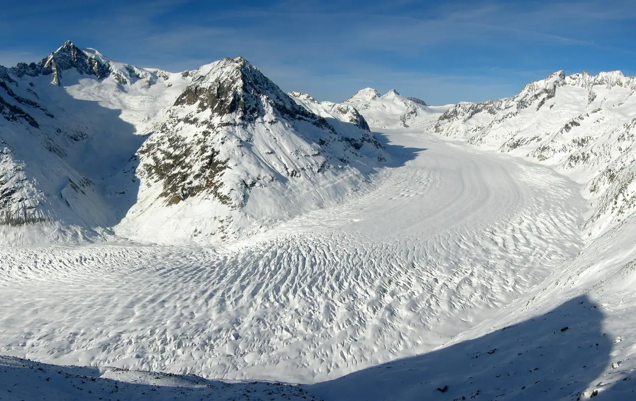
If you would rather start high and walk mostly downhill, take the cable car from Fiescheralp up to the Eggishorn viewpoint. From there you get the classic view straight down the curve of the glacier. The official Eggishorn – Märjela – Fiescheralp hike is 12.2 km with only about 130 m of climbing and 780 m of descent. It takes about 3 hours 45 minutes. The two routes share the section from Märjela through the tunnel.
How to get there
By public transport
The villages on the Aletsch plateau are car-free, so the trains and cable cars are the way to go. Take a train to Brig, then the Matterhorn Gotthard Bahn up the Rhône valley.
- To the start: get off at Mörel and take the cable car up to Riederalp. From Riederalp, the Moosfluh gondola takes you to the trailhead.
- From the finish: take the cable car from Fiescheralp down to Fiesch. The valley station is next to Fiesch railway station, so you can catch the train straight back to Mörel or Brig.
By car and parking
Parking: there is paid parking at the Mörel cable car station, including large car parks, and at the Fiesch valley station. As the hike is one way, I suggest you park at Fiesch or Mörel and use the short train ride between them to get back to your car.
Permits, fees & opening times
- You don't need a permit to hike the Aletsch Panoramaweg.
- Prices (2026): the Aletsch Explorer day pass costs CHF 55 for adults. It is CHF 27.50 with a Half-Fare Card or Swiss Travel Pass, for children aged 6–15, for youths aged 16–19 and for dogs. With a GA travelcard it costs CHF 18. It covers all the cable cars, including Moosfluh, Eggishorn and Bettmerhorn, plus the train between Brig, Mörel and Fiesch.
- Moosfluh gondola (2026): 6 June to 25 October, 8:30 am to 4:30 pm.
- Eggishorn cable car (2026): 8:55 am to 4:55 pm from 6 June. From 17 August 2026 it ran a restricted service because of building works. From 15 September the Eggishorn viewpoint was not accessible for wheelchairs or pushchairs.
- Check the live status page for the lifts and the trails before you set off. The summer season for 2027 had not been confirmed when I wrote this.
When to go
The best time is July to September. The lifts open in early June, but snow can stay on the high path above 2,300 m into early summer. September is my favourite month for high Alpine hikes. The weather is often stable, there are fewer people, and the air is really clear.
The weather changes quickly at this height. Afternoon thunderstorms are common in summer, and you are exposed on the open slopes. So start early and check the forecast. Also, make sure you arrive at Fiescheralp before the last cable car down.
Hiking with kids
Suitable for children: the full Panoramaweg is long, high and rocky, so it is best for fit, sure-footed kids aged about 10+ who are used to mountain walks. Younger children may enjoy shorter options more.
- Short and easy: walk to the Moosfluh viewpoint and back, or try the easy Aletschpromenade from Bettmeralp to Riederalp (about 3 km, 1 hour).
- Half day: the official Fiescheralp – Bettmeralp – Riederalp route is 7.9 km and graded easy, with only about 50 m of climbing.
- Pushchairs: not suitable on the Panoramaweg. Some paths in the villages are fine for all-terrain pushchairs.
- Keep it fun: spot marmots, count the stripes on the glacier and walk through the tunnel with a head torch. Kids will love that part!
- Never let children climb down onto the glacier or the moraine. The ice is full of hidden crevasses.
What to pack
- Hiking boots with good grip and ankle support
- Waterproof jacket and a warm layer. It can be cold at 2,500 m even in summer
- Sun cream, sunglasses and a hat, as the glacier reflects a lot of light
- At least 1.5 litres of water per person
- A head torch for the tunnel
- Walking poles for the rocky sections
- Your Aletsch Explorer pass or cable car tickets
- Swiss francs or a card for the Gletscherstube
It is a long day between food stops, so pack a good lunch and plenty of snacks. Nuts, energy bars and dried fruit are easy to carry and give you a quick boost. You can find more ideas in my post about the best food for expeditions.
Safety tips
- Stay on the marked trail. The slopes around Moosfluh are moving, and there can be rockfall.
- Never walk onto the glacier without a mountain guide. It has deep crevasses, often hidden under snow.
- Check the status page on the morning of your hike. Sections can close at short notice.
- Turn back at Hohbalm if the weather looks bad. There are easier paths down to Bettmeralp and Riederalp from there.
- Watch the time. Check when the last cable car leaves Fiescheralp.
- In an emergency, call 1414 (Rega air rescue) or 112.
Leave no trace & sustainable tips
- Arrive by train. The Aletsch plateau is car-free, and the train stops right at the cable cars.
- Stay on the paths. This is a UNESCO World Heritage area, and the alpine plants grow very slowly.
- Take all your rubbish home, including fruit peel.
- Keep your distance from wildlife, and keep dogs on a lead.
- Learn about the glacier. The Aletsch has lost more than 3 km of its length since 1870. Seeing it in person really makes you think about climate change.
Where to stay & eat nearby
- Riederalp is a car-free village right at the start, with hotels, holiday apartments and restaurants. You can be on the first gondola to Moosfluh.
- Bettmeralp and Fiescheralp are the other car-free villages on the plateau, with chalets, hotels and restaurants.
- Fiesch and Mörel in the valley are good, often cheaper bases with a train station.
- Gletscherstube Märjela: for something special, stay the night at the mountain inn by the glacier. Check opening times and book ahead.
More to explore nearby
- Aletsch Forest and Villa Cassel: walk through the protected forest of ancient arolla pines above Riederfurka, and visit the Pro Natura centre at Villa Cassel.
- Belalp suspension bridge: a 124 m suspension bridge crosses the Massa gorge below the glacier tongue, between Riederalp and Belalp.
- Aspi-Titter suspension bridge: another exciting bridge over a gorge near Fiesch and Bellwald.
- Bettmerhorn: take the cable car from Bettmeralp to another stunning glacier viewpoint.
- Bettmersee and Blausee: lovely small lakes near Bettmeralp, perfect for an easy afternoon.
FAQ
How long is the Aletsch Panoramaweg?
The whole route 39 is about 30 km in three stages. The section in this guide, from Moosfluh to Fiescheralp, is about 13–14 km and takes 4.5–5.5 hours with stops.
Can I see the Aletsch Glacier without hiking?
Yes. The cable cars to Moosfluh, Bettmerhorn and Eggishorn all take you to viewpoints over the glacier. Moosfluh is only a few steps from the top station.
How much does the Aletsch Explorer pass cost?
In 2026 it was CHF 55 for adults and CHF 27.50 with a Half-Fare Card, a Swiss Travel Pass or for children aged 6–15. It covers all the cable cars in the Aletsch Arena.
Is the Tälligrat tunnel scary?
Not really. It is straight, about 1 km long and lit. It is damp and a bit cold, so bring a warm layer and a head torch.
Can I walk on the Aletsch Glacier?
Only with a qualified mountain guide. The glacier has many crevasses, so never step onto the ice on your own.
Have you seen the Aletsch Glacier? Did you take the cable car to the Eggishorn or walk the Panoramaweg? Let me know in the comments!
Photo credits (4)
All photos on this page are by other photographers and are used under free licences. Thank you for sharing them.
- Cover photo: Aletsch Glacier view.jpg by Seba3mmm, CC BY-SA 4.0, via Wikimedia Commons. Resized and cropped for this page.
- Photo 2: Fieschertal VS - Märjelen (27988736250).jpg by Kecko, CC BY 2.0, via Wikimedia Commons. Resized for this page.
- Photo 3: Fieschertal VS - Tälligrat Tunnel (27654774943).jpg by Kecko, CC BY 2.0, via Wikimedia Commons. Resized for this page.
- Photo 4: Aletschgletscher-Eggishorn.jpg by Tobias Alt, Tobi 87, CC BY-SA 4.0, via Wikimedia Commons. Resized for this page.


join the conversation
Comments
No comments yet. Be the first to share your thoughts!