🥾 Trail guide · Utah – Arches National Park, Moab
Delicate Arch Trail: A Complete Guide to Arches National Park's Most Famous Hike (2026)

- Distance
- 4.8 km
- Ascent
- 146 m
- Time
- 2–3 hours
- Difficulty
- Moderate
- Route
- Out-and-back
- Best season
- March–May and September–October
👶 With kids: Not pushchair-friendly (slickrock slopes, steps and a narrow ledge). Fine for active kids around 6+ on foot or younger ones in a carrier – but go early or late, as there's no shade and summer heat is dangerous.
✅ Updated and fact-checked on 2 November 2026. Prices, timetables and rules can change, so check the official sources before you go.
This post contains affiliate links. If you book or buy through them, I may earn a small commission at no extra cost to you. More about this
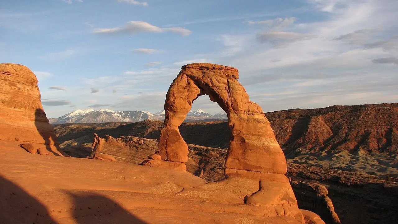
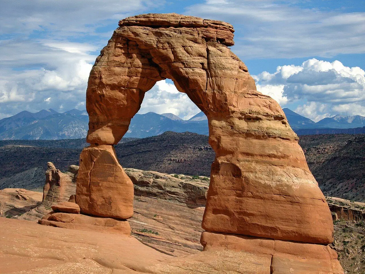
Have you ever seen a Utah licence plate? The arch on it is Delicate Arch. It is a lone, 16 m (52 ft) curve of salmon-pink sandstone, standing on the rim of a slickrock bowl, with the snowy La Sal Mountains behind it. It is the image of the American Southwest. However, you can't drive up to it. You have to earn the view!
We haven't hiked this one ourselves yet, but after our trip to Zion it is high on our bucket list, so I've researched every detail for you.
The trail is only around 4.8 km return, but it is steeper, more exposed and hotter than many people expect. It climbs up a huge sweep of bare rock with no shade at all. Then it follows a narrow ledge on a cliff, before the arch suddenly appears in front of you. Park rangers regularly rescue hikers who underestimated it, usually because of the heat.
Luckily there is good news for 2026. After several years of timed entry, the National Park Service has announced that advance timed-entry reservations are not required at Arches in 2026. So a spontaneous early morning or sunset visit is easier, as long as you plan around the crowds, the heat and the parking.
At a glance
- Distance: 4.8 km (3 miles) return from Wolfe Ranch trailhead, or 8 km (5 miles) if you have to park at the overflow car park.
- Elevation gain: about 146 m (480 ft), mostly in one long slickrock climb.
- Allow 2–3 hours return, including time at the arch.
- Difficulty: Moderate. It is short, but steadily uphill on bare rock in full sun, with a narrow cliff-side ledge at the end.
- Route type: Out-and-back.
- Start point: Wolfe Ranch trailhead (Delicate Arch trailhead), off Delicate Arch Road.
- Best season: March–May and September–October. Winter is quieter but icy.
- Prices: park entrance fee ($30 per private vehicle, $15 per person on foot or bike, valid 7 days). No timed-entry reservation needed in 2026.
- Toilets: at the trailhead. There is no water on the trail, so fill up at the visitor centre.
- Suitable for children: not pushchair-friendly. Use a carrier, or bring confident young walkers.
- Dogs: not allowed on any trail in the park, even in a carrier.
Route description
1. Wolfe Ranch and the petroglyphs
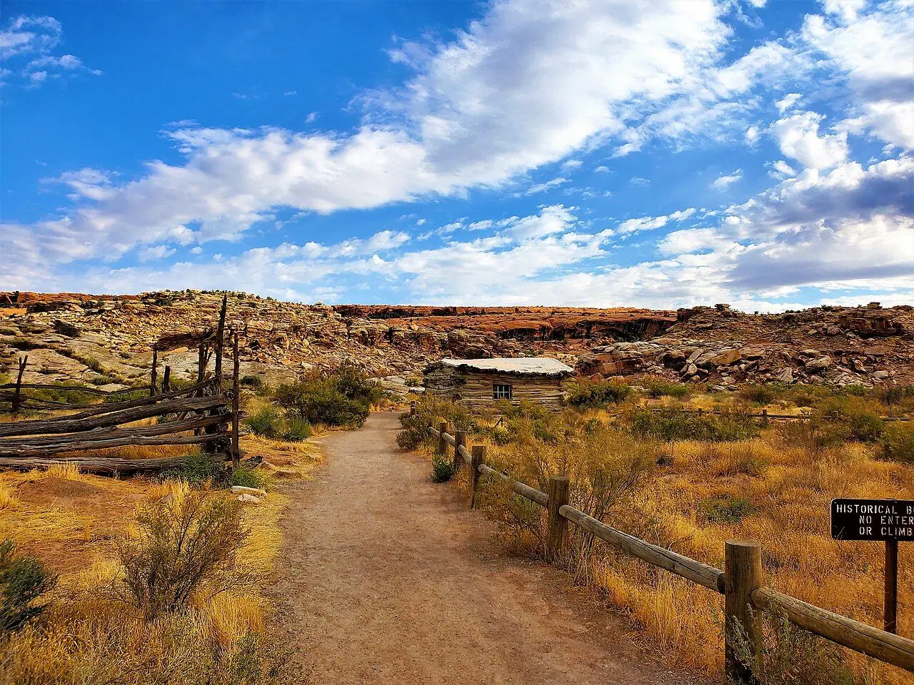
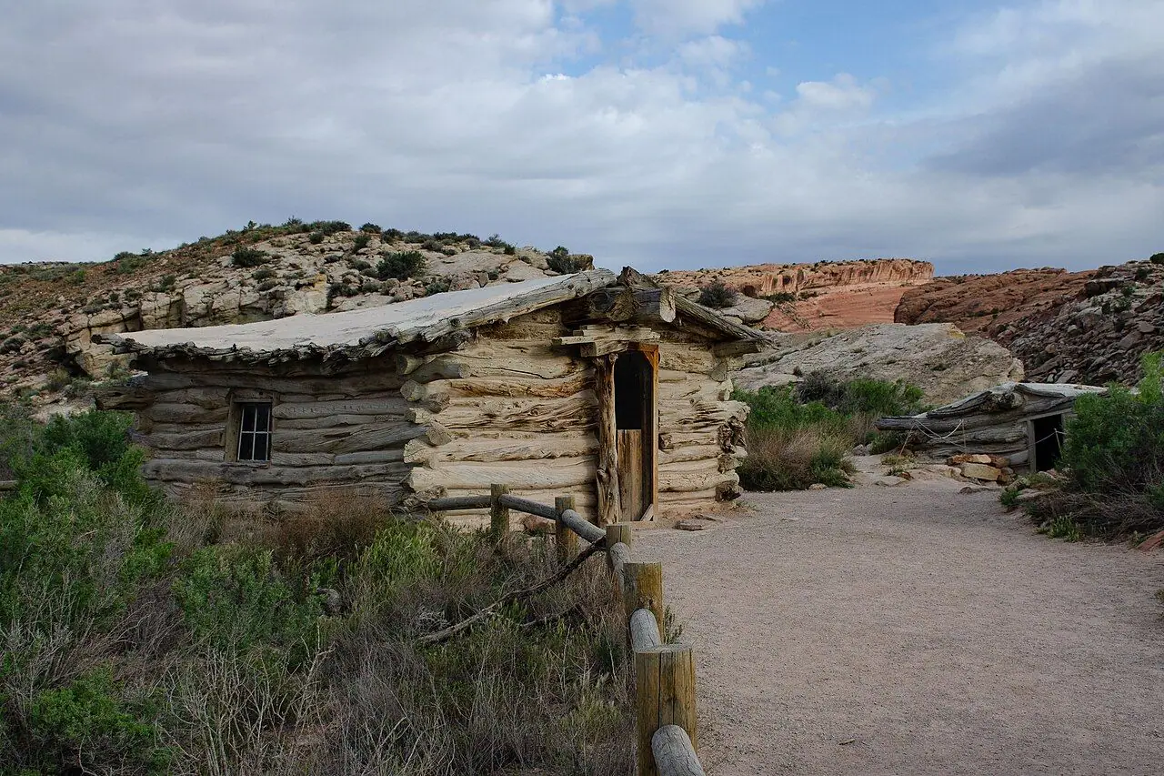
From the car park, a flat, well-made path leads past the Wolfe Ranch cabin. Fun fact: John Wesley Wolfe, a Civil War veteran, moved here in 1898 with his son and ranched along Salt Wash. The one-room cottonwood-log cabin dates from around 1906. That is when his daughter Flora joined them, and she asked for a proper floor and windows!
Shortly after you cross a footbridge over Salt Wash, a short side path on the left leads to a rock panel of Ute petroglyphs. They show figures on horseback and bighorn sheep. It is a short detour and definitely worth it.
2. Into the desert
The trail then climbs gently through desert scrub and across open ground. Look out for the dark, bumpy biological soil crust. It is a living layer of cyanobacteria, lichens and mosses, and it holds the desert together. One footstep can destroy decades of growth, so please keep to the path.
3. The slickrock climb
The main part of the hike is a long, wide climb up a huge tilted slab of bare slickrock. There is no clear path here, so follow the cairns (small rock piles) up the slope. It isn't technical, but it doesn't let up. Also, on sunny days the rock reflects the heat back at you. Take it slowly and stop for water.
4. The ledge and the reveal
Near the top, the route passes some wind-sculpted rock fins. Then it follows a narrow ledge cut into the side of a cliff, with a big drop on one side. It is wide enough to walk comfortably, but hold your children's hands here! As you go round the final corner, Delicate Arch appears on the far side of a smooth sandstone bowl. What a "wow" moment!
5. At the arch
The arch stands on the edge of the bowl, with the La Sal Mountains behind. You can walk around the rim to stand beneath it. However, take care, as the slopes into the bowl are steep and the edge beyond the arch drops sharply away. Climbing on or standing on any arch is prohibited. Find a spot on the rim, have a rest and enjoy the view. Then return the same way.
Alternative: the viewpoints
If the full hike isn't for you, there are two viewpoints. The Lower Delicate Arch Viewpoint is a flat 91 m (100 yd) walk from its own car park. You can see the arch from about 1.6 km away. The Upper Viewpoint is a 0.8 km (0.5 mile) walk with steps, and the view is a bit clearer.
How to get there
By public transport and shuttle
Arches is about 8 km (5 miles) north of Moab, the nearest town.
- Moab–Arches Shuttle: from 1 September 2026, a shuttle runs daily from downtown Moab to the Arches Visitor Center (8 am–5 pm). It also runs from the Visitor Center to Delicate Arch (8 am–4 pm, last return 4:05 pm), every 15–30 minutes. It is free with a valid national park pass, which you need to show to board. Check the latest times in the Moab Transit app or on the shuttle website. Unfortunately the last return is in the afternoon, so it doesn't work for sunset.
- Getting to Moab: Moab has no passenger railway. However, Salt Lake Express and several local shuttle companies connect it with Salt Lake City and Grand Junction, Colorado. Both are on Amtrak's California Zephyr line. Canyonlands Field airport is near Moab.
- By bike: cyclists pay $15 per person to enter. But the park road is long, hilly, busy and very hot in summer, so it is only for experienced riders.
By car and parking
From the park entrance, follow the main park road north (allow around 20–30 minutes). Then turn right on Delicate Arch Road to the Wolfe Ranch car park.
Parking: the car park fills early on busy days. In summer, many trailhead car parks are full by around 7:30 am, so arrive early to avoid disappointment. Overflow parking is at the Delicate Arch Viewpoint car park. This adds roughly 1.6 km (1 mile) of road walking each way.
On busy days, when the car parks fill, rangers may hold or divert vehicles at the entrance. Delays can last several hours.
Permits, fees & opening times
- Timed entry (2026): the NPS has announced that advance timed-entry reservations are not required at Arches in 2026. You can enter at any time during operating hours, but vehicles may still be diverted when the park is congested. Rules can change for future seasons, so always check the Plan Your Visit page on nps.gov/arch before you travel.
- Prices: $30 per private vehicle, $25 per motorcycle, $15 per person on foot or bike (under-16s free), all valid for 7 days. An Arches-area annual pass is $55 and covers Arches, Canyonlands, Natural Bridges and Hovenweep. The America the Beautiful pass is $80 for US residents, or $250 for non-residents. Check current fees on nps.gov/arch.
- Still reservable: Devils Garden Campground and Fiery Furnace hikes (self-guided permits and ranger-led tours) need reservations.
- Opening hours: the park is open 24 hours a day, all year. The visitor centre is open daily except 25 December.
When to go
- Spring (March–May) and autumn (September–October): the best seasons, with comfortable temperatures. But they are also the busiest. The weeks around Easter, Memorial Day and Labor Day are especially crowded.
- Summer (June–August): daytime temperatures often go over 38°C (100°F). Only hike at dawn or in the early evening, never in the middle of the day.
- Winter (November–February): quiet and beautiful, sometimes with snow on the arch. However, the slickrock and the ledge can be icy. Bring traction devices and take great care.
Time of day: sunrise is quieter and cooler, with soft light. Sunset is when the arch glows red and orange. It is also when the trail is busiest, sometimes with hundreds of people at the top. If you go for sunset, bring a head torch for the walk down. The park's busiest hours are roughly 8 am to 3 pm.
Also, watch out for summer thunderstorms (usually July to September). Avoid exposed slickrock if there is lightning around, and never cross flooded washes.
Hiking with kids
Many families can do Delicate Arch, but you need to respect it.
- Pushchairs: not possible, as the trail crosses steep slickrock and a narrow ledge.
- Carriers: a back carrier works well for babies and toddlers. But it is hard, hot work for the adult. Protect little ones from the sun and heat.
- Suitable for children: active children of around 6+ can usually walk it, especially in the cool of the morning. Hold hands on the ledge and near the bowl at the top.
- Heat: children overheat faster than adults. In warm weather, go early, keep stops in the sun short and carry plenty of water and salty snacks.
- Keeping them busy: hunt for cairns, spot the petroglyph horses and sheep, look for lizards and ravens, and count the arches on the drive in. Ask at the visitor centre about any children's activity booklets or ranger programmes during your visit.
What to pack
- At least 2–3 litres of water per person (more in summer), as there is none on the trail
- Salty snacks
- Sun hat, sunglasses and high-factor sun cream, plus light, light-coloured long sleeves
- Sturdy shoes with good grip for the slickrock
- Head torch if you hike at sunrise or sunset
- Warm layer for early mornings, evenings and winter
- Microspikes in winter
- Your park pass, and a phone with an offline map (signal is patchy)
Safety tips
- Respect the heat. Avoid hiking between about 10 am and 5 pm in hot weather. Watch for dizziness, weakness or heavy sweating. If you notice them, rest in the shade, drink and cool down, and get help if things get worse.
- Turn back if you've drunk half your water.
- Follow the cairns on the slickrock and stay on the trail.
- Take care on the ledge and around the bowl at the arch. Keep well back from drops.
- Never climb on arches. It is prohibited and dangerous.
- Lightning and flash floods: shelter in a vehicle if you hear thunder, and wait 30 minutes after the last rumble. Don't cross flooded washes.
- Tell someone your plans. Mobile coverage is unreliable. In an emergency in the US, call 911.
Leave no trace & sustainable tips
- Protect the soil crust: walk only on the trail, bare rock or sandy washes.
- Take the shuttle from Moab when it is running. It cuts traffic and parking pressure.
- Pack out everything, including food scraps and tissues.
- Don't build or move cairns. It can lead other hikers the wrong way.
- Don't touch the petroglyphs. The oils from your skin damage them. Never carve or mark rocks.
- Leave pets at home or in pet-friendly accommodation, as they are not allowed on the trails.
- Support local businesses in Moab.
Where to stay & eat nearby
Stay:
- Moab has a huge choice, from motels and chain hotels to B&Bs and holiday rentals. Book well ahead in spring and autumn.
- Devils Garden Campground, inside the park, is the only campground in Arches. You need a reservation, and it is usually full in season.
- There are many campgrounds on public land along the Colorado River near Moab.
Eat:
- There is no food for sale in the park, so stock up in Moab. It has supermarkets, cafés, brewpubs and restaurants.
- I suggest picking up picnic supplies for a sunrise hike, then having a big breakfast in town afterwards.
More to explore nearby
- Windows Section and Double Arch: short, easy walks to some of the park's biggest arches.
- Devils Garden and Landscape Arch: a longer trail to one of the world's longest natural arches.
- Fiery Furnace: a maze of sandstone fins (permit or ranger-led tour required).
- Canyonlands National Park (Island in the Sky): Mesa Arch at sunrise and huge canyon views.
- Dead Horse Point State Park: a famous Colorado River overlook. Dogs are allowed on a lead.
FAQ
Do you need a reservation for Arches National Park in 2026? No. The National Park Service has announced that advance timed-entry reservations are not required in 2026. However, vehicles may be diverted when the park is congested, and you still need to pay the entrance fee. Check nps.gov/arch for future seasons.
How long does the Delicate Arch hike take? Most people take 2–3 hours for the 4.8 km (3 mile) return hike, including time at the arch.
Is the Delicate Arch trail hard? It is short but quite tough: about 146 m (480 ft) of steady climbing on exposed slickrock with no shade, plus a narrow ledge near the top. The heat makes it much harder in summer.
When is the best time to hike to Delicate Arch? Sunrise for cooler temperatures and fewer people, or sunset for the famous glowing light (but big crowds). Avoid the middle of the day in summer.
Can you bring a dog to Delicate Arch? No. Pets aren't allowed on any trails in Arches National Park, even in a carrier.
Have you hiked to Delicate Arch? Did you go for sunrise or sunset? Let me know in the comments!
Photo credits (4)
All photos on this page are by other photographers and are used under free licences. Thank you for sharing them.
- Cover photo: Delicate Arch sunset.jpg by Ymaup, CC BY-SA 3.0, via Wikimedia Commons. Resized and cropped for this page.
- Photo 2: Wolfe Ranch, Arches National Park 07.jpg by John Manard, CC BY-SA 2.0, via Wikimedia Commons. Resized for this page.
- Photo 3: Wolfe Ranch, Arches National Park 10.jpg by Mark Levisay, CC BY 2.0, via Wikimedia Commons. Resized for this page.
- Photo 4: USA Arches NP Delicate Arch(1).jpg by Thomas Schoch, CC BY-SA 3.0, via Wikimedia Commons. Resized for this page.



join the conversation
Comments
No comments yet. Be the first to share your thoughts!