🥾 Trail guide · County Clare – The Burren & Cliffs of Moher
Cliffs of Moher Coastal Walk: Doolin, Hag's Head & Liscannor Guide (Including 2026 Closures)

- Distance
- 19.5 km
- Ascent
- 250 m
- Time
- 4.5–5 hours (full route, when open)
- Difficulty
- Strenuous
- Route
- Point-to-point
- Best season
- April–September
👶 With kids: Not pushchair-friendly and officially not suitable for young children on the clifftop sections (unfenced edges, stiles, strong winds). The short paved paths at the Visitor Centre work for families and all-terrain pushchairs.
✅ Updated and fact-checked on 2 November 2026. Prices, timetables and rules can change, so check the official sources before you go.
This post contains affiliate links. If you book or buy through them, I may earn a small commission at no extra cost to you. More about this
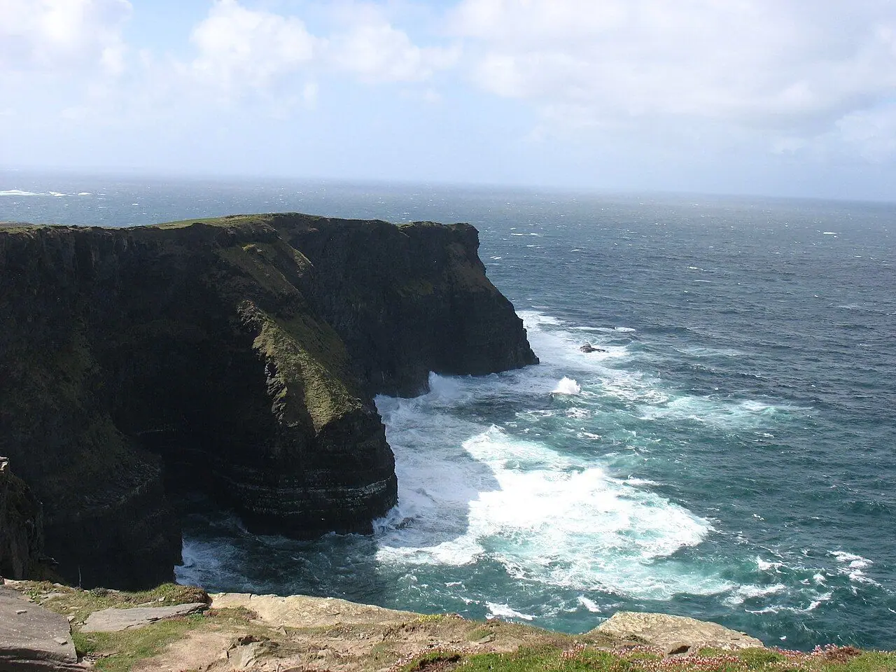
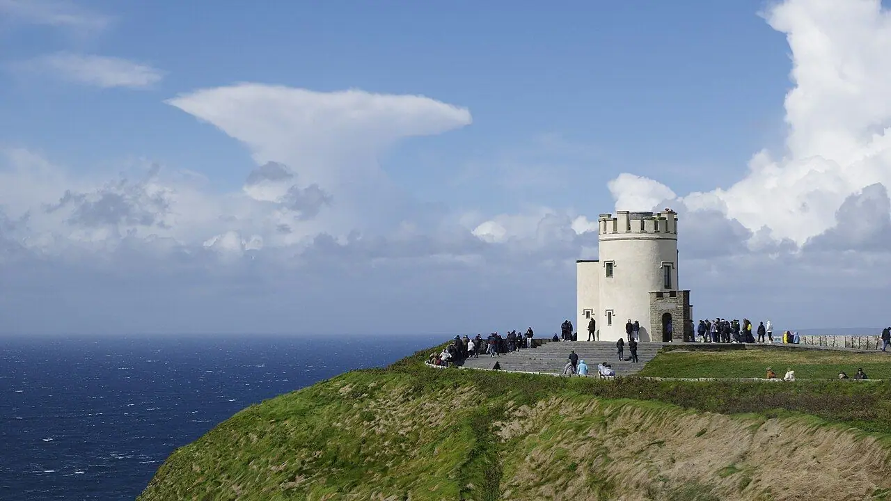
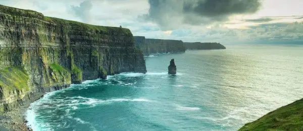
Have you ever seen a place that looks exactly like the postcards? The Cliffs of Moher are one of those places. For around 8 km along the coast of County Clare, dark cliffs of shale and sandstone rise straight out of the Atlantic. Near O'Brien's Tower they reach about 214 m. Seabirds fly below you, the Branaunmore sea stack stands offshore, and on a clear day you can see the Aran Islands.
The best way to see the cliffs is on foot. The Cliffs of Moher Coastal Walk runs for roughly 20 km between the villages of Liscannor and Doolin. It passes Hag's Head, the Visitor Centre and O'Brien's Tower on an unfenced path right at the top of the cliffs. Away from the crowds, it is just you, the wind, some grazing cattle and a 200 m drop. We haven't walked it ourselves yet, but it is high on our bucket list, so I've researched every detail for you.
However, there is important news before you plan anything. Since August 2024, large parts of the trail have been closed for safety reasons. An inspection raised serious concerns about the path near the cliff edge. As of August 2026, the southern section (Liscannor–Hag's Head–Visitor Centre) is fully closed. From Doolin you can only walk as far as Surfers Path and then turn back. Clare County Council and the landowners are working on a long-term plan, but full reopening is expected around 2028. So this guide covers the full route for when it reopens, and also exactly what you can walk right now.
At a glance
- Distance: the full route is about 19.5–20 km one way (Liscannor to Doolin). At the moment only the Doolin end is open, as an out-and-back.
- Elevation gain: around 250 m (official figure for the full route), with several steep climbs
- Allow 4.5–5 hours for the full route, or 2–3 hours for the current Doolin out-and-back
- Difficulty: strenuous (official grade). It is an exposed, remote clifftop path, narrow and steep in places.
- Route type: point-to-point (currently out-and-back from Doolin)
- Start points: Doolin (Fisher Street area) or Liscannor. Hag's Head via Moher sports field.
- Best season: April–September
- Prices: the trail is free. The Cliffs of Moher Visitor Centre and its car park are paid.
- Toilets: toilets, café and shop at the Visitor Centre, and pubs, cafés and toilets in Doolin and Liscannor. There is nothing on the open trail.
- Suitable for children: the clifftop path is not suitable for pushchairs or young children. The paved Visitor Centre paths are.
- Dogs: not permitted on the coastal walk
- Waymarking: blue arrow on a white background
Route description
Current status (2026)
This is the status according to the Cliffs of Moher Experience (as of 1 August 2026):
- Southern section (Liscannor/Hag's Head to the Visitor Centre): closed because of severe safety concerns. There is no access from Liscannor or from the Visitor Centre.
- Northern section (Doolin): open from Doolin as far as Surfers Path only. Turn back there. There is no walking access to the Visitor Centre from Doolin, and the road at Surfers Path is described as hazardous.
- At the Visitor Centre: short, surfaced paths are open. This includes an 800 m stretch north of O'Brien's Tower that was resurfaced in 2025.
Closures can change at short notice, so check the coastal walk page on cliffsofmoher.ie before you go. Please never cross barriers or fences! People have been seriously hurt and killed on this coast.
What you can walk now: Doolin to Surfers Path and back
From Doolin, walk up Fisher Street (the road climbing past the Doolin Inn) to the start of the trail. The road can be busy, so take care. Then the path leaves the lanes and crosses farmland over stone stiles, slowly climbing above the sea.
Soon you will spot Doonagore Castle, a 16th-century round tower house on the hill inland. On your right the Atlantic opens up, and behind you are the Aran Islands and the limestone hills of the Burren. As you carry on south, the cliffs get higher, and you can see ahead to the cliffs around O'Brien's Tower. Turn back at Surfers Path, as signed, and walk the same way back to Doolin.
The official site does not give a distance for this open stretch. So I would plan for a 2–3 hour round trip at a relaxed pace, depending on how far you are allowed to go on the day. Expect stiles, uneven ground, mud after rain and a few steep climbs.
The full route (for when it reopens)
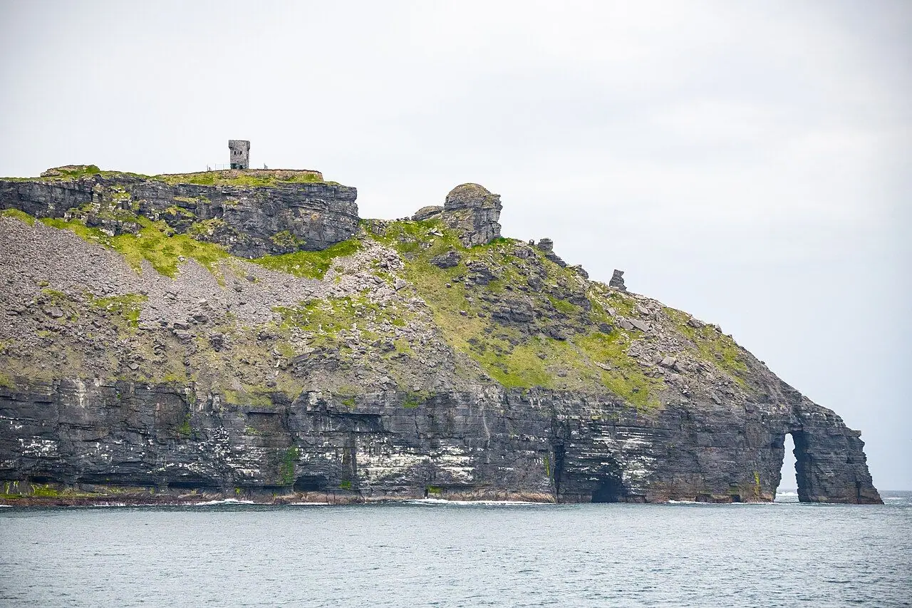
Liscannor to Hag's Head (about 7 km): From Liscannor village, the trail follows quiet roads and farm tracks north, past the Liscannor Stone (Rock Shop), to the Moher sports field. From here, flagstone markers lead about 1 km to Hag's Head. This is the southern tip of the cliffs, with a ruined signal tower from the Napoleonic era on top.
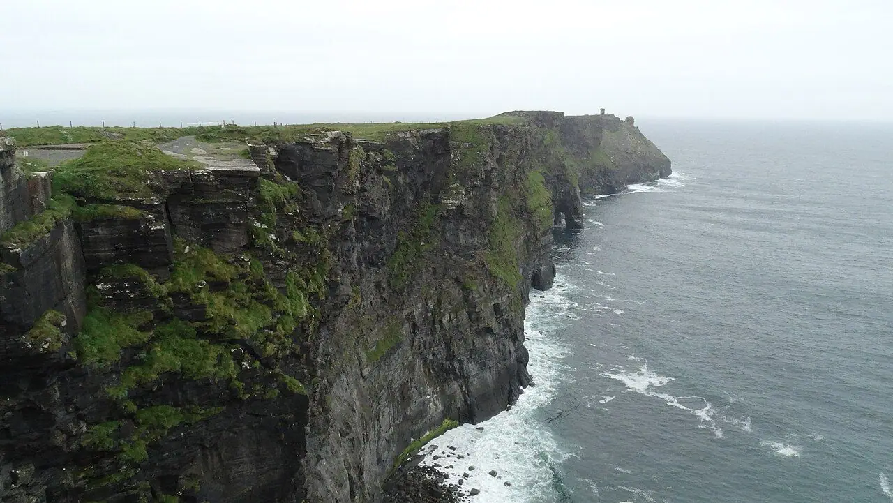
Hag's Head to the Visitor Centre (about 5 km): This is the most stunning and most exposed stretch. The path hugs the clifftop, with views north along the whole line of cliffs and down to the Branaunmore sea stack. Unfortunately, this is the section that is closed at the moment.
Visitor Centre to Doolin (about 8 km): After O'Brien's Tower, the highest point of the cliffs, the trail continues north on farm paths and narrow ledges. It goes through a gap beside a cattle pen and along stone walls, then slowly descends towards Doolin.
There is also a popular out-and-back "Moher Walk" from the Visitor Centre to Hag's Head (about 10 km, 2.5–3 hours). It is closed while the southern section is shut.
How to get there
By public transport
- Bus Éireann Route 350 links Galway, Kinvara, Doolin, the Cliffs of Moher, Liscannor, Lahinch and Ennis. There are roughly ten departures a day in each direction. Galway to Doolin takes around 1 hour 35 minutes. Ennis has a railway station on the Limerick–Galway line, and from there it is about an hour to Doolin. Check current times on buseireann.ie or the TFI Journey Planner app.
- Burren & Cliffs Explorer: a free hop-on hop-off shuttle that ran from 21 May to 20 September 2026. It linked Doolin, Liscannor, Lahinch, Ennistymon, Lisdoonvarna, the Cliffs of Moher Experience, the Burren National Park and other villages every 15–45 minutes. Pushchairs were welcome, but pets were not. It is a pilot scheme, so check cliffsofmoher.ie to see if it returns in 2027.
By car and parking
Doolin is on the R479. The Visitor Centre and Liscannor are on the R478, north of Lahinch.
Parking: in Doolin there is parking around Fisher Street and the village. The Cliffs of Moher Experience has a large car park, which is included in your admission ticket. Please only park in designated areas! Parking on the narrow lanes causes serious problems for locals and emergency vehicles.
Permits, fees & opening times
- Coastal walk: free to walk where it is open.
- Cliffs of Moher Experience (Visitor Centre): admission includes parking, the exhibition and the main viewing areas. Booking online in advance is cheaper than paying at the gate. Recent gate prices have been around €15 for adults, and there are family tickets too. Opening hours vary by season, so check current prices and hours on cliffsofmoher.ie.
- Guided walks: local farmer and historian Pat Sweeney runs the Doolin Cliff Walk guided tour from Doolin. He takes you across his family's land and shares local stories and history. I think this is a lovely way to learn about the area. Check doolincliffwalk.com for current routes, because of the closures.
When to go
- Spring and early summer (April–June): this is seabird season. Puffins, razorbills, guillemots and kittiwakes nest on the ledges, and wildflowers cover the clifftops. The days are long and the weather is often the clearest.
- Summer (July–August): the busiest time, especially at the Visitor Centre from late morning to mid-afternoon. Come early or late.
- Autumn and winter: big Atlantic swells and few people. However, gales, rain and short days are common. Strong winds can make the clifftop really dangerous.
- Fog is common and can roll in suddenly. Then you might only see a few metres ahead.
Check the forecast with Met Éireann (met.ie) before you set out, and do not walk the cliffs in high winds.
Hiking with kids
The official trail map says the clifftop path is dangerous and not suitable for children. The edges are unfenced, and the ground can be crumbly, slippery and exposed to sudden gusts.
- Pushchairs: not possible on the coastal path, as it has stiles and is narrow, muddy and uneven. The paved paths around the Visitor Centre and O'Brien's Tower work well, also for all-terrain pushchairs.
- Older children: confident, sensible older kids can manage the Doolin section if you watch them closely. Hold hands near the edge and stay well back from it.
- Better family options: walk the surfaced paths at the Visitor Centre, take a boat trip from Doolin Pier to see the cliffs from below, or explore Doolin Cave.
- Keeping them busy: bring binoculars for puffin-spotting, count the stiles, and look for Doonagore Castle and the Aran Islands.
What to pack
- Waterproof walking boots with good grip
- Waterproof jacket and trousers, plus a warm layer. It is often windy and cool, even in summer.
- Hat and sun cream (there is no shade)
- At least 1–2 litres of water and snacks
- Binoculars for seabirds
- Fully charged phone
- Cash or card for the café or pub at the end
Safety tips
- Respect the closures. Do not climb over fences or barriers. The closed sections are shut because they are unsafe.
- Stay well back from the edge. Overhangs can collapse, and gusts can come without warning.
- Do not walk in strong winds, fog or heavy rain. On the higher sections the wind can switch from onshore to offshore.
- Watch your footing on wet stiles, flagstones and mud.
- Take care on the roads at the Doolin start and near Surfers Path.
- In an emergency, call 112 or 999 and ask for the Coast Guard if someone is in difficulty on the cliffs or in the sea.
Leave no trace & sustainable tips
- Use the bus: Route 350 and the summer shuttle make car-free visits easy.
- Stay on the path: a lot of the trail crosses private farmland, and its future depends on goodwill between walkers and landowners. Close gates, use stiles and keep away from livestock.
- No dogs: they are not permitted on the coastal walk because of livestock and nesting birds.
- Do not disturb nesting seabirds. Keep the noise down and never throw anything over the edge.
- Take all litter home.
- Support local businesses in Doolin and Liscannor. They rely on the trail and have been hit by the closures.
Where to stay & eat nearby
Stay:
- Doolin has hostels, B&Bs and guesthouses, plus campsites near the pier. It is handy for the walk and the ferry to the Aran Islands.
- Liscannor and Lahinch have hotels, B&Bs and self-catering. Lahinch's surf beach is a bonus for families.
- Ennistymon and Lisdoonvarna have more options on the shuttle and bus routes.
Eat:
- Doolin is famous for its traditional music pubs, like Gus O'Connor's, which serves food and hosts regular sessions.
- The Visitor Centre has a café.
- Liscannor and Lahinch have pubs, cafés and seafood restaurants.
More to explore nearby
- Doolin Ferry / cliff cruise: see the cliffs, the Branaunmore sea stack and the Hag's Head sea arch from the water (seasonal).
- Aran Islands: day trips by ferry from Doolin in season. Inis Oírr is just a short crossing.
- Doolin Cave: home to one of the longest free-hanging stalactites in the world.
- The Burren: limestone pavements, wildflowers and walking trails in the Burren National Park.
- Lahinch: surf lessons and a long sandy beach.
FAQ
Is the Cliffs of Moher Coastal Walk open? Only partly. As of August 2026, the southern section from Liscannor and Hag's Head to the Visitor Centre is closed. From Doolin you can only walk as far as Surfers Path. Check cliffsofmoher.ie for the latest status.
When will the Cliffs of Moher Coastal Walk fully reopen? There is no confirmed date. A 2025 management plan suggested it might not fully reopen until around 2028. It depends on agreements with landowners and repair works.
How long is the Cliffs of Moher walk from Doolin to Liscannor? About 19.5–20 km one way, taking 4.5–5 hours, when the full route is open.
Can I walk to the Cliffs of Moher from Doolin? Not at the moment. The path from Doolin stops at Surfers Path, and there is no access through to the Visitor Centre. Take Bus Éireann Route 350 instead.
Can I bring my dog on the Cliffs of Moher Coastal Walk? No, dogs are not permitted on the coastal walk.
Have you walked the Cliffs of Moher, or are you waiting for the full trail to reopen like us? Let me know in the comments!
Photo credits (4)
All photos on this page are by other photographers and are used under free licences. Thank you for sharing them.
- Cover photo: Hag's Head, Cliffs of Moher - geograph.org.uk - 4946790.jpg by David Purchase, CC BY-SA 2.0, via Wikimedia Commons. Resized and cropped for this page.
- Photo 2: Cliffs of Moher - View SW towards Hag's Head - geograph.org.uk - 5610726.jpg by Colin Park, CC BY-SA 2.0, via Wikimedia Commons. Resized for this page.
- Photo 3: Ireland Cliffs of Moher BW 2025-09-11 14-26-55.jpg by Berthold Werner, CC BY-SA 4.0, via Wikimedia Commons. Resized for this page.
- Photo 4: Hag’s Head, Cliffs of Moher.jpg by Cdogsea, CC BY-SA 4.0, via Wikimedia Commons. Resized for this page.


join the conversation
Comments
No comments yet. Be the first to share your thoughts!