🥾 Trail guide · Alberta – Banff National Park
Johnston Canyon to the Ink Pots: A Complete Guide to Banff's Canyon and Spring Pools Hike

- Distance
- 11 km
- Ascent
- 640 m
- Time
- 4–5 hours
- Difficulty
- Moderate
- Route
- Out and back
- Best season
- June–October (open all year, but icy in winter, so traction devices are essential)
👶 With kids: The canyon section to the Lower and Upper Falls is short, mostly paved and great fun for kids, but Parks Canada doesn't recommend pushchairs. The full hike to the Ink Pots suits children used to longer walks, or little ones in a carrier.
✅ Updated and fact-checked on 5 November 2026. Prices, timetables and rules can change, so check the official sources before you go.
This post contains affiliate links. If you book or buy through them, I may earn a small commission at no extra cost to you. More about this
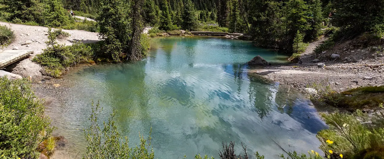
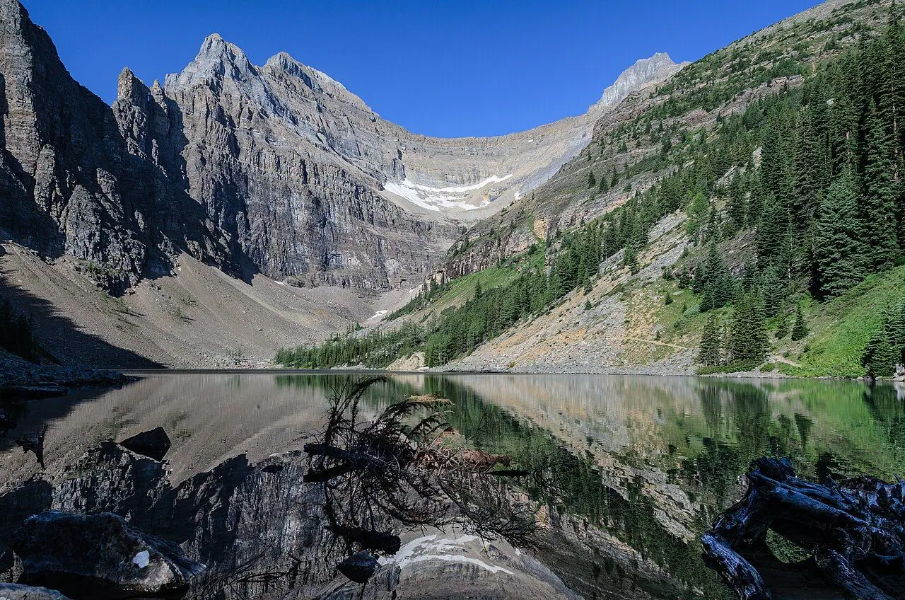
Have you ever walked along a canyon wall on a metal catwalk, with a waterfall roaring below your feet? That is what Johnston Canyon in Banff National Park is famous for. The trail follows Johnston Creek through a narrow limestone gorge, past the Lower Falls and the 30 m Upper Falls. Most people turn around there. However, if you keep going, the path leaves the crowds behind and climbs through the forest to the Ink Pots. These are a group of small blue-green pools in an open meadow, where spring water bubbles up from below the ground.
We haven't hiked this one yet, but it's high on our bucket list, so I've researched every detail for you.
Important: as of November 2026, the Johnston Canyon trail, the day-use area, the toilets and the main P1 car park are closed until 11 December 2026 for rock slope repair work. You can still reach the Upper Falls and the Ink Pots on the Moose Meadows trail, which I describe below. So always check the Parks Canada bulletins before you go.
At a glance
- Distance: about 11 km return (5.5 km each way, according to Parks Canada). The Lower Falls are 1.1 km from the trailhead and the Upper Falls 2.4 km.
- Elevation gain: about 425 m of climbing on the way out and 215 m on the way back, so around 640 m in total.
- Allow 4–5 hours. Parks Canada says about 4 hours return, plus your stops.
- Difficulty: Moderate. The canyon section is easy and mostly paved. The trail above the Upper Falls is a forest path with roots and rocks.
- Route type: Out and back.
- Start/finish: Johnston Canyon day-use area on the Bow Valley Parkway, 25 km from Banff. Or the Moose Meadows car park, 27 km from Banff.
- Best season: June to October. The trail is open all year, but it is icy in winter.
- Prices: free to hike, but you need a Parks Canada pass to stop in the park.
- Toilets: at the Johnston Canyon day-use area (closed until 11 December 2026). Don't count on any further up the trail.
- Dogs: allowed, but they must be on a leash of 3 m or less at all times.
Route description
Trailhead to the Lower Falls
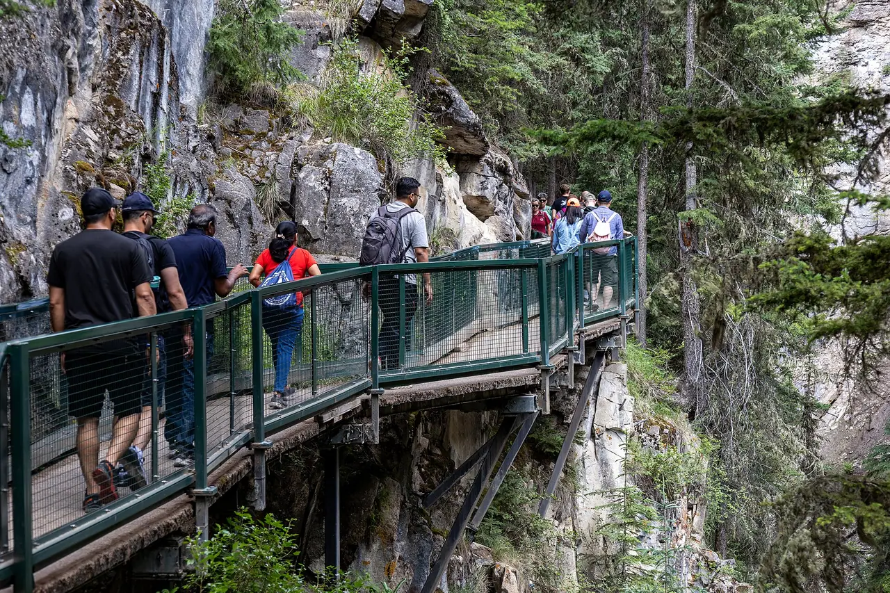
The trail starts at the Johnston Canyon day-use area, right next to the Bow Valley Parkway. It follows the creek into the canyon on a paved path. Soon the walls close in, and the path turns into narrow catwalks bolted to the rock, with railings on both sides. The water below is a lovely turquoise colour.
After 1.1 km you reach the Lower Falls. Parks Canada says this part is 100% paved, with about 85 m of climbing. It takes about 1 hour return if this is all you want to do. Expect crowds at the viewpoint on busy days!
Lower Falls to the Upper Falls
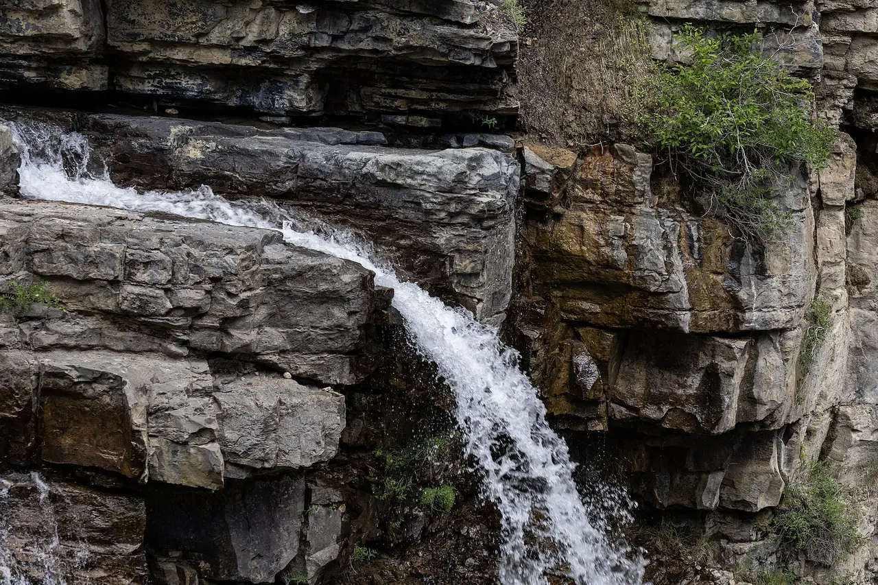
From the Lower Falls the path keeps climbing through the canyon. It is mostly paved, with more catwalks, bridges and a few steeper ramps. After 2.4 km from the trailhead you reach the Upper Falls, where the creek drops about 30 m over the cliff. There is a lower viewing platform, and another viewpoint about 265 m further up the trail looks down on the top of the falls.
Upper Falls to the Moose Meadows junction
Above the Upper Falls the paving stops. The trail becomes a normal forest path with exposed roots and rocks. It climbs steadily through the forest, so this is where you will feel the ascent. After a while you reach the junction with the Moose Meadows trail. Keep following the signs for the Ink Pots.
To the Ink Pots
From the junction the trail continues through the forest and reaches its highest point. Then it drops down to Johnston Creek and opens out into a wide meadow with mountain views. Here you find the Ink Pots. They are small, clear pools in shades of blue and green. If you look closely, you may see the water bubbling up from below. It is a really peaceful spot for a picnic. Then you return the same way.
Please don't step into the pools or walk on their edges. The meadow is fragile, and the pools are what makes this place special.
The Moose Meadows alternative
You can also start from the Moose Meadows car park, about 2 km further along the parkway. Parks Canada says this route is about the same distance as the canyon route, with sections of roots and rocks. It joins the main trail at the Moose Meadows junction above the Upper Falls. You miss the catwalks, but it is much quieter. Until 11 December 2026 it is the only way to reach the Upper Falls and the Ink Pots, because the canyon trail is closed.
How to get there
By car and parking
Johnston Canyon is on the Bow Valley Parkway (Highway 1A), 25 km northwest of Banff and about 33 km southeast of Lake Louise. The drive from Banff takes about 30 minutes.
Parking: the day-use area has a limited paved car park, including 8 accessible spaces. It fills quickly on summer days, and you must only park in marked spaces. The Moose Meadows car park is smaller, with limited unlined paved parking. I suggest arriving early in the morning or later in the afternoon to avoid the crowds.
Also, the parkway has some seasonal rules. From 1 March to 25 June, nobody may travel on the eastern 17 km section between 8 pm and 8 am, to protect wildlife. In spring and early autumn, Parks Canada also closes this eastern section to private vehicles for a cycling pilot. In 2026 this ran until 25 June in spring and from 1 September to 6 October in autumn. On those days you can still drive to Johnston Canyon and Moose Meadows from the Trans-Canada Highway via Castle Junction.
By public transport
Roam Transit Route 9 runs from the Banff High School Transit Hub to Johnston Canyon. It runs daily in summer (in 2026, from 18 June to 21 September), and on weekends and holidays in the colder months. Fares were around $5 for adults in 2026. Check Roam's website before you travel, especially while the day-use area is closed.
By bike
If you love cycling, the Bow Valley Parkway is a dream. During the car-free periods in spring and autumn you can ride the 17 km eastern section from Banff almost without traffic. Remember that cyclists must also follow the 8 pm to 8 am travel restriction in spring.
Permits, fees & opening times
- Park pass: you need a valid Parks Canada pass to stop in Banff National Park. In 2026 daily admission was $12.25 for adults, $10.75 for seniors and $24.50 for a family or group in one vehicle. Youth aged 17 and under go free.
- Closure: the Johnston Canyon trail and day-use area are closed from 13 October to 11 December 2026. Entering a closed area can lead to a fine of up to $25,000.
- Stay on the trail: from May to mid-November, off-trail travel in the canyon is banned to protect a small colony of endangered black swifts that nest there.
When to go
In my opinion, June to early October is the best time. The trail to the Ink Pots is usually clear of snow then, and the meadow is green. July and August are really busy, though. So I recommend starting before 9 am, or hiking on a weekday.
September is lovely too, with fewer people on the trail. Just remember the parkway's cycling closure in autumn, and plan your drive via Castle Junction.
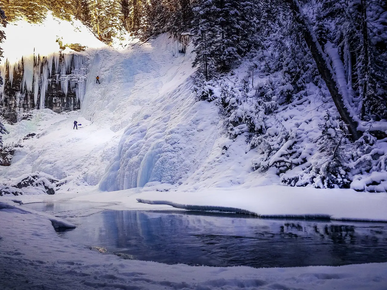
In winter the canyon turns into a world of ice. The waterfalls freeze, and ice climbers use the frozen Upper Falls. Banff & Lake Louise Tourism says traction devices are essential, and guided icewalks run from November to April. However, check that the trail has reopened after the 2026 work before you plan a winter visit.
Hiking with kids
Suitable for children: yes, especially the canyon part. Kids will love the catwalks and the waterfalls. The walk to the Lower Falls is short and easy, and the Upper Falls are a good goal for most school-age children. The full hike to the Ink Pots is 11 km, so it suits kids who are used to longer walks.
- Pushchairs: Parks Canada does not recommend them. The canyon path is narrow and busy, and there is a large rock on the trail about 765 m from the start. A baby carrier is a much better idea.
- Carriers: fine all the way, but take care on the roots and rocks above the Upper Falls.
- Keep them close: the railings are good, but the drops are big and the paths are crowded.
What to pack
- Comfortable walking shoes or boots with good grip, as the trail can be wet from the spray
- Ice cleats or microspikes from late autumn to spring
- A waterproof and a warm layer, as the canyon feels cool even in summer
- At least 1 litre of water per person
- Bear spray, and know how to use it
- Your Parks Canada pass
- A picnic for the Ink Pots meadow
It is a 4–5 hour day, so I always suggest packing more snacks than you think you need. Nuts, energy bars and dried fruit are easy to carry. You can find more ideas in my post about the best food for expeditions.
If the Ink Pots inspire you to explore further up the Johnston Creek valley, you will be in much wilder country. For trips like that, a satellite messenger is a good idea. The Garmin inReach Mini is one I recommend in my personal locator beacon guide. It lets you send an SOS and messages without phone signal.
Safety tips
- You are in bear country. Carry bear spray, make noise on the quieter forest sections and keep children close. Never feed any wildlife.
- Stay on the trail and behind the railings. The canyon walls are steep and the water is fast and cold.
- Watch your footing on wet catwalks and rocks, and on icy paths in winter.
- Respect closures. They are there for your safety, and fines are high.
- In an emergency, call 911.
Leave no trace & sustainable tips
- Protect the black swifts. They are endangered, and their numbers at Johnston Canyon have dropped a lot. Stay on the official trail and don't climb over railings for photos.
- Take the bus in summer. It helps with the long queues of cars on the parkway.
- Keep out of the Ink Pots. Don't throw stones or walk on the soft edges.
- Pack out all your litter, including fruit peel.
Where to stay & eat nearby
- Banff is the best base. It has hotels, hostels, campsites and lots of places to eat, and it is only 30 minutes away. It is also where Roam Route 9 starts.
- Johnston Canyon Lodge & Bungalows sits right at the trailhead. It has 42 cabins, the Black Swift Bistro, the Market Cafe and a small stand selling ice cream and coffee. Check their opening season before you plan around it.
- Johnston Canyon Campground is a Parks Canada campground next to the canyon. It is a seasonal campground, so book ahead through Parks Canada.
More to explore nearby
- Lake Agnes Tea House: one of the most popular hikes from Lake Louise, with a cute teahouse at the top.
- Castle Lookout and Rockbound Lake: two longer hikes from the Castle Mountain area, a short drive further along the parkway.
- Silverton Falls: another waterfall hike near Castle Junction.
- The Bow Valley Parkway: drive it slowly and keep your eyes open for wildlife.
FAQ
How long is the hike from Johnston Canyon to the Ink Pots?
About 5.5 km each way, so around 11 km return. Parks Canada says it takes about 4 hours return, so allow 4–5 hours with stops.
Is Johnston Canyon open now?
Not until 11 December 2026. The trail, toilets and main car park are closed for rock slope repairs. You can still reach the Upper Falls and the Ink Pots from the Moose Meadows car park.
Is the Ink Pots hike hard?
It is moderate. The canyon section to the Upper Falls is easy and mostly paved. After that, the trail climbs through the forest on roots and rocks, with around 640 m of climbing in total.
Do I need a pass for Johnston Canyon?
You don't need a hiking permit. But you do need a Parks Canada pass to stop anywhere in Banff National Park.
Can I get to Johnston Canyon without a car?
Yes. Roam Transit Route 9 runs from Banff, daily in summer and at weekends in the colder months. You can also cycle the Bow Valley Parkway.
Have you hiked to the Ink Pots, or did you stop at the Upper Falls? Let me know in the comments!
Photo credits (4)
All photos on this page are by other photographers and are used under free licences. Thank you for sharing them.
- Cover photo: The Ink Pots, Johnston Canyon, Banff National Park, Alberta, 2025-07-12 01.jpg by Chris Woodrich, CC BY-SA 4.0, via Wikimedia Commons. Resized and cropped for this page.
- Photo 2: Johnston Canyon, Banff National Park, Alberta, 2025-07-12 02.jpg by Chris Woodrich, CC BY-SA 4.0, via Wikimedia Commons. Resized for this page.
- Photo 3: Upper Falls, Johnston Canyon, Banff National Park, Alberta, 2025-07-12 03.jpg by Chris Woodrich, CC BY-SA 4.0, via Wikimedia Commons. Resized for this page.
- Photo 4: Ice climbers at Johnston Canyon Banff National Park Canada.jpg by Bitan Banerjee, CC BY-SA 4.0, via Wikimedia Commons. Resized for this page.


join the conversation
Comments
No comments yet. Be the first to share your thoughts!